<?xml version="1.0" encoding="utf-8"?><feed xmlns="http://www.w3.org/2005/Atom" xml:lang="en_US"><generator uri="https://jekyllrb.com/" version="3.10.0">Jekyll</generator><link href="https://wizardkingz.github.io/feed.xml" rel="self" type="application/atom+xml" /><link href="https://wizardkingz.github.io/" rel="alternate" type="text/html" hreflang="en_US" /><updated>2026-11-18T23:14:48-05:00</updated><id>https://wizardkingz.github.io/feed.xml</id><title type="html">Johnew Zhang</title><subtitle>Johnew Zhang on financial services, fintech, and complex situations, with research, projects, and lecture notes in mathematics and economics.</subtitle><author><name>Johnew Zhang</name></author><entry><title type="html">Investing as System Design</title><link href="https://wizardkingz.github.io/investing-as-system-design/" rel="alternate" type="text/html" title="Investing as System Design" /><published>2026-10-24T21:00:00-04:00</published><updated>2026-10-24T21:00:00-04:00</updated><id>https://wizardkingz.github.io/investing-as-system-design</id><content type="html" xml:base="https://wizardkingz.github.io/investing-as-system-design/"><![CDATA[<h2 id="two-levels-of-the-same-question">Two Levels of the Same Question</h2>

<p>In December 2016, before starting a master’s in financial economics, I wrote that I wanted to learn how capital is allocated efficiently at two levels: inside a single company and across a portfolio. Ten years later, I still work on those two questions. What has changed is how I answer them: I start with the structure of the system, test it against data, and design a solution around a defined objective.</p>

<p>The same letter listed two side interests, leverage and illiquidity. My path has run through actuarial work, private credit, asset-based finance, special situations, and public markets. This essay traces how each step shaped the habit.</p>

<h2 id="math-and-actuarial-work-taught-me-to-price-risk">Math and Actuarial Work Taught Me to Price Risk</h2>

<p>My undergraduate training combined pure mathematics, finance, and computer science. My first career was as a property and casualty actuary, in reserving, pricing, and analytics. Both taught me to treat a problem as a system: define the parts, write down how they interact, then solve.</p>

<p>Actuarial work is about pricing risk and managing it, and that made my framework risk-first. A premium or a reserve is a judgment about outcomes that have not happened yet, made from incomplete data. I apply the same discipline to every risk I take: business risk, deal risk, credit risk, and factor risk. Each one has to be named, priced, and managed before the return case counts.</p>

<p>What these tools did not give me was judgment about which problems were worth solving. Give me a well-posed problem and I can model it, prove it, or code it. Deciding which problem to pose is economics.</p>

<h2 id="at-the-portfolio-level-i-model-the-system-before-i-test-it">At the Portfolio Level, I Model the System Before I Test It</h2>

<p>Financial economics supplied the questions, starting with asset pricing. Every asset reduces to one line: price equals expected payoff, discounted by how much investors value money in the states where that payoff arrives. In symbols, with p the price, x the payoff, and m the stochastic discount factor:</p>

\[p = E[m \, x]\]

<p>The disagreement is over how to fill in m. The reduced-form approach starts from the data: find portfolios that explain returns and call them factors. The structural approach starts from the investor’s problem: ask what a long-horizon investor fears, then test whether those fears are priced. I belong to the second camp. Merton’s intertemporal CAPM (1973) says investors care not only about today’s return but about news that changes tomorrow’s opportunities. Campbell and Shiller (1988) showed that valuation ratios carry that news, because discount rates, not only cash flows, move prices.</p>

<p>My master’s thesis tested this view. I replicated two ICAPM models, Campbell and Vuolteenaho (2004) and Campbell, Giglio, Polk and Turley (2018), on US equities from 1963 to 2018, then took them out of sample to equity strategies and currency carry trades. Exposure to news about future market volatility did most of the work in separating small and value stocks from the rest, and the models showed some ability to price those strategies (<a href="/icapm-evidence/">thesis summary</a>).</p>

<p>What I took from the thesis was less a finding than a method. A regression shows that a pattern exists. A structural model explains why: it writes down how the system works, from what investors fear to the state variables that carry that fear, then tests each link against data. The thesis took a full model of where returns come from, starting from fundamentals, and let the data accept or reject it.</p>

<p>I have worked that way since, and it is how I came to see investing as a system-design problem. A strategy is reliably profitable only once you understand the system that pays it. Otherwise it is a pattern waiting to stop working.</p>

<p>The thesis also left me cycle-aware. Investors pay to avoid more than lost cash flow; they also pay to avoid bad news about future volatility and, to a lesser degree, about discount rates. Both swing with the cycle. Patient capital gets paid when discount rates are high, which is exactly when most investors cannot wait.</p>

<h2 id="i-chose-businesses-over-signals">I Chose Businesses over Signals</h2>

<p>The 2016 letter ended with a plan to run a quantitative hedge fund. I did not follow it, for two reasons.</p>

<p>The first is that insurance had already shown me I like businesses: how a company prices risk, funds itself, and earns its return. I wanted to point quantitative skills and a quantitative mindset at those problems, not at the search for signals in prices.</p>

<p>The second is candor about my edge. I do not expect to out-compute the market, or to win a race on speed or on spotting patterns others miss. When I win, it is because I understand a system better than its price does. That pointed me toward businesses, contracts, and capital structures, where patient understanding gets paid.</p>

<h2 id="at-the-company-level-control-decides-the-payoff">At the Company Level, Control Decides the Payoff</h2>

<p>Asset pricing values a claim once its payoff is given. Corporate finance asks who shapes the payoff. Modigliani and Miller (1958) describe a world where capital structure does not matter. The rest of the field explains why it does, and the part that shaped me most is control.</p>

<p>Contract theory, where <a href="https://business.columbia.edu/faculty/people/patrick-bolton">Patrick Bolton</a> at Columbia did much of the work on financial contracts, starts from the fact that contracts are incomplete. No document anticipates every state of the world, so what matters is who decides when the unforeseen happens.</p>

<ul>
  <li><strong>Debt allocates control by state.</strong> In <a href="https://ideas.repec.org/a/oup/restud/v59y1992i3p473-494..html">Aghion and Bolton (1992)</a>, the founder runs the firm while things go well, and control passes to the lender when they do not.</li>
  <li><strong>The shape of the creditor group sets the endgame.</strong> Bolton and Scharfstein (1996) show that spreading debt across more creditors deters strategic default but makes renegotiation harder when default is genuine.</li>
</ul>

<p>Restructuring is this game played live. Each class of claim holds a different payoff, and the outcome follows whoever controls the next decision. Liability management exercises are the modern example: a document that looked protective on day one can be turned against the lenders who relied on it.</p>

<p>Venture debt is my favorite puzzle in the field. Why lend to a company with no earnings? <a href="https://www.nber.org/papers/w20587">Hochberg, Serrano and Ziedonis (2018)</a> find the answer outside the borrower: patents that can be resold, and the credibility of the venture investors’ commitment to keep funding. The lender underwrites the collateral and the sponsor’s incentives, not the income statement.</p>

<p>This is why governance and incentives come first in <a href="/investment-principles-v1/">my order of analysis</a>. Before I model fundamentals, I want to know who decides, what they are paid to want, and what the documents let them do.</p>

<h2 id="investing-is-a-design-problem">Investing Is a Design Problem</h2>

<p>Put the two levels together and investing becomes a system-design problem. A strategy earns money for a reason, and the reason sits in the structure: who bears which risk, who controls which decision, and what the price assumes. Once I understand that, the rest is design. I have an objective (a return at a given level of risk) and constraints (liquidity, leverage, time horizon, and what can be known). The job is to build the mix of instrument, structure, and position size that meets the objective within those constraints.</p>

<p>When I say system, I mean what Ray Dalio (2013) calls the economic machine: the whole global economy. A company or a household is a subsystem inside it.</p>

<p>Rates, liquidity, credit, and growth set the discount rate on which every asset is priced, and financial institutions sit closest to that machine. So I work in two directions at once. Top-down, the macro view sets the portfolio’s exposures and risk budget. Bottom-up, company-level work decides which claims fill it. Both directions are structural: I model the macro the same way I model a balance sheet, by writing down how the parts connect and then testing it. Portfolio construction is where the two meet, and each position is judged by how it changes the risk of everything else I hold.</p>

<p>Capital solutions and public markets pose the same design problem through different games. In capital solutions, the game is control, and the borrower can be a company or a household. With a company, each deal is an incomplete contract written for the states where things go wrong. The investor decides who holds control in those states and what that control is worth. With households, buying portfolios of non-performing loans is the classic version. The borrowers have already defaulted, so the return depends on the purchase price, the servicer’s workout decisions, and the recovery curve across thousands of loans.</p>

<p>In public markets, the game is information. <a href="https://business.columbia.edu/faculty/people/lawrence-glosten">Glosten</a> and Milgrom (1985) show that the bid-ask spread is what a market maker charges for trading against people who may know more. Every trade has someone on the other side, so the first question is what I know that they do not. Research earns a return only on information that is costly to collect and not yet in the price (Grossman and Stiglitz, 1980). If I cannot name that information, I am probably the one paying the spread.</p>

<p>Financial institutions sit where the two problems meet. A bank, an insurer, or a specialty lender is a balance sheet of contracts, priced by a market whose discount rate swings with the cycle. These institutions also run on leverage and liquidity, my two side interests from 2016. That is why I specialize in them, and why one view can be expressed through equity, credit, or structured paper.</p>

<h2 id="markets-adapt-so-the-framework-is-only-v10">Markets Adapt, So the Framework Is Only v1.0</h2>

<p>The 2016 letter also named an interest in Andrew Lo’s Adaptive Markets Hypothesis (2004), which he later expanded in <em>Adaptive Markets</em> (2017). Lo describes markets less as a fixed equilibrium than as an ecosystem: a strategy that works attracts capital until it stops working. I still think that is right, and it has a personal consequence. A framework that never changes will eventually be priced out.</p>

<p>That is why I called <a href="/investment-principles-v1/">my principles v1.0</a>, and why I treat curiosity as part of the method rather than a personality trait. Most of what I use today, from venture debt to the macro work behind the <a href="/macro-monitor/">Trident Macro Monitor</a>, I learned because a question would not leave me alone.</p>

<p>Project Trident is the current version of this approach. I define it as a structural model of financial institutions and the markets that price them, run as a repeatable process. It works out how each institution makes and loses money, finds where the market misprices it, chooses the claim that best expresses the view, and sizes and monitors that claim within a portfolio. The three prongs are long/short financials equity, asset-based and structured credit, and special situations, which share one underwriting process and one macro view underneath. Put simply, Trident is a system I am building to understand other systems. I will open it one piece at a time in later essays.</p>

<h2 id="the-short-version">The Short Version</h2>

<p>Structure tells me what can happen. Data tells me what is likely. Design decides what I own and how I am protected if I am wrong. Curiosity keeps all three current.</p>

<h2 id="references">References</h2>

<ul>
  <li>Aghion, P. and Bolton, P. (1992). An Incomplete Contracts Approach to Financial Contracting. <em>Review of Economic Studies</em>. <a href="https://ideas.repec.org/a/oup/restud/v59y1992i3p473-494..html">link</a></li>
  <li>Bolton, P. and Scharfstein, D. (1996). Optimal Debt Structure and the Number of Creditors. <em>Journal of Political Economy</em>.</li>
  <li>Campbell, J. and Shiller, R. (1988). The Dividend-Price Ratio and Expectations of Future Dividends and Discount Factors. <em>Review of Financial Studies</em>.</li>
  <li>Campbell, J. and Vuolteenaho, T. (2004). Bad Beta, Good Beta. <em>American Economic Review</em>.</li>
  <li>Campbell, J., Giglio, S., Polk, C. and Turley, R. (2018). An Intertemporal CAPM with Stochastic Volatility. <em>Journal of Financial Economics</em>.</li>
  <li>Dalio, R. (2013). How the Economic Machine Works. Bridgewater Associates (video).</li>
  <li>Glosten, L. and Milgrom, P. (1985). Bid, Ask, and Transaction Prices in a Specialist Market with Heterogeneously Informed Traders. <em>Journal of Financial Economics</em>. <a href="https://business.columbia.edu/faculty/people/lawrence-glosten">author page</a></li>
  <li>Grossman, S. and Stiglitz, J. (1980). On the Impossibility of Informationally Efficient Markets. <em>American Economic Review</em>.</li>
  <li>Hochberg, Y., Serrano, C. and Ziedonis, R. (2018). Patent Collateral, Investor Commitment, and the Market for Venture Lending. <em>Journal of Financial Economics</em>. <a href="https://www.nber.org/papers/w20587">NBER version</a></li>
  <li>Lo, A. (2004). The Adaptive Markets Hypothesis. <em>Journal of Portfolio Management</em>.</li>
  <li>Lo, A. (2017). <em>Adaptive Markets: Financial Evolution at the Speed of Thought</em>. Princeton University Press.</li>
  <li>Merton, R. (1973). An Intertemporal Capital Asset Pricing Model. <em>Econometrica</em>.</li>
  <li>Modigliani, F. and Miller, M. (1958). The Cost of Capital, Corporation Finance and the Theory of Investment. <em>American Economic Review</em>.</li>
  <li>Zhang, J. (2019). Essay on Asset Returns with Intertemporal CAPM. <a href="/icapm-evidence/">link</a></li>
</ul>]]></content><author><name>Johnew Zhang</name></author><category term="investing" /><category term="asset pricing" /><category term="corporate finance" /><category term="financials" /><category term="framework" /><summary type="html"><![CDATA[Two Levels of the Same Question]]></summary><media:thumbnail xmlns:media="http://search.yahoo.com/mrss/" url="https://wizardkingz.github.io/assets/images/share-logo.png" /><media:content medium="image" url="https://wizardkingz.github.io/assets/images/share-logo.png" xmlns:media="http://search.yahoo.com/mrss/" /></entry><entry><title type="html">Three Questions I Keep Asking</title><link href="https://wizardkingz.github.io/three-questions/" rel="alternate" type="text/html" title="Three Questions I Keep Asking" /><published>2026-02-14T09:00:00-05:00</published><updated>2026-02-14T09:00:00-05:00</updated><id>https://wizardkingz.github.io/three-questions</id><content type="html" xml:base="https://wizardkingz.github.io/three-questions/"><![CDATA[<p>My birthday passed two weeks ago, and looking back on the last 15 years, from actuarial work to financial economics to investing in asset-based finance (ABF) and financials, three questions have stayed with me.</p>

<h2 id="1-how-do-you-get-your-money-back">1. How Do You Get Your Money Back?</h2>

<p>This is the first and most important question. It matters for returns, but also because we carry a fiduciary duty to those who entrust us with capital. If you cannot clearly map the path from capital deployed to capital returned, you are relying on hope.</p>

<p>This matters most in private markets. Unlike in public markets, you cannot sell a piece tomorrow, so you need a structured, time-bound approach to exits. Otherwise, you are just selling a story and a dream.</p>

<h2 id="2-do-you-truly-understand-the-risks-youre-taking">2. Do You Truly Understand the Risks You’re Taking?</h2>

<p>I think about risk in two layers.</p>

<p>The qualitative layer is business logic: origination quality, underwriting discipline, funding structure, reinsurance, governance, duration, and asset-liability matching. And never forget people and culture. Cycles and special situations quickly reveal whether you understood the risk or simply benefited from a forgiving environment. Sloppy thinking doesn’t always lose money immediately, but on average, it does.</p>

<p>The quantitative layer is pricing. Where is the return actually coming from: market beta, illiquidity, complexity, or term? If you can’t decompose the drivers of return, you’re guessing.</p>

<h2 id="3-can-you-design-the-right-architecture-around-that-risk">3. Can You Design the Right Architecture around That Risk?</h2>

<p>The third question is structural. In insurance, the architecture is risk allocation, reinsurance, capital buffers, and disciplined asset-liability management. In credit, it is covenants, concentration limits, subordination, and funding matched to asset duration. Documentation isn’t paperwork; it’s how you turn a model into a controlled box. Structure determines whether you survive when you’re wrong.</p>

<h2 id="what-ive-learned">What I’ve Learned</h2>

<p>Technology and data are table stakes. Everyone has models, and some would say AI can now build one quickly. My edge has never been data mining. It is thinking about durability: building the right mousetrap.</p>

<p>One lesson I’ve internalized: making money does not mean you were right. It may simply mean the environment was forgiving. Many people are smarter than me, so competing on intelligence alone feels futile. Iterating on logic, process, and judgment is more durable.</p>

<p>I’m still in the middle of the path. I’m wrong more often than I’m right, but I hope to get a few things right. I’m sharing this in case it resonates, and I’m always happy to talk about ABF and financials investing.</p>]]></content><author><name>Johnew Zhang</name></author><category term="investing" /><category term="ABF" /><category term="financials" /><category term="risk" /><category term="structured credit" /><summary type="html"><![CDATA[My birthday passed two weeks ago, and looking back on the last 15 years, from actuarial work to financial economics to investing in asset-based finance (ABF) and financials, three questions have stayed with me.]]></summary><media:thumbnail xmlns:media="http://search.yahoo.com/mrss/" url="https://wizardkingz.github.io/assets/images/share-logo.png" /><media:content medium="image" url="https://wizardkingz.github.io/assets/images/share-logo.png" xmlns:media="http://search.yahoo.com/mrss/" /></entry><entry><title type="html">My Investment Principles (v1.0)</title><link href="https://wizardkingz.github.io/investment-principles-v1/" rel="alternate" type="text/html" title="My Investment Principles (v1.0)" /><published>2025-12-31T09:00:00-05:00</published><updated>2025-12-31T09:00:00-05:00</updated><id>https://wizardkingz.github.io/investment-principles-v1</id><content type="html" xml:base="https://wizardkingz.github.io/investment-principles-v1/"><![CDATA[<p>Going into 2026, I wrote down a first draft of my investment principles. It is a living framework, shaped by my own path: trained as an actuary, educated as a financial economist, and practiced across structured credit and financials investing.</p>

<p>My focus is financial institutions (FIG) across equity, credit, and structured and asset-backed investments. Over time, I expect the framework to extend to financial-adjacent business services, such as brokers, payments, and intermediated platforms, once I understand that ecosystem well.</p>

<h2 id="how-i-think-about-investing">How I Think about Investing</h2>

<ul>
  <li><strong>Investing is an optimization problem under uncertainty.</strong> Risk premia and capital allocation matter.</li>
  <li><strong>Domain expertise is earned, not read.</strong> Real understanding comes from reasoning like an operator, especially in regulated balance-sheet businesses.</li>
  <li><strong>Curiosity and humility are prerequisites,</strong> because frameworks must evolve with markets.</li>
</ul>

<h2 id="how-i-analyze-before-choosing-the-capital-structure">How I Analyze, before Choosing the Capital Structure</h2>

<ol>
  <li>Governance and incentives</li>
  <li>Industry structure and evolution</li>
  <li>Structural or regulatory change</li>
  <li>Corporate change: balance sheet, strategy, and management</li>
  <li>Business fundamentals and the durability of returns</li>
</ol>

<p>Only then do I decide whether the asset, the credit, or the equity is the right expression.</p>

<h2 id="where-this-shows-up-today">Where This Shows Up Today</h2>

<ul>
  <li>Long/short financials equity</li>
  <li>Asset-based and structured credit</li>
  <li>Special situations and opportunistic investments</li>
</ul>

<p>To be continued. I wish everyone a great 2026.</p>]]></content><author><name>Johnew Zhang</name></author><category term="investing" /><category term="principles" /><category term="financials" /><category term="structured credit" /><summary type="html"><![CDATA[Going into 2026, I wrote down a first draft of my investment principles. It is a living framework, shaped by my own path: trained as an actuary, educated as a financial economist, and practiced across structured credit and financials investing.]]></summary><media:thumbnail xmlns:media="http://search.yahoo.com/mrss/" url="https://wizardkingz.github.io/assets/images/share-logo.png" /><media:content medium="image" url="https://wizardkingz.github.io/assets/images/share-logo.png" xmlns:media="http://search.yahoo.com/mrss/" /></entry><entry><title type="html">Rebalanced: Tokyo, Kyoto, and Osaka in Nine Days</title><link href="https://wizardkingz.github.io/japan-rebalanced/" rel="alternate" type="text/html" title="Rebalanced: Tokyo, Kyoto, and Osaka in Nine Days" /><published>2025-12-30T12:00:00-05:00</published><updated>2025-12-30T12:00:00-05:00</updated><id>https://wizardkingz.github.io/japan-rebalanced</id><content type="html" xml:base="https://wizardkingz.github.io/japan-rebalanced/"><![CDATA[<p class="caption"><img src="/assets/images/japan-2025/japan-map.jpg" alt="An old-style map of central Japan marking Tokyo, Hakone, Mt Fuji, Kyoto, Arashiyama, Nara, and Osaka along the Tōkaidō" />
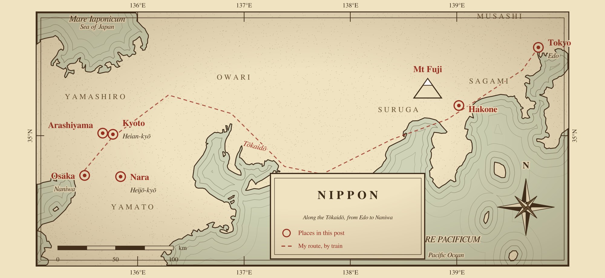
<em>Central Japan, drawn for this post in the style of an old map. The dashed line follows the Tōkaidō Shinkansen; old names and provinces are in italics.</em></p>

<p>This trip was not an escape. It was about resetting my orientation. I arrived in Japan in December 2025 with more open questions than answers, but I was no longer panicking about that uncertainty; I was learning to stand inside it. My planning notes called the trip Project Samurai, for the discipline more than the swords, and the plan was really a hypothesis: that a country where solitude is not loneliness, where restraint is a form of strength, and where beauty often lives in what is left unsaid might be the right place for that. I did not need answers. I wanted clarity of mind, steadiness of body, and a little quiet.</p>

<p>The route followed the Tōkaidō, the old “Eastern Sea Road” between the shogun’s city of Edo and the emperor’s city of Kyoto, and on to the merchants’ city of Osaka. Each turned out to have something to teach: Tokyo independence, Kyoto restraint, and Osaka ease. Along the way, the trip also ran backward through Japanese history, from the Tokyo of today to Edo, the courts of Kyoto and Nara, and the wars that decided who would rule. So I have written it up by city, with the history and the food folded in where I met them.</p>

<h2 id="the-periods-and-where-i-saw-them">The Periods, and Where I Saw Them</h2>

<p>Historians name most of Japan’s periods after the seat of power. The dates below are approximate.</p>

<table>
  <thead>
    <tr>
      <th>Period</th>
      <th>Dates</th>
      <th>Where I saw it</th>
    </tr>
  </thead>
  <tbody>
    <tr>
      <td>Nara</td>
      <td>710–794</td>
      <td>Tōdai-ji and Kasuga Taisha, Nara</td>
    </tr>
    <tr>
      <td>Heian</td>
      <td>794–1185</td>
      <td>Kyoto; Fushimi Inari</td>
    </tr>
    <tr>
      <td>Kamakura and Muromachi</td>
      <td>1185–1573</td>
      <td>Zen, tea, and ink painting in Kyoto and Arashiyama</td>
    </tr>
    <tr>
      <td>Sengoku and unification</td>
      <td>1467–1603</td>
      <td>Osaka Castle</td>
    </tr>
    <tr>
      <td>Edo</td>
      <td>1603–1868</td>
      <td>The Imperial Palace (Edo Castle), Nihonbashi, Zōjō-ji, Hakone, Mt Fuji, Hokusai</td>
    </tr>
    <tr>
      <td>Meiji to today</td>
      <td>1868–</td>
      <td>Meiji Jingu, Tokyo Station, Odaiba, Shibuya, Dōtonbori</td>
    </tr>
  </tbody>
</table>

<h2 id="kami-and-buddha-emperor-and-shogun">Kami and Buddha, Emperor and Shogun</h2>

<p>Two ideas help with almost everything a visitor sees in Japan.</p>

<p>The first is that Japan has two main religions, and most people practice both. Shinto is the older one. It has no founder and no single scripture; it holds that <em>kami</em>, gods or spirits, live in the natural world, in mountains, rivers, trees, rocks, even earthquakes and volcanoes. In that sense it resembles other nature religions, such as the old Norse one. Shinto sites are shrines, marked by a torii gate. Buddhism arrived in the 6th century, by tradition in 538 or 552, from India by way of China and the Korean kingdom of Baekje, bringing ideas of impermanence and enlightenment, monks, and scripture. It did not replace Shinto. It layered onto it, and for most of Japanese history the two were practiced together, often on the same grounds. Buddhist sites are temples. The habit continues: the government’s religious yearbook counts about 87 million Shinto adherents and 83 million Buddhists in a country of about 125 million, because so many people are counted by both. A common description is that Japanese life begins at the shrine and ends at the temple, which handles most funerals.</p>

<p>Zen, the school of Buddhism best known abroad, came later. The monk Eisai brought Rinzai Zen back from China in 1191, along with a taste for powdered green tea, which he promoted in a book on the health benefits of drinking it. Dōgen founded the Sōtō school after returning in 1227. Zen’s emphasis on discipline and direct experience appealed to the warrior class, and it shaped ink painting, rock gardens, and the tea ceremony.</p>

<p>The second idea is the difference between the emperor and the shogun. The imperial house is often called the oldest continuous hereditary monarchy in the world; by legend it descends from the sun goddess Amaterasu, and the current emperor, Naruhito, who acceded in 2019, is counted as the 126th. For most of the last thousand years, though, the emperor reigned while someone else ruled. From the late 12th century, real power lay with the shogun, the military ruler at the head of the samurai. Japan’s history is largely the story of how those two roles were divided, fought over, and in 1868 put back together.</p>

<h2 id="tokyo-motion-scale-and-independence">Tokyo: Motion, Scale, and Independence</h2>

<p class="dayline">Fri 19–Tue 23 Dec · Tokyo, Mt Fuji, Hakone · Days 1–5</p>

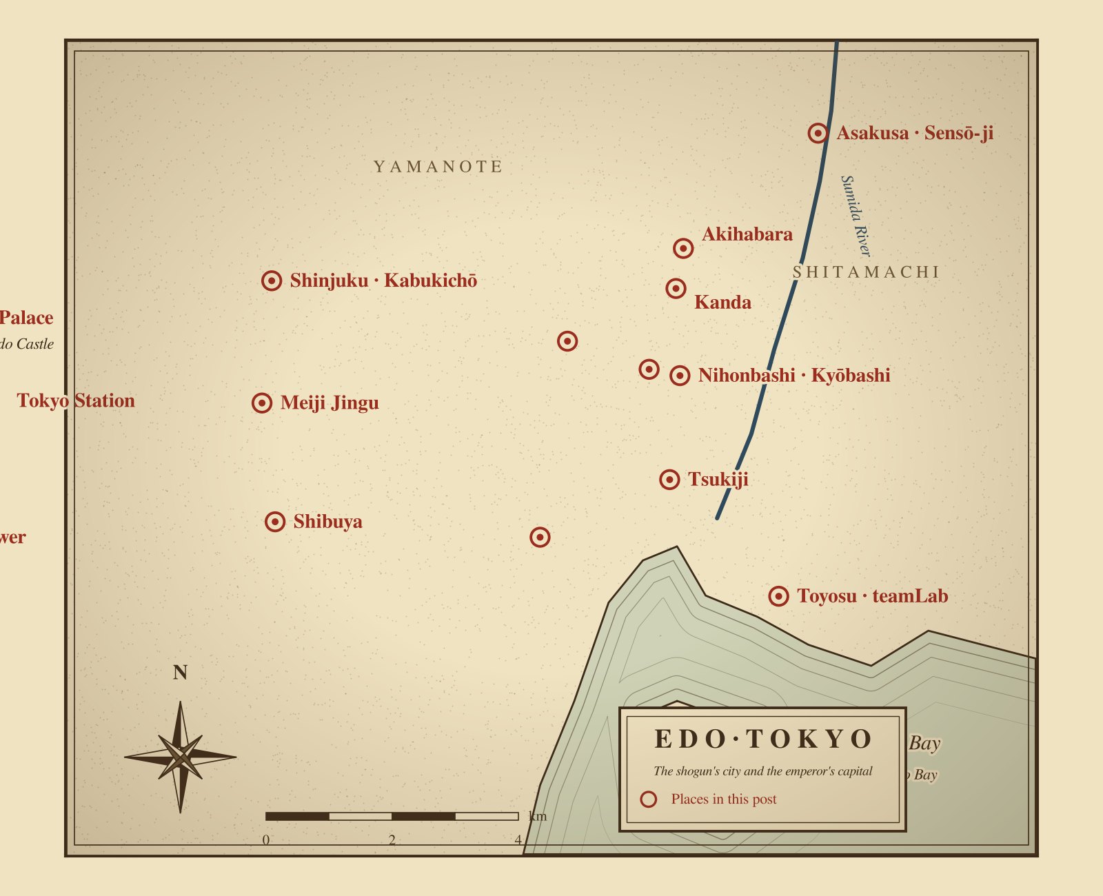
<p class="caption"><img src="/assets/images/japan-2025/tokyo-map.jpg" alt="An old-style map of Tokyo marking the Imperial Palace, Tokyo Station, Nihonbashi, Kanda, Akihabara, Asakusa, Shinjuku, Meiji Jingu, Shibuya, Zōjō-ji, Tsukiji, Toyosu, and Odaiba" />
<em>Tokyo, drawn for this post in the style of an old map, with the places I visited. The bay shore is approximate.</em></p>

<p>Tokyo was where I landed back into the world. The city did not wait for me. It moved immediately, trains, people, and lights, all with precision. I was anonymous, and that felt good: no one was watching, and no one expected anything. I walked without a destination, and the city absorbed me. On my first night I ate at Ichiran, a tonkotsu ramen chain from Fukuoka where each diner sits in a booth with partitions on either side, which may be the most Tokyo way possible to eat alone without explanation. (At home, my own attempt is a <a href="/kitchen/#r-double-soup-shoyu-ramen">double-soup shoyu ramen</a>, topped with <a href="/kitchen/#r-adam-liaws-ajitama-ramen-eggs">ajitama</a>.)</p>

<h3 id="edo">Edo</h3>

<p>Tokyo is a young capital by Japanese standards. It began as Edo, a castle town that the warrior Ōta Dōkan fortified in 1457. Ten years later, the Ōnin War broke out in Kyoto and began more than a century of civil war among regional lords, the Sengoku or “Warring States” period. It ended with three unifiers in turn: Oda Nobunaga, Toyotomi Hideyoshi, and Tokugawa Ieyasu. Ieyasu, who had made Edo his base in 1590, won the decisive battle of Sekigahara in 1600 and became shogun in 1603. For the next 265 years, the Edo period, his family ruled from here in peace, with the emperor in Kyoto and foreign contact restricted, from the 1630s, mainly to the Dutch and Chinese at Nagasaki.</p>

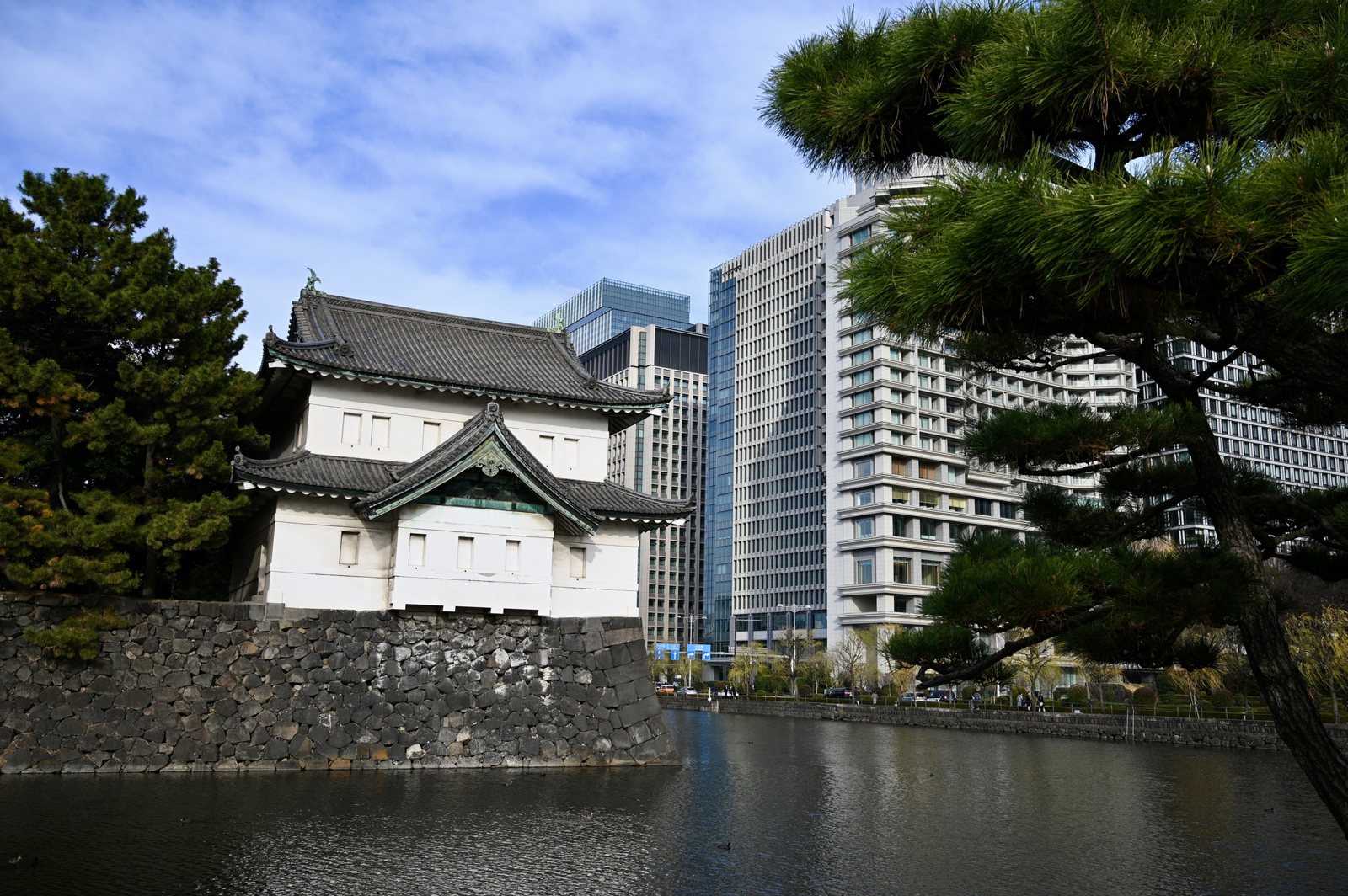
<p>What is left of Edo Castle is now the Imperial Palace, next to Tokyo Station. Most of its grounds are closed, but its moats and walls run through the business district, and the Tatsumi Yagura, a two-story corner turret, is one of only three that survive. The office towers behind it make the point about scale. In the late-1980s bubble, the palace’s land was said to be worth more than all the real estate in California.</p>

<p class="caption"><img src="/assets/images/japan-2025/tatsumi-yagura.jpg" alt="A white two-story Edo Castle corner turret on a stone wall above the moat, with office towers behind" />
<em>The Tatsumi Yagura, one of three surviving turrets of Edo Castle.</em></p>

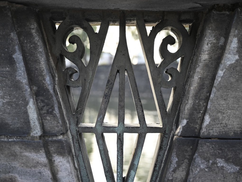
<p class="caption"><img src="/assets/images/japan-2025/palace-moat-grille.jpg" alt="An old iron grille set in stone, with the palace moat blurred behind it" />
<em>Ironwork on a bridge over the palace moat.</em></p>

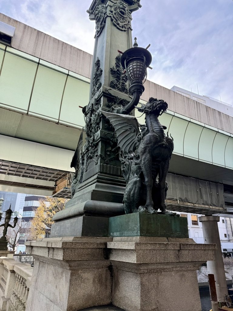
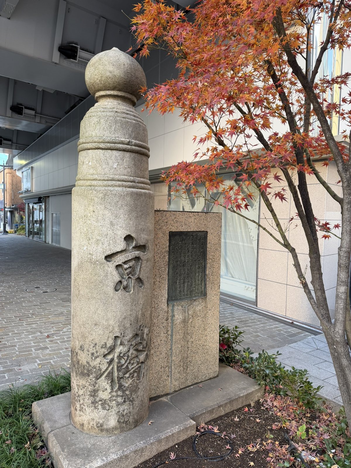
<p>The shogun’s roads began a few blocks away. In 1603 Ieyasu had a bridge put across the river at Nihonbashi, and the next year it became the starting point of the five great roads out of Edo, the Tōkaidō to Kyoto among them. Distances in Japan are still measured from a marker in its road. The current stone bridge opened in 1911, with bronze kirin on its lamp posts whose wings are said to stand for journeys out across the country. In 1963, in the rush to prepare for the Tokyo Olympics, an expressway was built directly over it; it is now being moved underground, with the overhead section due to come down by 2040. One bridge south, a stone post carved 京橋, “the bridge toward the capital,” survives from the Kyōbashi bridge of 1875.</p>

<p class="caption"><img src="/assets/images/japan-2025/nihonbashi-kirin.jpg" alt="A bronze winged kirin on the Nihonbashi bridge, under the expressway" />
<em>A winged kirin on Nihonbashi, under the expressway built over it in 1963.</em></p>

<p class="caption"><img src="/assets/images/japan-2025/kyobashi-pillar.jpg" alt="A stone bridge post carved with the characters for Kyōbashi" />
<em>A post from the 1875 Kyōbashi bridge, the next bridge down the Tōkaidō.</em></p>

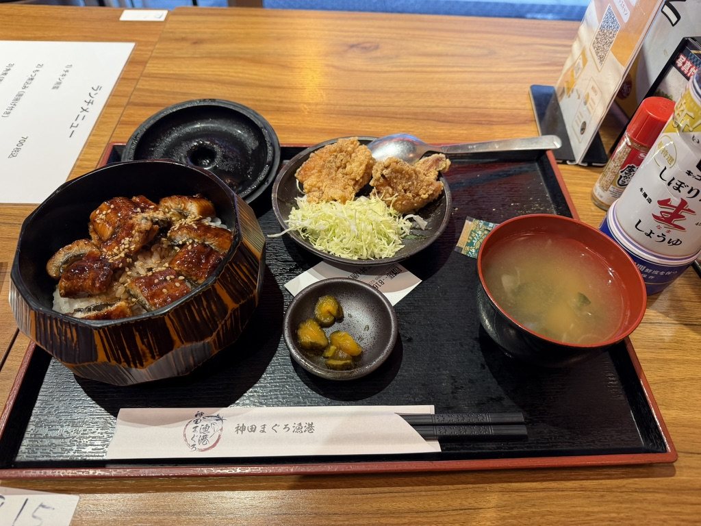
<p>Edo was also where much of what the world now calls Japanese food took shape, as fast food for a crowded city of working men. Nigiri sushi, a slice of fish pressed onto vinegared rice, is credited to a vendor named Hanaya Yohei in the 1820s. Tempura had arrived earlier with Portuguese traders in Nagasaki and became an Edo street snack. Eel grilled in a sweet soy glaze, <em>kabayaki</em>, was another. Near Kanda I had it over rice for lunch, with <a href="/kitchen/#r-chicken-karaage">karaage</a> on the side. Next door, Akihabara grew from a postwar black market in radio parts into the city’s district of electronics, anime, and arcades.</p>

<p class="caption"><img src="/assets/images/japan-2025/kanda-unagi.jpg" alt="A lacquered bowl of grilled eel over rice, with fried chicken, miso soup, and pickles on a tray" />
<em>Unagi over rice in Kanda, an Edo dish.</em></p>

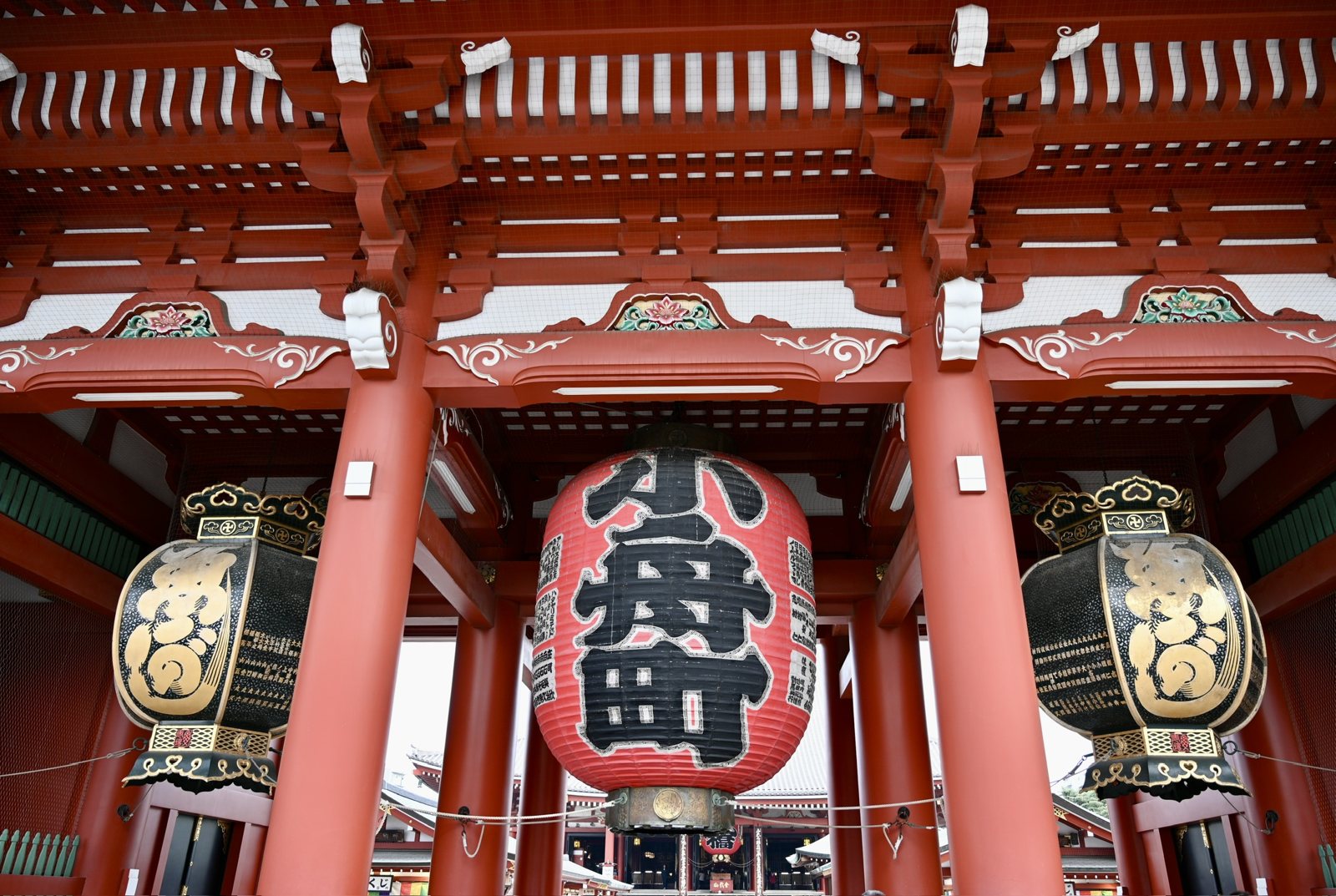
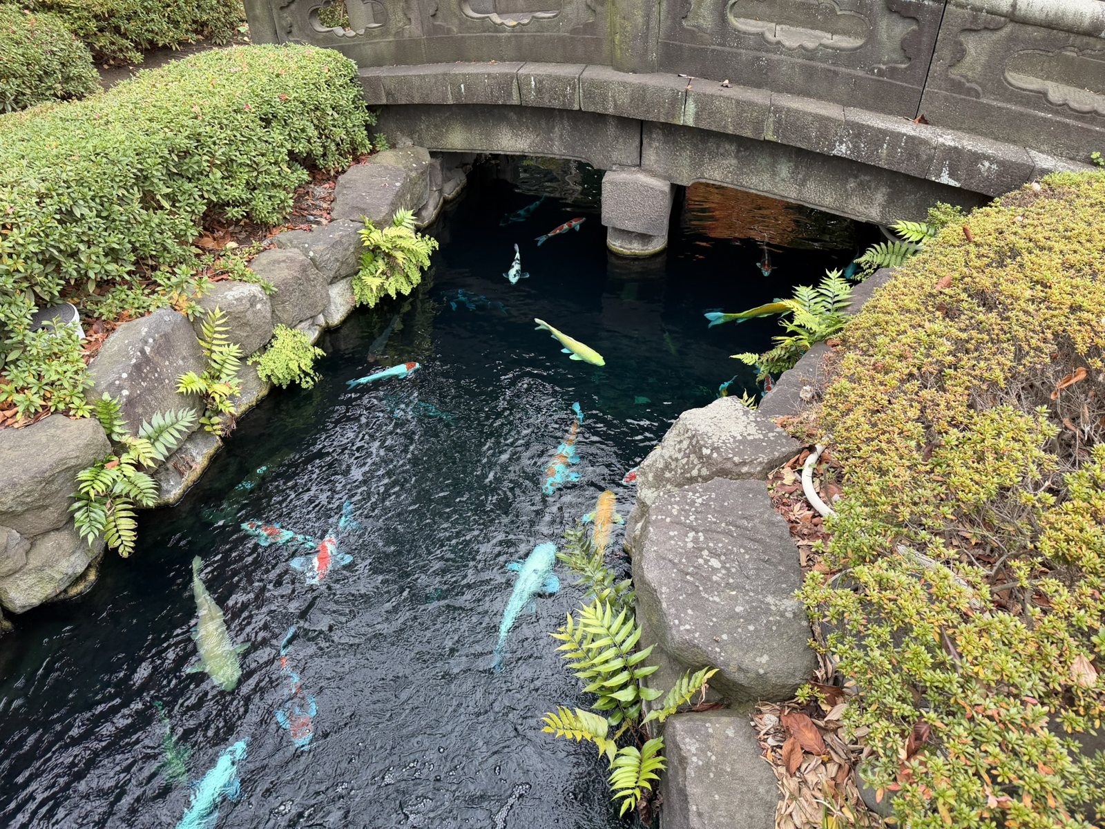
<p>Edo grew up around older places. Sensō-ji in Asakusa, on the Sumida River, is traditionally dated to 628, when two fishermen found a statue of Kannon in their net, which makes it older than Edo by eight centuries. Its inner gate, the Hōzōmon, hangs a red lantern marked 小舟町, for the neighborhood that donated it. Behind the main hall, koi drift under a stone bridge, and the noise of the shopping street disappears within a few steps.</p>

<p class="caption"><img src="/assets/images/japan-2025/hozomon.jpg" alt="A huge red paper lantern hanging in the vermilion Hōzōmon gate of Sensō-ji, flanked by two black-and-gold lanterns" />
<em>The Hōzōmon at Sensō-ji. The red lantern names the Kobunachō neighborhood that gave it.</em></p>

<p class="caption"><img src="/assets/images/japan-2025/sensoji-koi.jpg" alt="Koi swimming in a dark pond under an arched stone bridge" />
<em>Koi in the garden at Sensō-ji.</em></p>

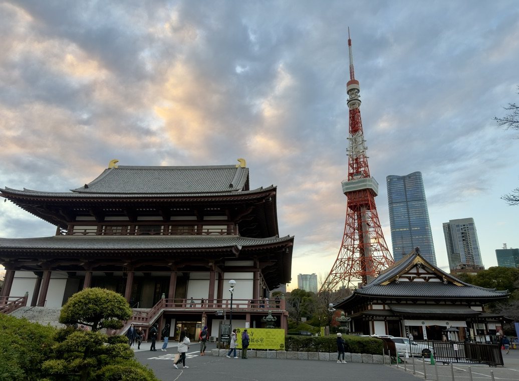
<p>The Tokugawa family temple, Zōjō-ji, holds the graves of six of the fifteen shoguns. It now sits at the foot of Tokyo Tower, a 1958 steel tower painted orange and white for air safety, which is a fair summary of what happened to Edo next.</p>

<p class="caption"><img src="/assets/images/japan-2025/zojoji-tower.jpg" alt="The main hall of Zōjō-ji with Tokyo Tower rising behind it at dusk" />
<em>Zōjō-ji, the Tokugawa family temple, and Tokyo Tower.</em></p>

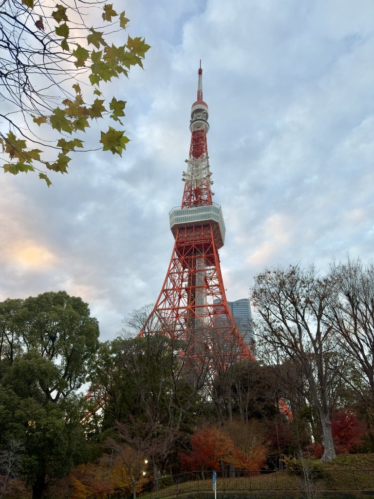
<p class="caption"><img src="/assets/images/japan-2025/tokyo-tower.jpg" alt="Tokyo Tower above autumn trees" />
<em>Tokyo Tower from Shiba Park.</em></p>

<h3 id="meiji-the-emperor-comes-to-edo">Meiji: The Emperor Comes to Edo</h3>

<p>In 1853 Commodore Perry’s American warships anchored in Edo Bay and demanded that Japan open its ports. The shogunate built cannon batteries, <em>daiba</em>, on artificial islands in the bay; two survive, and the district around them is still called Odaiba. The shogunate could not hold off the pressure, and in 1868 a coalition of domains overthrew it in the name of the emperor. The Meiji Restoration renamed Edo as Tokyo, the “eastern capital,” moved the teenage emperor into the castle, and set out to industrialize the country within a generation.</p>

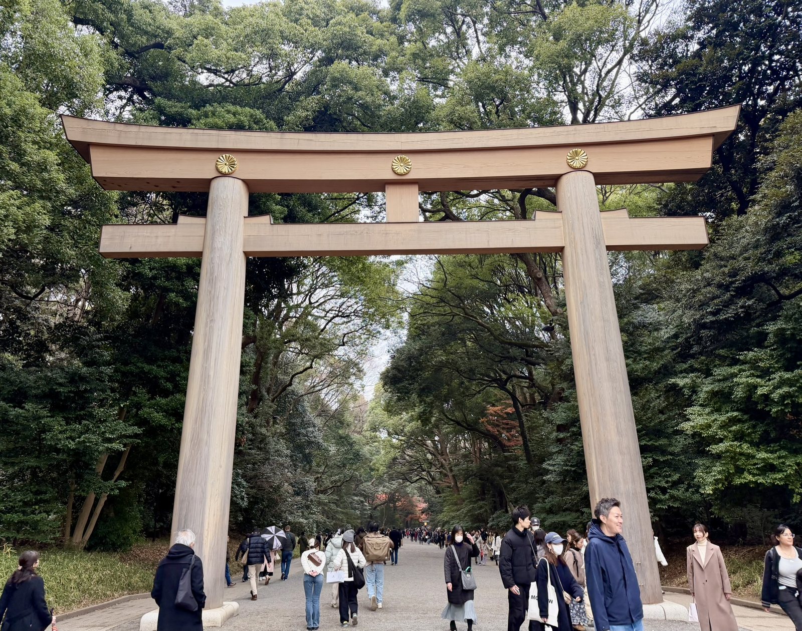
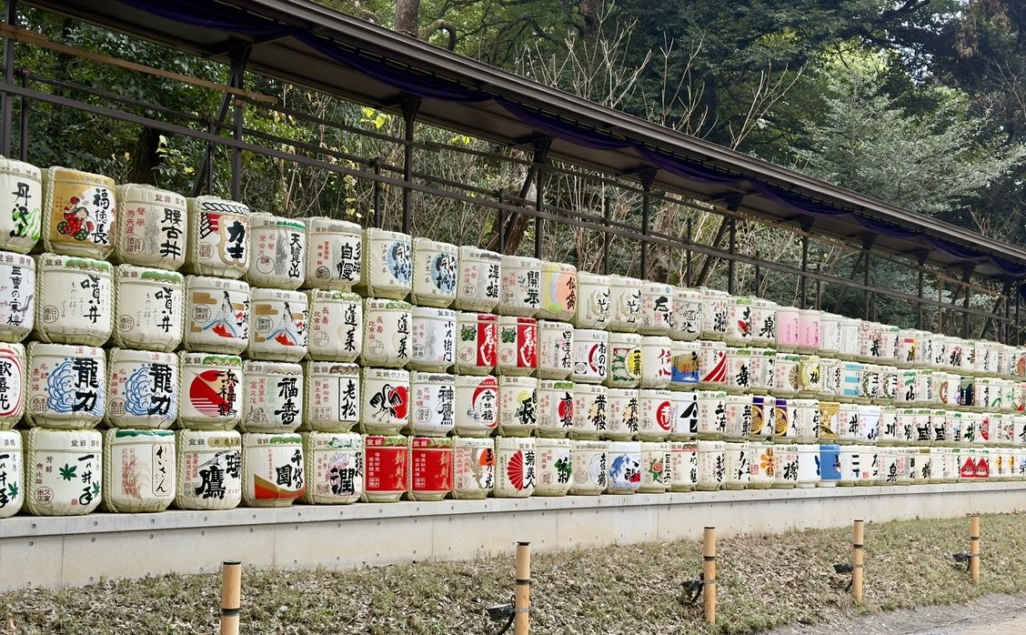
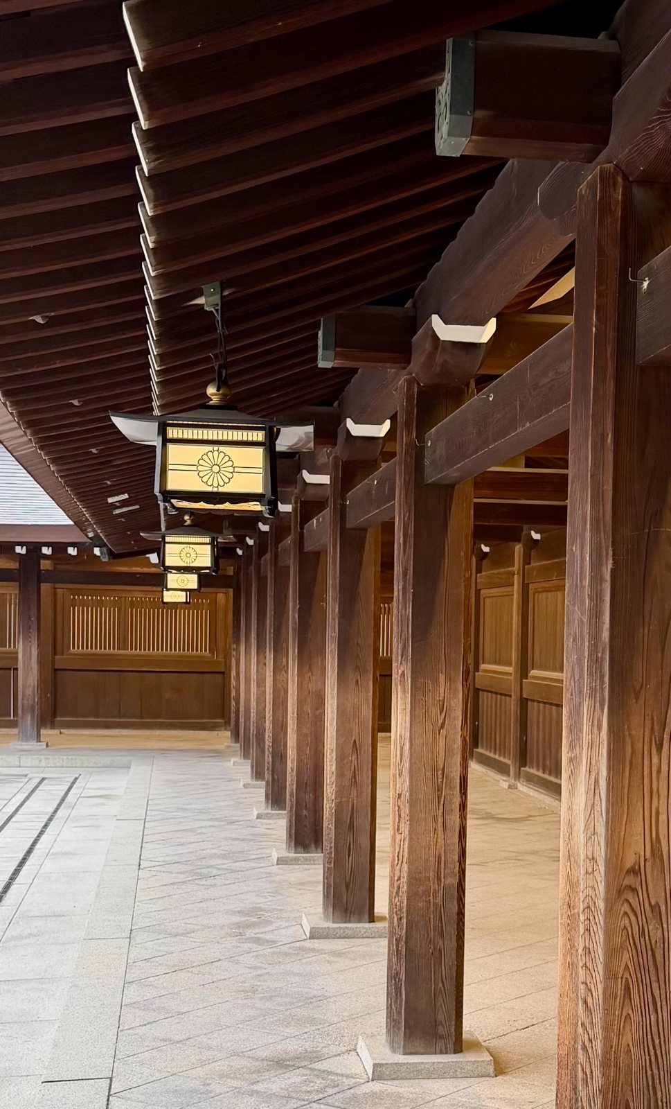
<p>Meiji Jingu, dedicated in 1920 to that emperor and his empress, is Shinto’s answer to the modern city. It lies between Harajuku and Shinjuku, and its forest feels ancient, but it was planted: about 100,000 trees were donated from across Japan and beyond, and they have grown into a 70-hectare wood. The great torii on the approach, about 12 meters tall, is made of Taiwanese cypress more than 1,500 years old, and its crossbeam carries the imperial chrysanthemum. Along the path, sake brewers have stacked barrels as offerings; across from them, so have winemakers from Burgundy, a nod to the emperor’s taste for French wine.</p>

<p>Meiji Jingu was the first shrine of the trip, so it is where I learned how to pray at one. Bow once before passing under the torii, and walk to the side of the path, since the center is said to belong to the kami. At the water basin, the <em>temizuya</em>, take the ladle in your right hand and rinse your left hand, then your right; pour a little water into your cupped left hand to rinse your mouth, spit it to the side, and rinse the ladle’s handle before putting it back. At the hall, drop a coin in the offering box, ring the bell if there is one, then bow twice, clap twice, pray, and bow once more. At a Buddhist temple the gestures are quieter: a bow, a coin, and palms pressed together, with no clapping.</p>

<p class="caption"><img src="/assets/images/japan-2025/meiji-torii.jpg" alt="The great wooden torii at Meiji Jingu, with the imperial chrysanthemum crest on the crossbeam" />
<em>The Ōtorii at Meiji Jingu.</em></p>

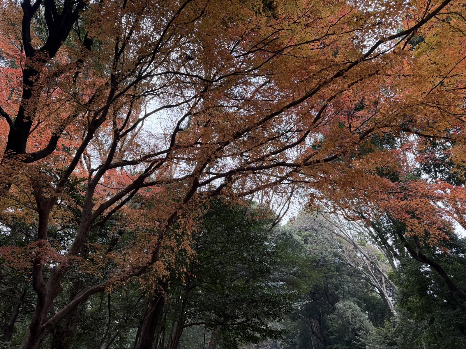
<p class="caption"><img src="/assets/images/japan-2025/meiji-maples.jpg" alt="Orange and red maple leaves over the path through the Meiji Jingu forest" />
<em>Late maples in a forest planted a century ago.</em></p>

<p class="caption"><img src="/assets/images/japan-2025/meiji-sake.jpg" alt="A long wall of decorated sake barrels at Meiji Jingu" />
<em>Sake barrels donated by brewers from across Japan.</em></p>

<p class="caption"><img src="/assets/images/japan-2025/meiji-corridor.jpg" alt="A wooden colonnade with hanging lanterns bearing the chrysanthemum crest" />
<em>The colonnade around the main courtyard.</em></p>

<p>Meiji changed the menu too. Buddhist teaching had discouraged eating meat for centuries, and in 1872 the emperor ate beef in public to show the country that modern people did. Beef hot pots, the ancestor of sukiyaki and of the <a href="/kitchen/#r-gyudon-with-onsen-egg">gyūdon</a> beef bowl, spread through the port cities. Western-style dishes, <em>yōshoku</em>, followed, among them <a href="/kitchen/#r-japanese-beef-curry">curry rice</a> and the breaded pork cutlet that became <a href="/kitchen/#r-adam-liaws-tonkatsu">tonkatsu</a>. Chinese cooks in Yokohama’s Chinatown brought the noodle soup that became ramen; the first dedicated ramen shop opened in Asakusa in 1910.</p>

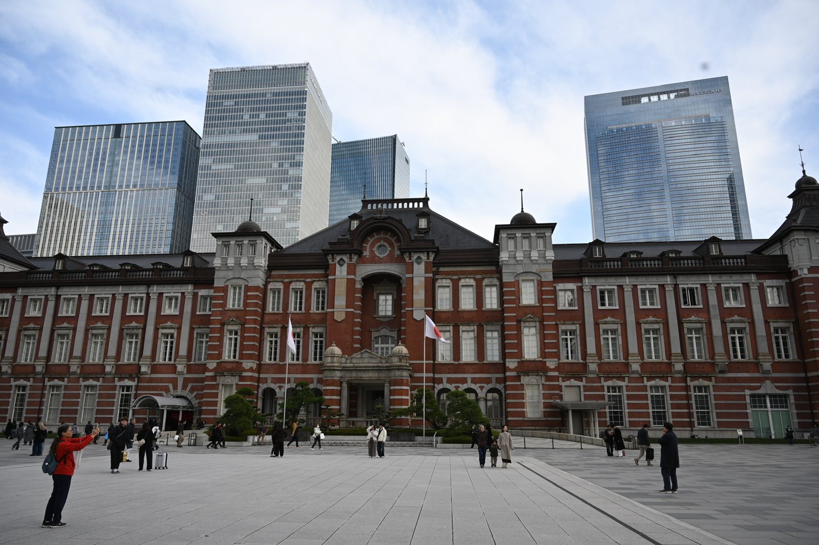
<p>Tokyo Station faces the palace on purpose. Tatsuno Kingo’s red-brick building opened in 1914, lost its domes to the air raids of 1945, made do with octagonal roofs for decades, and was restored to its original design in 2012.</p>

<p class="caption"><img src="/assets/images/japan-2025/tokyo-station.jpg" alt="The red-brick Marunouchi building of Tokyo Station, with glass towers behind it" />
<em>Tokyo Station, restored in 2012 to its 1914 design.</em></p>

<p>After the war, the 1946 “Humanity Declaration” set aside the emperor’s divine status, and the 1947 constitution made him “the symbol of the State and of the unity of the people.” Shinto and the imperial house remain, as Meiji Jingu shows, but as heritage and ritual rather than as instruments of the state.</p>

<h3 id="shibuya-shinjuku-and-the-tokyo-of-today">Shibuya, Shinjuku, and the Tokyo of Today</h3>

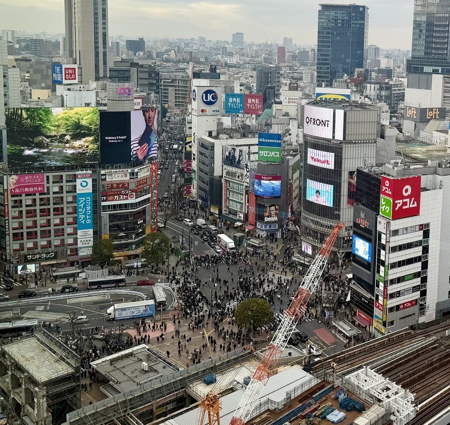
<p>From Meiji Jingu I walked down through Harajuku and Omotesando to Shibuya, where the famous crossing takes up to about 3,000 people on a single light change. One moment I had been in quiet greenery; the next I was watching thousands of people flow past one another in near silence. It was crowded but not chaotic. Everyone had somewhere to be, and no one was in anyone else’s way. That was when I understood something about Tokyo: here, independence is not defiance. It is normal.</p>

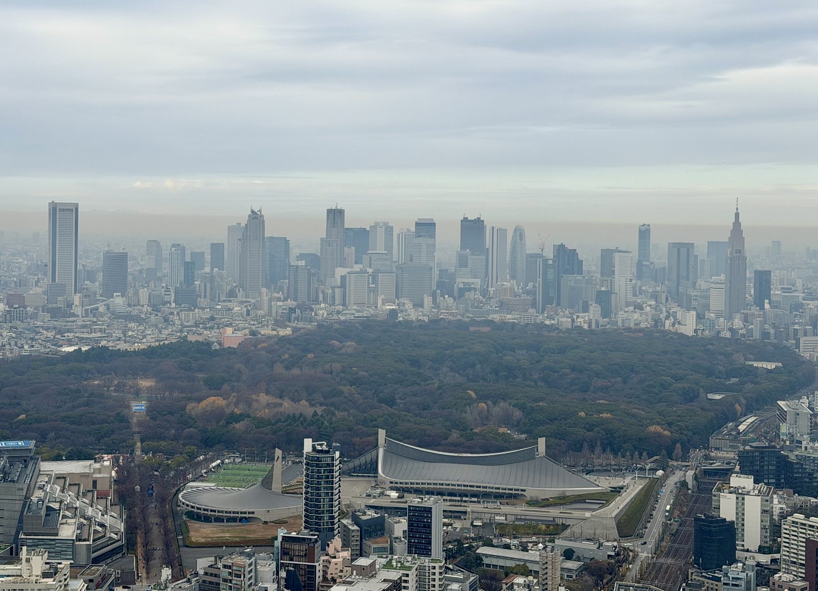
<p>From the roof of Shibuya Sky, about 230 meters up, the day’s route lay in a single view: the dark forest of Meiji Jingu, the shrine to the emperor in whose name Japan remade itself after 1868; in front of it, Kenzō Tange’s sweeping gymnasium for the 1964 Olympics, the event that announced Japan’s postwar recovery; and behind it, the towers of Shinjuku. It is about a century and a half of modern Japan in one frame.</p>

<p class="caption"><img src="/assets/images/japan-2025/shibuya-sky-meiji.jpg" alt="The Meiji Jingu forest seen from Shibuya Sky, with the Yoyogi National Gymnasium in front and the Shinjuku skyline behind" />
<em>From Shibuya Sky: the Meiji Jingu forest, the 1964 Olympic gymnasium in front of it, and Shinjuku beyond.</em></p>

<p class="caption"><img src="/assets/images/japan-2025/shibuya-crossing.jpg" alt="The Shibuya scramble crossing from above, full of people, surrounded by billboards" />
<em>The Shibuya crossing, mid-scramble.</em></p>

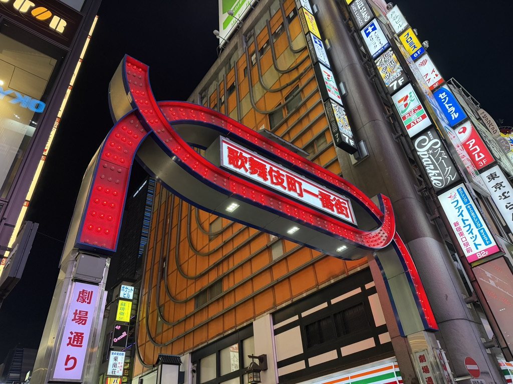
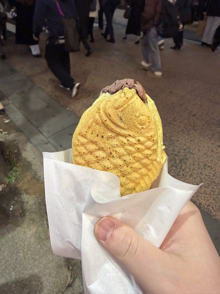
<p>Tokyo is less one city than a set of them. Shibuya is youth, fashion, and energy; Shinjuku is offices, the metropolitan government, and nightlife. Shinjuku’s narrow alleys, and the tiny bars of Golden Gai, were Tokyo at its most playful and slightly absurd. I watched people more than I took part, and that was enough; it was enough to be present. Kabukichō, under its red neon arch, is named for a kabuki theater planned there after the war that was never built. Taiyaki, the fish-shaped cake filled with sweet bean paste that I ate on the street nearby, is said to date from 1909, late in the Meiji era. At night the city glows without trying to impress, and there is comfort in that.</p>

<div class="pair">
  <figure><img src="/assets/images/japan-2025/kabukicho.jpg" alt="The red neon arch at the entrance to Kabukichō at night" loading="lazy" /><figcaption>Kabukichō, Shinjuku.</figcaption></figure>
  <figure><img src="/assets/images/japan-2025/taiyaki.jpg" alt="A fish-shaped taiyaki filled with sweet bean paste, held over a busy street" loading="lazy" /><figcaption>Taiyaki in Shinjuku.</figcaption></figure>
</div>

<p>The Japan I visited was also in the middle of a change that I follow for work. Sanae Takaichi had become its first woman prime minister two months earlier. A record 42.7 million foreign visitors came in 2025, and on some streets it felt like it. After decades of near-zero interest rates, the Bank of Japan has been raising rates and shrinking its holdings of government bonds, which it had bought until it owned about half the market. Japan’s government debt is close to 200 percent of GDP, and the country is the largest foreign holder of US Treasuries, so what happens to yields in Tokyo travels. I track all of this in the Japan section of my <a href="/macro-monitor/">Macro Monitor</a>. Standing in Shibuya, it was a useful reminder that the charts are about a place.</p>

<h3 id="mt-fuji-and-hakone">Mt Fuji and Hakone</h3>

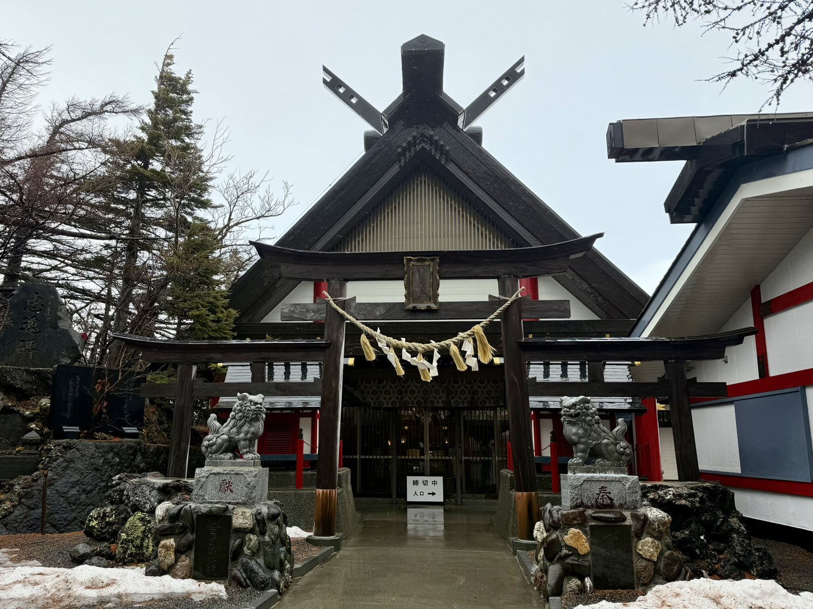
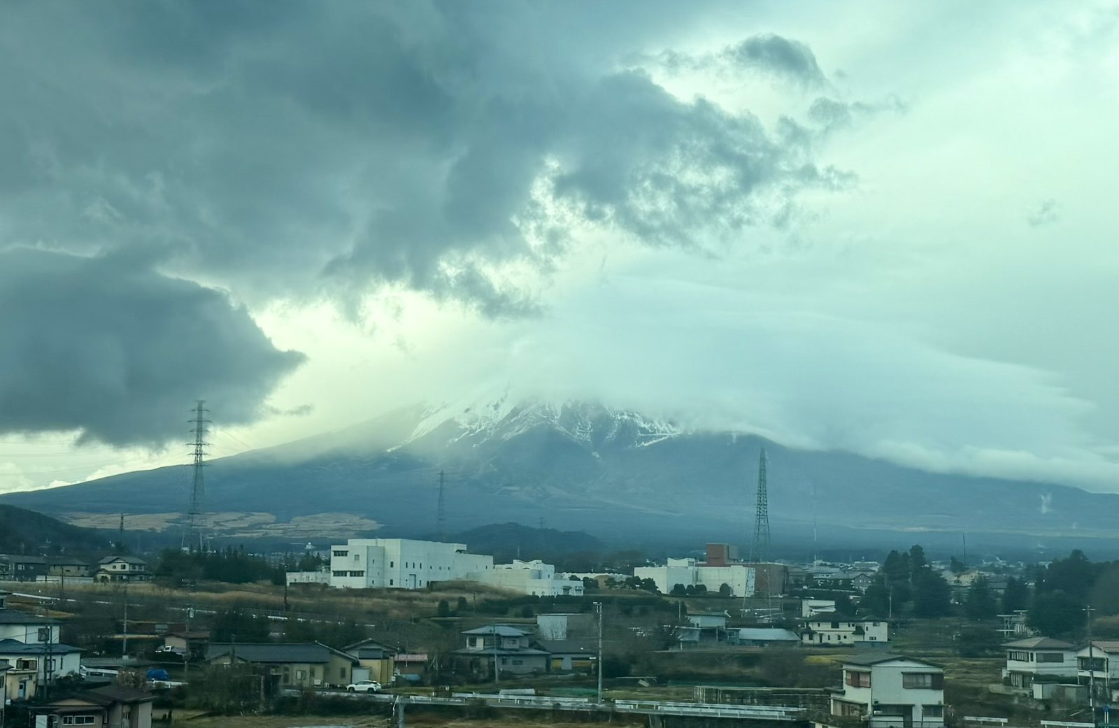
<p>Leaving the city made Tokyo feel even sharper in hindsight. Mt Fuji, 3,776 meters high, is an active volcano that last erupted in 1707, and in Shinto it is a kami. The goddess of the mountain is Konohanasakuya-hime, “the princess who makes the trees blossom,” often linked with the cherry blossom, and she is worshipped at some 1,300 Sengen shrines, headed by Fujisan Hongū Sengen Taisha at the mountain’s foot. Fear of the volcano and reverence for it grew together, and worship is often described as partly a way to calm it.</p>

<p>At the fifth station, the road ends beside Komitake Shrine, which honors her older sister, Iwanaga-hime, the goddess of rock. In the old chronicles, the heavenly prince Ninigi was offered both sisters and chose the beautiful Konohanasakuya-hime over the enduring Iwanaga-hime, and so, the story goes, human lives became as brief as blossoms rather than as lasting as stone. It is the Japanese idea of impermanence in a single myth.</p>

<p class="caption"><img src="/assets/images/japan-2025/komitake-shrine.jpg" alt="Komitake Shrine at the Mt Fuji fifth station, with a torii, a sacred rope, and guardian lion-dogs, and snow on the ground" />
<em>Komitake Shrine at the fifth station, for Iwanaga-hime, the goddess of rock.</em></p>

<p>Climbing Fuji was historically a pilgrimage rather than a sport. In the Edo period, confraternities called Fuji-kō saved up to send members to the summit for purification, and women were barred from climbing the mountain until 1872. The mountain did not demand attention when I saw it. It sat in its own cloud, immovable and indifferent, and put scale back into perspective. My problems shrank without disappearing, which seemed like the right balance.</p>

<p class="caption"><img src="/assets/images/japan-2025/fuji-clouds.jpg" alt="Mt Fuji wrapped in heavy cloud, with snow on its upper slopes and houses in the foreground" />
<em>Fuji, mostly in its own weather.</em></p>

<p>It is also perhaps the most painted mountain in Japan, and the story of how it came to be painted is the story of Japanese painting in brief. Court painters of the Heian period developed <em>yamato-e</em>, a native style of bright color and gentle landscapes. Zen monks brought ink painting from China, and the monk Sesshū made it Japanese in the 15th century. The Kanō school painted gold-leaf folding screens for warlords and shoguns. Then, in Edo, woodblock prints, <em>ukiyo-e</em>, “pictures of the floating world,” put art within reach of merchants and townspeople; printers even used techniques such as <em>mokume-zuri</em>, printing the grain of the wood itself for texture. In the Meiji era, the word <em>nihonga</em> was coined for painting in these traditions, to tell it apart from the Western-style painting arriving at the same time.</p>

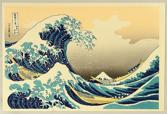
<p>The mountain’s most famous image came from an artist who was already old. Katsushika Hokusai was born in Edo in 1760 in the district of Katsushika, which gave him the name he is known by. He was apprenticed to a woodcarver at 14 and joined the studio of the print designer Katsukawa Shunshō at 18. He used at least 30 names over his career, and he was about 70 when the publisher Nishimuraya Yohachi brought out his <em>Thirty-Six Views of Mount Fuji</em>. In the colophon to his later <em>One Hundred Views of Mount Fuji</em>, he wrote that nothing he drew before 70 was worth noticing, and that by 110 every dot and line would be alive. He died in 1849, at 88, reportedly wishing for a few more years to become a real painter. From 1834 he signed his work Gakyō Rōjin Manji, “the old man mad about art.”</p>

<p>The first print of the series, <em>Under the Wave off Kanagawa</em>, printed around 1830 to 1832, is often called the best-known Japanese image in the world. A wave the size of a cliff curls over three fishing boats, and Fuji sits small and calm in the distance, the one thing in the picture that will still be there afterward. Hokusai printed it with Prussian blue, a pigment newly imported from Europe, and the print later traveled back the other way: Debussy put it on the cover of the score of <em>La Mer</em> in 1905. Public-domain impressions are in the <a href="https://www.metmuseum.org/art/collection/search/56353">Metropolitan Museum of Art</a> and the <a href="https://www.artic.edu/artworks/24645">Art Institute of Chicago</a>.</p>

<p class="caption"><img src="/assets/images/japan-2025/great-wave.jpg" alt="Hokusai's Great Wave: a towering blue wave curling over three boats, with a small Mt Fuji in the distance" />
<em>Katsushika Hokusai, Under the Wave off Kanagawa (c. 1830–32), from Thirty-Six Views of Mount Fuji; shown here in a later woodblock reproduction. Original impressions: Metropolitan Museum of Art and Art Institute of Chicago.</em></p>

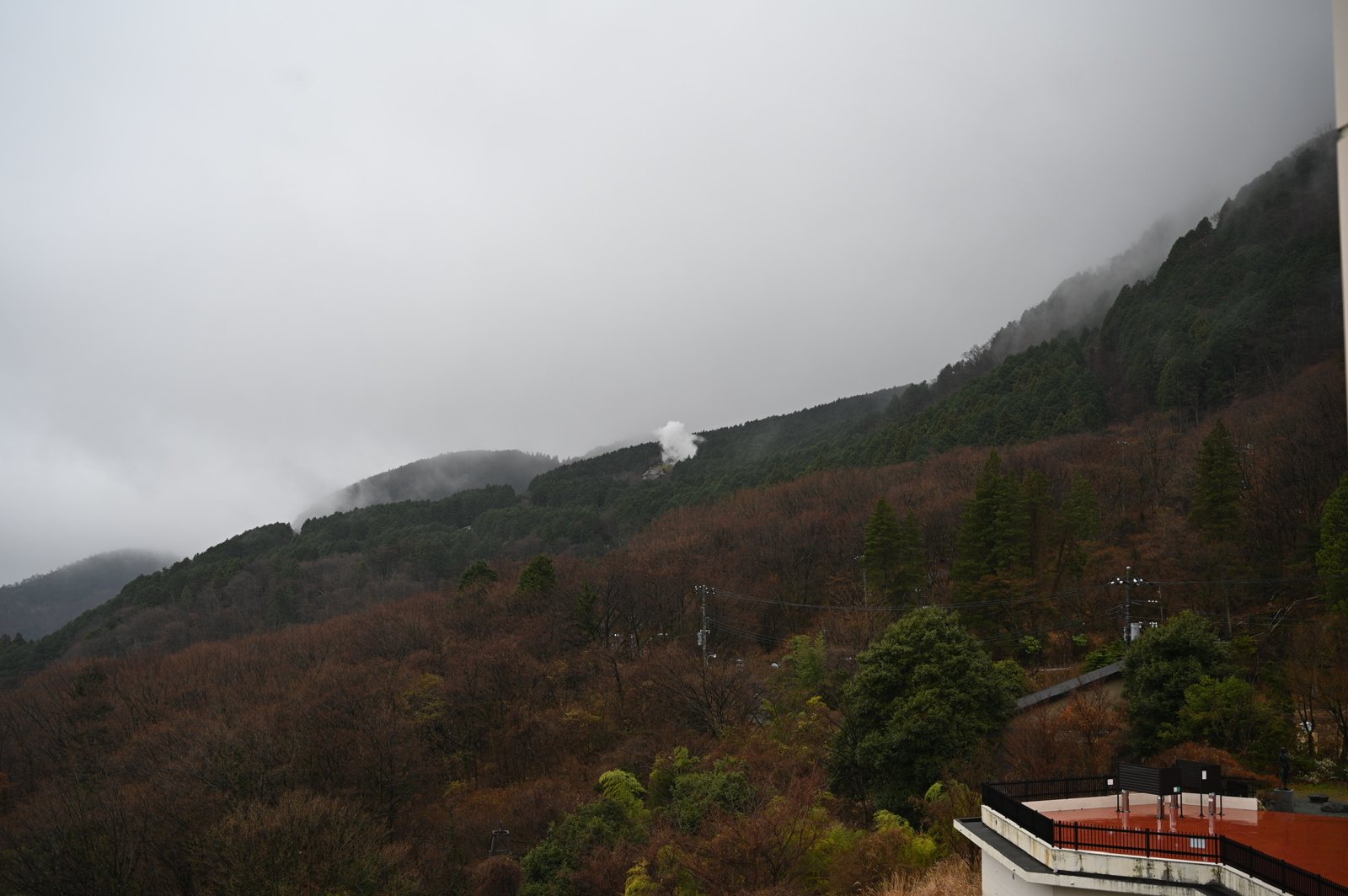
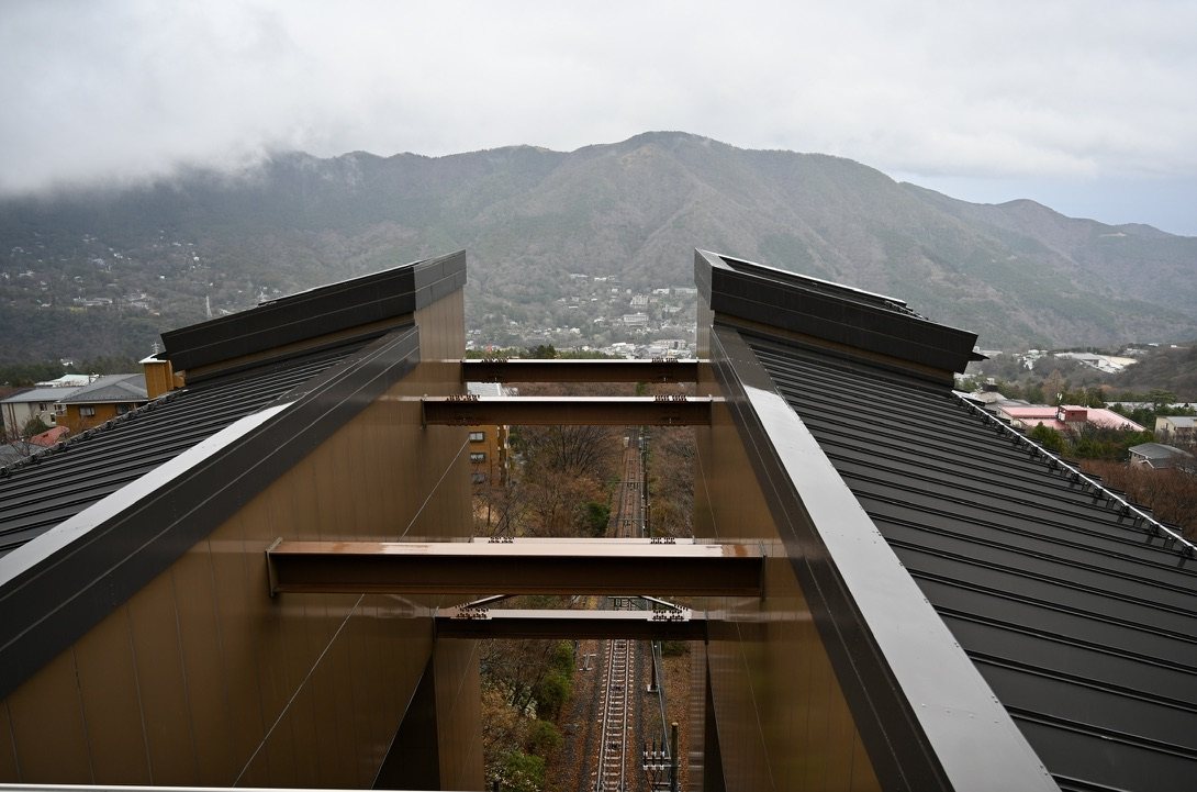
<p>That afternoon, after the fifth station, I crossed into Hakone, the volcanic hot-spring district where the old Tōkaidō climbed over the mountains and the shogunate kept a checkpoint. Hakone sits inside the caldera of Mt Hakone, a volcano that is still alive. White plumes rise from its slopes: these are fumaroles, vents where volcanic gas, mostly water vapor laced with sulfur, escapes from the hot rock below. They are densest at Ōwakudani, the “Great Boiling Valley,” where the ground was last blown open by small steam-driven explosions, and the same heat feeds the town’s hot springs. A cable car hauls visitors up slopes the old travelers walked. I came back to Tokyo tired, but steadier.</p>

<p class="caption"><img src="/assets/images/japan-2025/hakone-steam.jpg" alt="A white plume of volcanic gas rising from a fumarole on a forested, cloud-covered mountainside in Hakone" />
<em>A fumarole on the slopes of Mt Hakone: volcanic gas venting from the hillside.</em></p>

<p class="caption"><img src="/assets/images/japan-2025/hakone-cable-car.jpg" alt="The track of the Hakone cable car running steeply downhill between station roofs" />
<em>The Hakone cable car, looking down the mountain.</em></p>

<h3 id="odaiba-the-futures-waiting-room">Odaiba: The Future’s Waiting Room</h3>

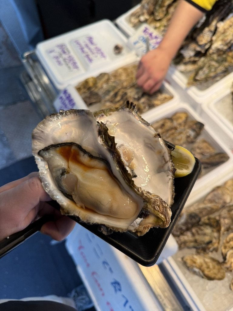
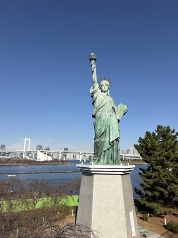
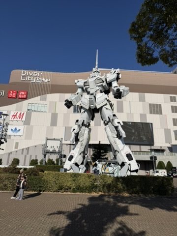
<p>My last Tokyo day began with oysters at the Tsukiji outer market, which stayed put when the wholesale fish market left for Toyosu in 2018. From there I went out onto the reclaimed land of the bay. Odaiba felt like the future’s waiting room: wide, quiet, and slightly unreal, with a replica of the Statue of Liberty facing the Rainbow Bridge and, until 2026, a life-size Unicorn Gundam standing guard over a shopping mall.</p>

<p class="caption"><img src="/assets/images/japan-2025/tsukiji-oyster.jpg" alt="A large raw oyster held up at a stall in the Tsukiji outer market" />
<em>Breakfast at Tsukiji.</em></p>

<p class="caption"><img src="/assets/images/japan-2025/odaiba-liberty.jpg" alt="A replica of the Statue of Liberty in Odaiba, with the Rainbow Bridge across the bay" />
<em>Odaiba’s Statue of Liberty, with the Rainbow Bridge behind.</em></p>

<p class="caption"><img src="/assets/images/japan-2025/odaiba-gundam.jpg" alt="The white Unicorn Gundam statue in front of DiverCity Tokyo Plaza" />
<em>The Unicorn Gundam at DiverCity. Update, 2026: it was taken down at the end of August.</em></p>

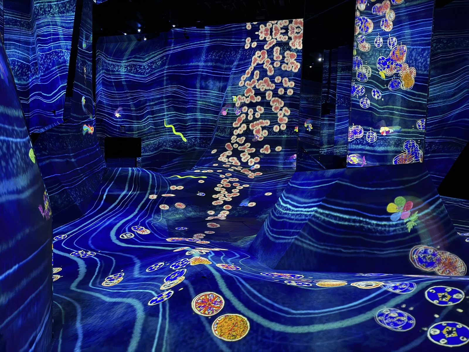
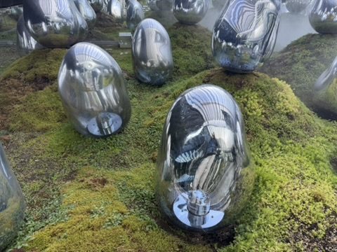
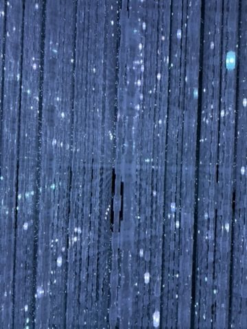
<p>At teamLab Planets, in Toyosu, visitors take off their shoes and walk, partly through water, into rooms of digital art. It was impressive but strangely calming; the technology did not overwhelm, it invited a quiet curiosity. By the end of that day I felt complete with Tokyo. I did not need more.</p>

<p class="caption"><img src="/assets/images/japan-2025/teamlab-planets.jpg" alt="A room at teamLab Planets with blue projected light and drifting flower-like shapes across sloped walls and floor" />
<em>teamLab Planets, Toyosu.</em></p>

<div class="pair">
  <figure><img src="/assets/images/japan-2025/teamlab-moss.jpg" alt="Mirrored egg-shaped sculptures on a moss garden" loading="lazy" /><figcaption>The moss garden.</figcaption></figure>
  <figure><img src="/assets/images/japan-2025/teamlab-crystal.jpg" alt="Strings of tiny lights in a dark room" loading="lazy" /><figcaption>The Infinite Crystal Universe.</figcaption></figure>
</div>

<p>What stayed with me was how quiet the city actually is, how normal it feels to be alone, how efficiency can feel humane, and how the absence of eye contact comes with an absence of judgment. Tokyo taught me that self-containment is a kind of strength.</p>

<h2 id="kyoto-and-nara-stillness-history-and-inner-space">Kyoto and Nara: Stillness, History, and Inner Space</h2>

<p class="dayline">Wed 24–Fri 26 Dec · Kyoto, Nara, Arashiyama · Days 6–8</p>

<p>I took the Shinkansen down the corridor the Tōkaidō once followed. The line opened in 1964 as the world’s first high-speed railway, and covers in a little over two hours a road that took travelers on foot about two weeks.</p>

<h3 id="kyoto-the-emperors-city">Kyoto: The Emperor’s City</h3>

<p>The court moved to Heian-kyō, modern Kyoto, in 794, and the emperors stayed for more than a thousand years, until 1869. Kyoto arrived softly. It does not announce itself; it reveals itself slowly, in wooden buildings, narrower streets, and warmer light. It is not a city for distraction.</p>

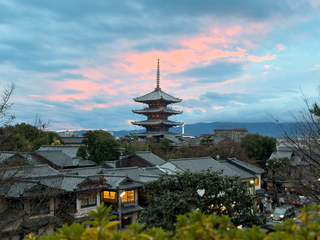
<p>At dusk I walked through Gion, past Yasaka Shrine and down Hanamikoji, and along the Shirakawa canal. Time stretched. Nothing was rushed, and even my thoughts slowed down. The light caught the five-story pagoda of Hōkan-ji, the “Yasaka pagoda,” above the tiled roofs.</p>

<p class="caption"><img src="/assets/images/japan-2025/yasaka-pagoda.jpg" alt="The five-story Yasaka pagoda above tiled rooftops at sunset" />
<em>The Yasaka pagoda at dusk.</em></p>

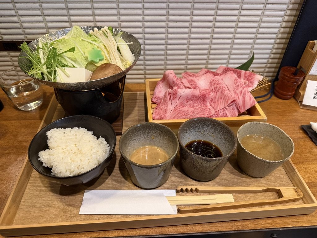
<p class="caption"><img src="/assets/images/japan-2025/kyoto-wagyu.jpg" alt="A tray of wagyu slices, vegetables in a hot pot, rice, and dipping sauces" />
<em>Wagyu hot pot in Kyoto, a meal that would have been unthinkable before 1872. At home I keep it simpler, with a <a href="/kitchen/#r-japanese-wagyu-steak">seared wagyu steak</a>.</em></p>

<h3 id="fushimi-inari">Fushimi Inari</h3>

<p>Fushimi Inari sits on the rail line from Kyoto to Nara, which makes it a natural first stop on the way. Founded in 711, it is the head of some 30,000 to 40,000 Inari shrines across Japan. Inari began as the kami of rice, and since rice was once how wealth, taxes, and power were measured, Inari became the kami of business and prosperity as well. That makes it one of the most practical gods in Shinto.</p>

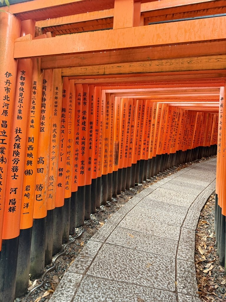
<p>The shrine is less a building than a mountain, which suits a religion that places the divine in nature rather than in buildings: its paths climb Mount Inari under thousands of vermilion torii, each given by a business or a family, often in thanks after a wish came true, and inscribed with the donor’s name and the date. The vermilion is said to ward off misfortune and, practically, to help protect the wood from decay. The foxes that guard the paths are not gods but Inari’s messengers, chosen because foxes hunt the rodents that eat the rice; they often hold a key to the granary, a jewel, or a scroll in their mouths, for access to abundance, stored wealth, and knowledge.</p>

<p>Walking through the gates is an act of gratitude rather than petition, and the long climb turns that into a ritual. As the path rises, the crowds thin, the gates grow older, and the mountain grows quieter; the full walk to the summit and back takes two to three hours, and many visitors turn back early. The idea it expresses is reciprocity: effort comes first, and thanks follow success. It is easy to see why it suited Kyoto’s merchants, and why it still suits a country that values patience and long commitment.</p>

<p class="caption"><img src="/assets/images/japan-2025/fushimi-inari.jpg" alt="A tunnel of vermilion torii gates at Fushimi Inari, inscribed in black" />
<em>The torii at Fushimi Inari, each inscribed with its donor.</em></p>

<h3 id="nara-where-buddhism-became-the-states">Nara: Where Buddhism Became the State’s</h3>

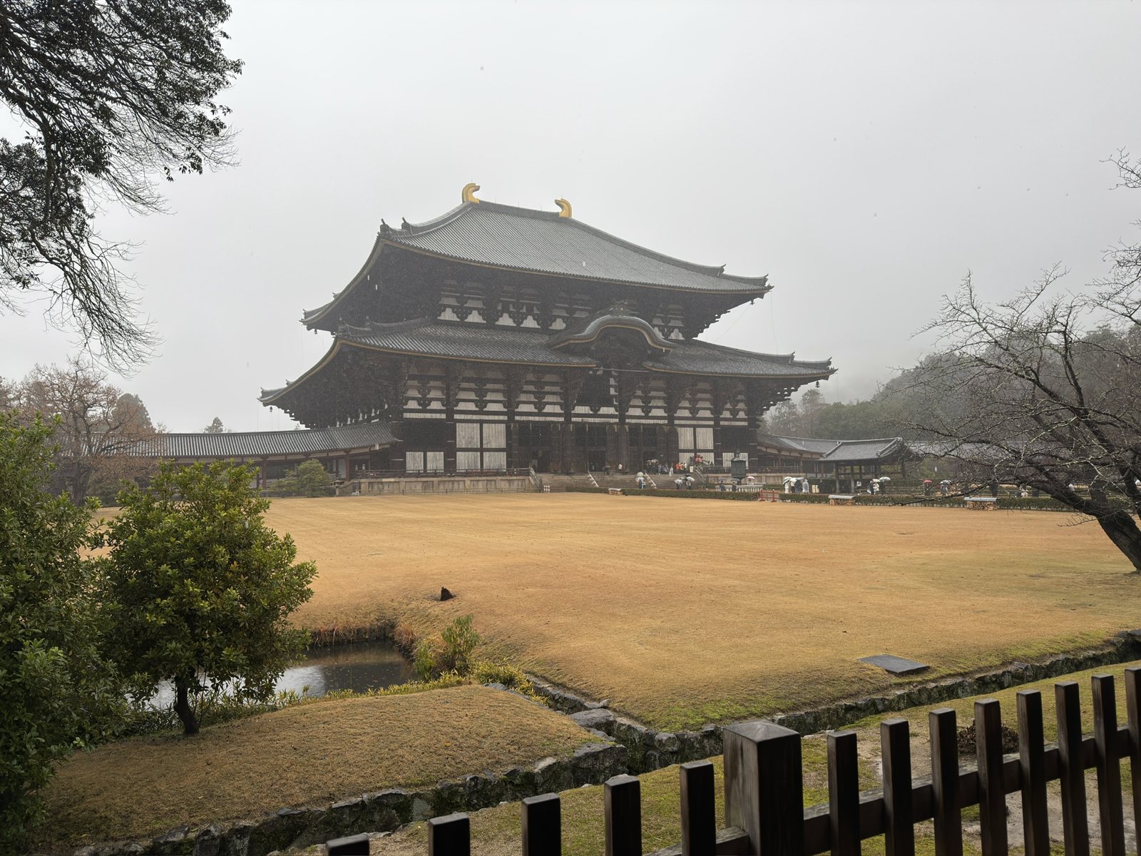
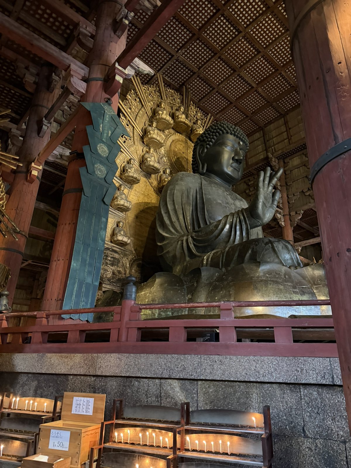
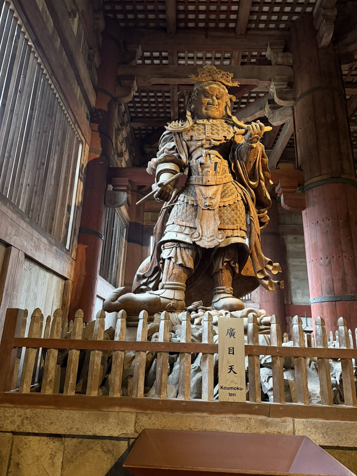
<p>Nara was Japan’s first permanent capital, from 710 to 784, laid out on the grid of the Chinese capital at Chang’an. It is where Buddhism became an affair of state, and it feels ancient in a way that is not performative. Emperor Shōmu ordered a temple in every province and built Tōdai-ji at the head of them; its Great Buddha was dedicated in 752. The figure is about 15 meters tall, and the hall around it, rebuilt in 1709, is about a third smaller than the original and still among the largest wooden buildings in the world. The Buddha does not intimidate; it steadies. Beside it stands Kōmokuten, one of the Four Heavenly Kings who guard the directions, holding a brush and scroll to record what he sees. I felt small, but not insignificant. That distinction matters.</p>

<p class="caption"><img src="/assets/images/japan-2025/daibutsuden.jpg" alt="The Great Buddha Hall of Tōdai-ji in rain and mist, across a lawn" />
<em>The Daibutsuden, rebuilt in 1709.</em></p>

<div class="pair">
  <figure><img src="/assets/images/japan-2025/daibutsu.jpg" alt="The bronze Great Buddha of Tōdai-ji with a gilded halo" loading="lazy" /><figcaption>The Great Buddha, dedicated in 752.</figcaption></figure>
  <figure><img src="/assets/images/japan-2025/komokuten.jpg" alt="A large wooden statue of the guardian Kōmokuten in armor" loading="lazy" /><figcaption>Kōmokuten, guardian of the west.</figcaption></figure>
</div>

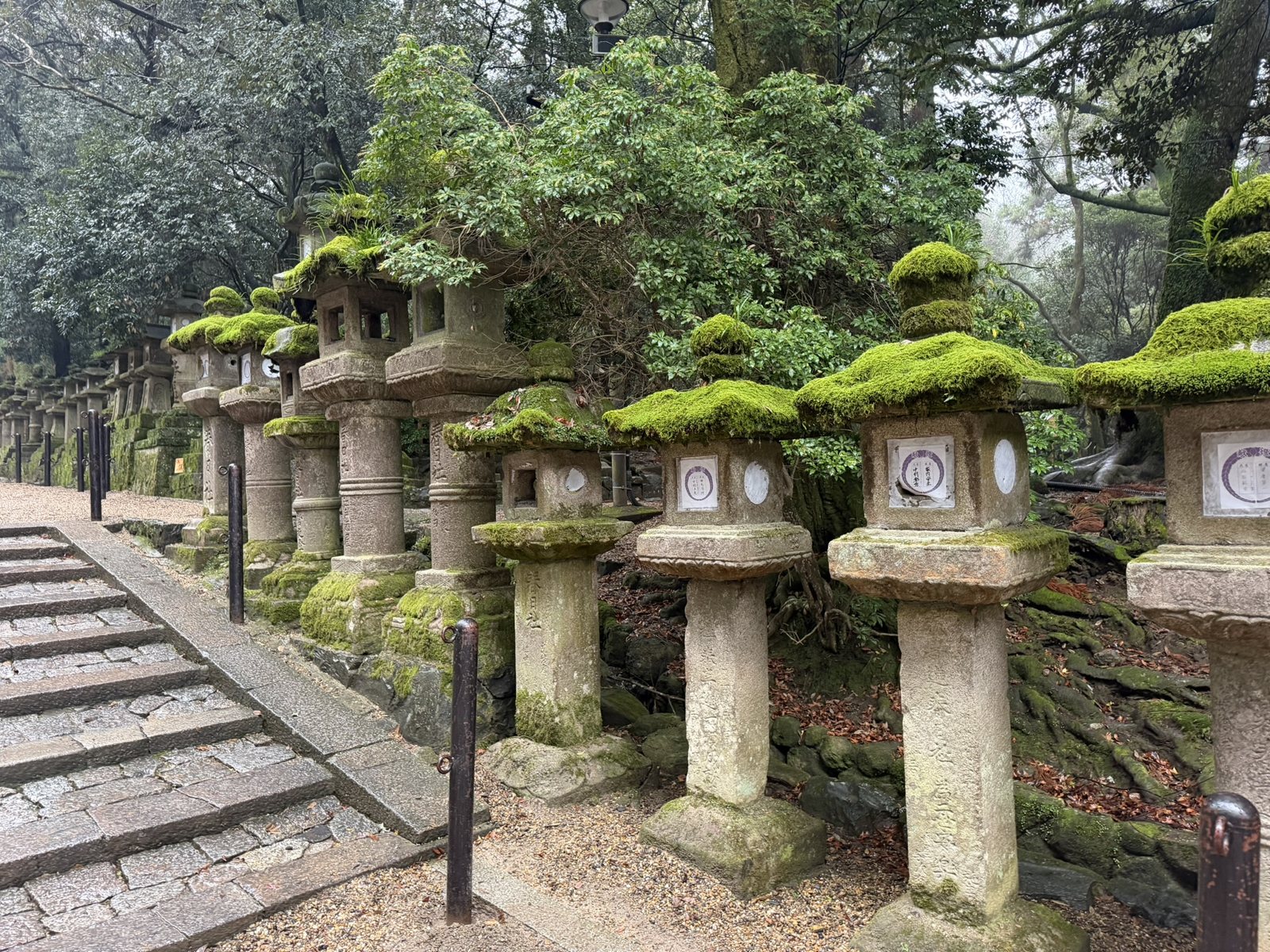
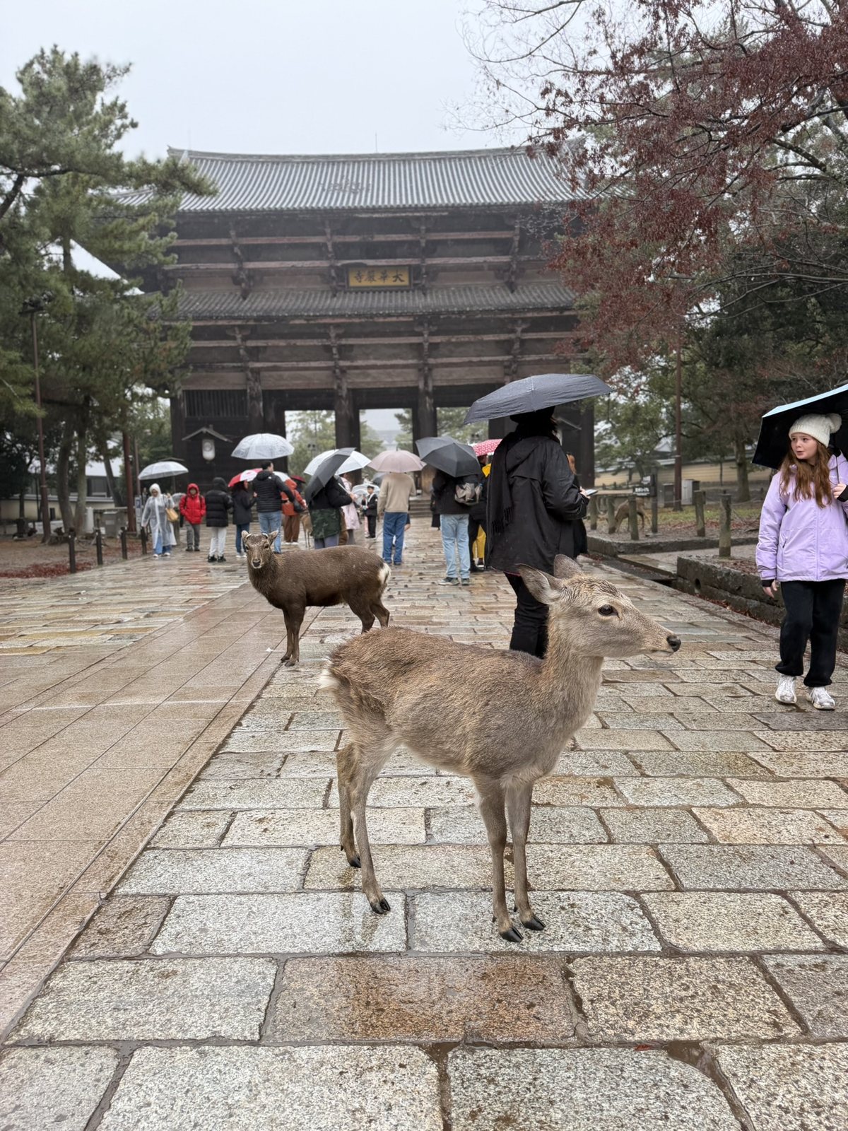
<p>A short walk away, the two religions sit side by side. Kasuga Taisha, a Shinto shrine founded in 768 for the guardian kami of the powerful Fujiwara family, is reached by a path of some 3,000 stone and bronze lanterns, most of them furred with moss. Its gods are said to have arrived riding a white deer, which is why Nara’s deer, now about 1,465 of them, are treated as sacred messengers and protected as a national Natural Monument. They move freely, unconcerned with tourists or time, and they stood about in the rain at Tōdai-ji’s Great South Gate.</p>

<p class="caption"><img src="/assets/images/japan-2025/kasuga-lanterns.jpg" alt="Moss-covered stone lanterns lining a path at Kasuga Taisha" />
<em>Stone lanterns on the approach to Kasuga Taisha.</em></p>

<p class="caption"><img src="/assets/images/japan-2025/nara-deer.jpg" alt="Two deer on a wet stone path in front of the Great South Gate of Tōdai-ji" />
<em>Deer at the Great South Gate of Tōdai-ji. The plaque reads 大華厳寺, “Great Kegon Temple.”</em></p>

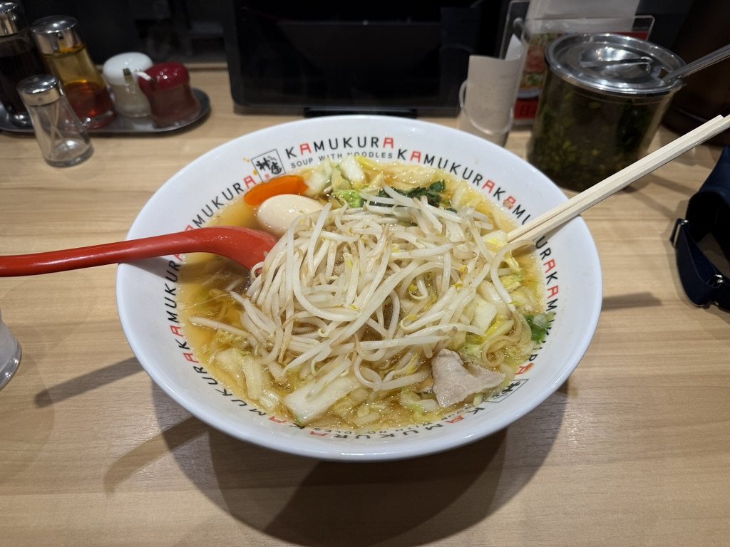
<p class="caption"><img src="/assets/images/japan-2025/kamukura.jpg" alt="A bowl of ramen with cabbage, bean sprouts, and an egg in a Kamukura bowl" />
<em>Lunch in Nara, from an Osaka ramen chain: a preview of what was coming.</em></p>

<h3 id="zen-tea-and-the-kyoto-table">Zen, Tea, and the Kyoto Table</h3>

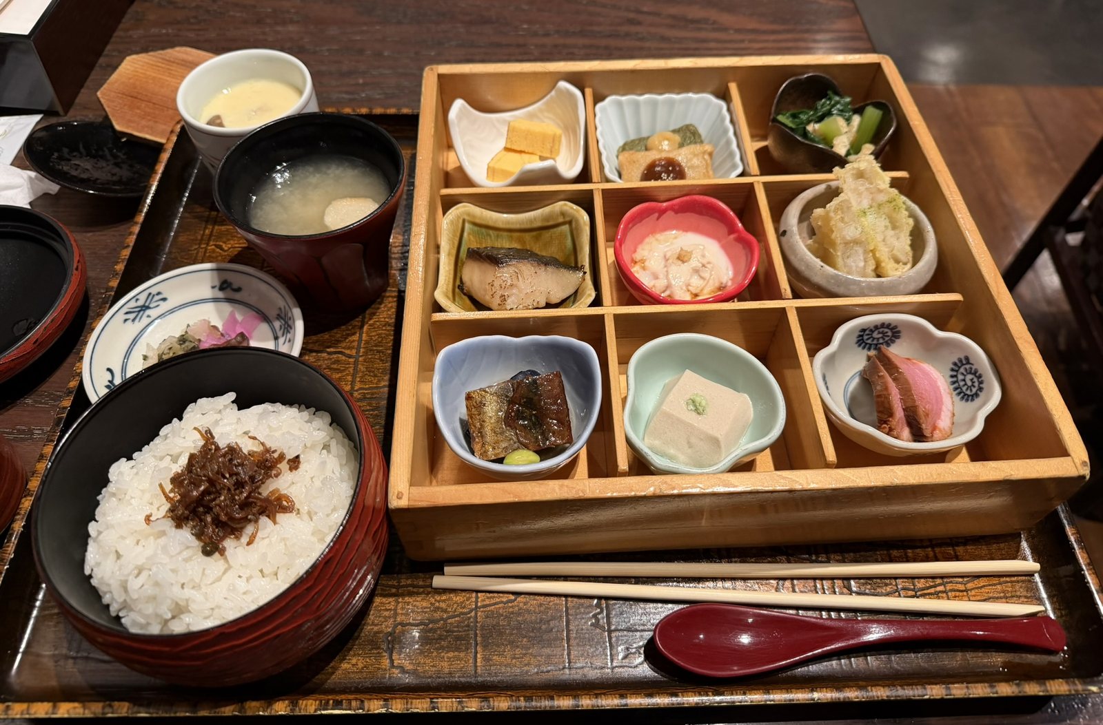
<p>Kyoto is also where Zen became a way of living rather than only a doctrine. The great Zen temples here were patrons of ink painting and garden design, and the tea ceremony grew out of them. Sen no Rikyū, a merchant’s son trained in Rinzai Zen, refined it in the 16th century as tea master to Hideyoshi, into the spare, rustic style called <em>wabi-cha</em>. The light meal served before tea became <em>kaiseki</em>, Japan’s formal cuisine, and the temples’ vegetarian cooking, <em>shōjin ryōri</em>, shaped it too. What reached the ordinary Kyoto table was <em>obanzai</em>, home-style dishes served in small portions, many at once, nearly all of them built on <a href="/kitchen/#r-dashi-stock">dashi</a>, the kelp-and-bonito stock that is also the base of <a href="/kitchen/#r-miso-soup">miso soup</a>.</p>

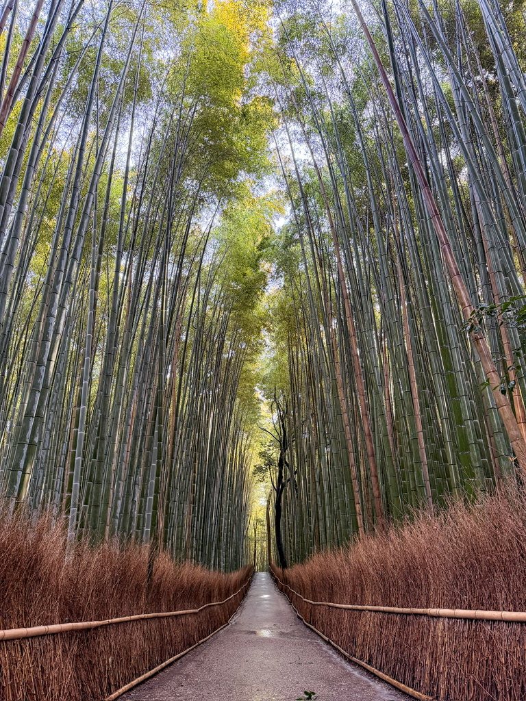
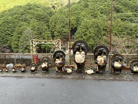
<p>On my last morning I went west to Arashiyama, early enough to have the bamboo grove almost to myself; it runs beside Tenryū-ji, one of the city’s great Zen temples. Then I rode out along the Hozu River gorge, where a crowd of ceramic tanuki waits on the platform at Hozukyo station. In folklore the tanuki is a shape-shifting trickster; in ceramics it is a round-bellied figure of good luck.</p>

<p class="caption"><img src="/assets/images/japan-2025/arashiyama-bamboo.jpg" alt="A path running through a tall bamboo grove in morning light" />
<em>The bamboo grove at Arashiyama, early.</em></p>

<p class="caption"><img src="/assets/images/japan-2025/hozukyo-tanuki.jpg" alt="A row of ceramic tanuki statues on a station platform above a river gorge" />
<em>The tanuki of Hozukyo station.</em></p>

<p class="caption"><img src="/assets/images/japan-2025/kyoto-lunch.jpg" alt="A lunch tray with rice, miso soup, and a nine-compartment box of small Kyoto dishes" />
<em>A last Kyoto lunch: nine small dishes in a box, before the train to Osaka.</em></p>

<p>I noticed the sound of footsteps on stone, how the light changed in the afternoon, how little signage there was, and the restraint in architecture and color. Kyoto reminded me that depth does not need volume.</p>

<h2 id="osaka-warmth-appetite-and-release">Osaka: Warmth, Appetite, and Release</h2>

<p class="dayline">Fri 26–Sat 27 Dec · Osaka · Days 8 and 9</p>

<p>Osaka, once called Naniwa, greeted me differently. It was louder, looser, and more human. People laughed more openly, food was everywhere, and it was less polished and more alive. After Kyoto’s introspection, it felt like permission to re-engage.</p>

<h3 id="the-last-battle-of-the-warring-states">The Last Battle of the Warring States</h3>

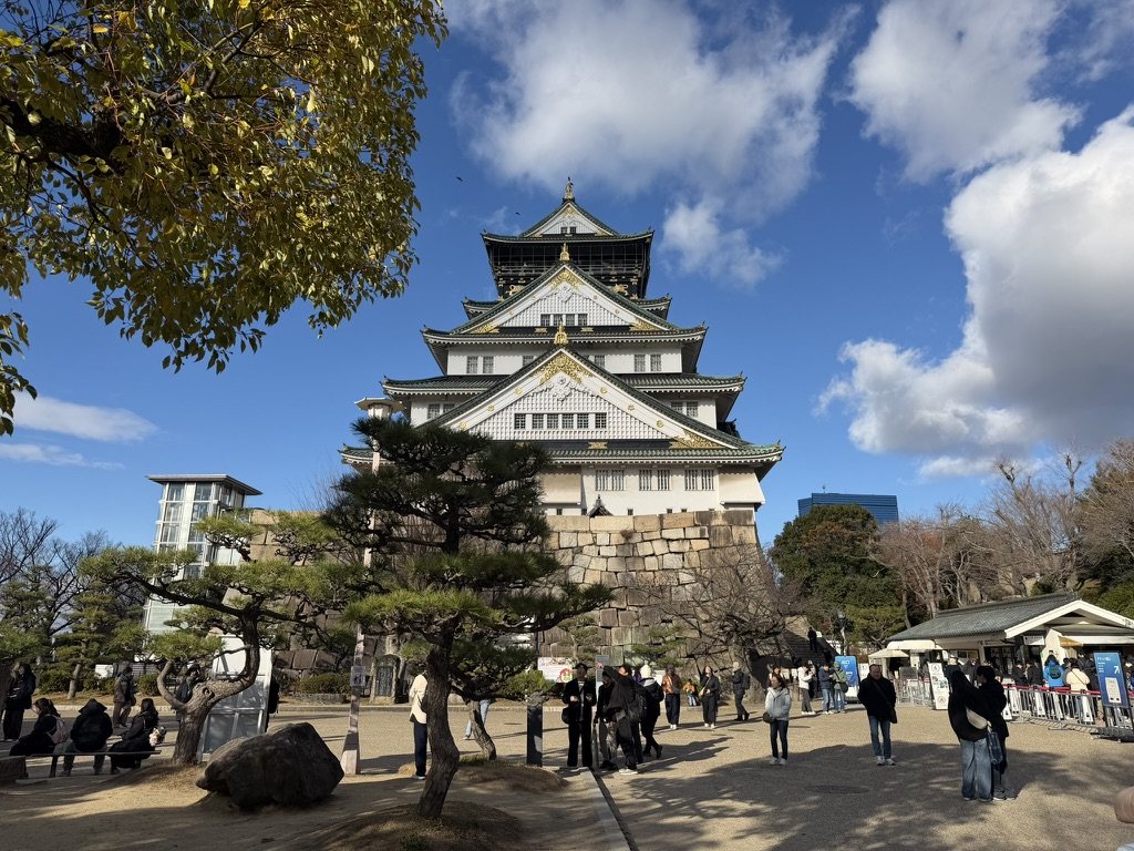
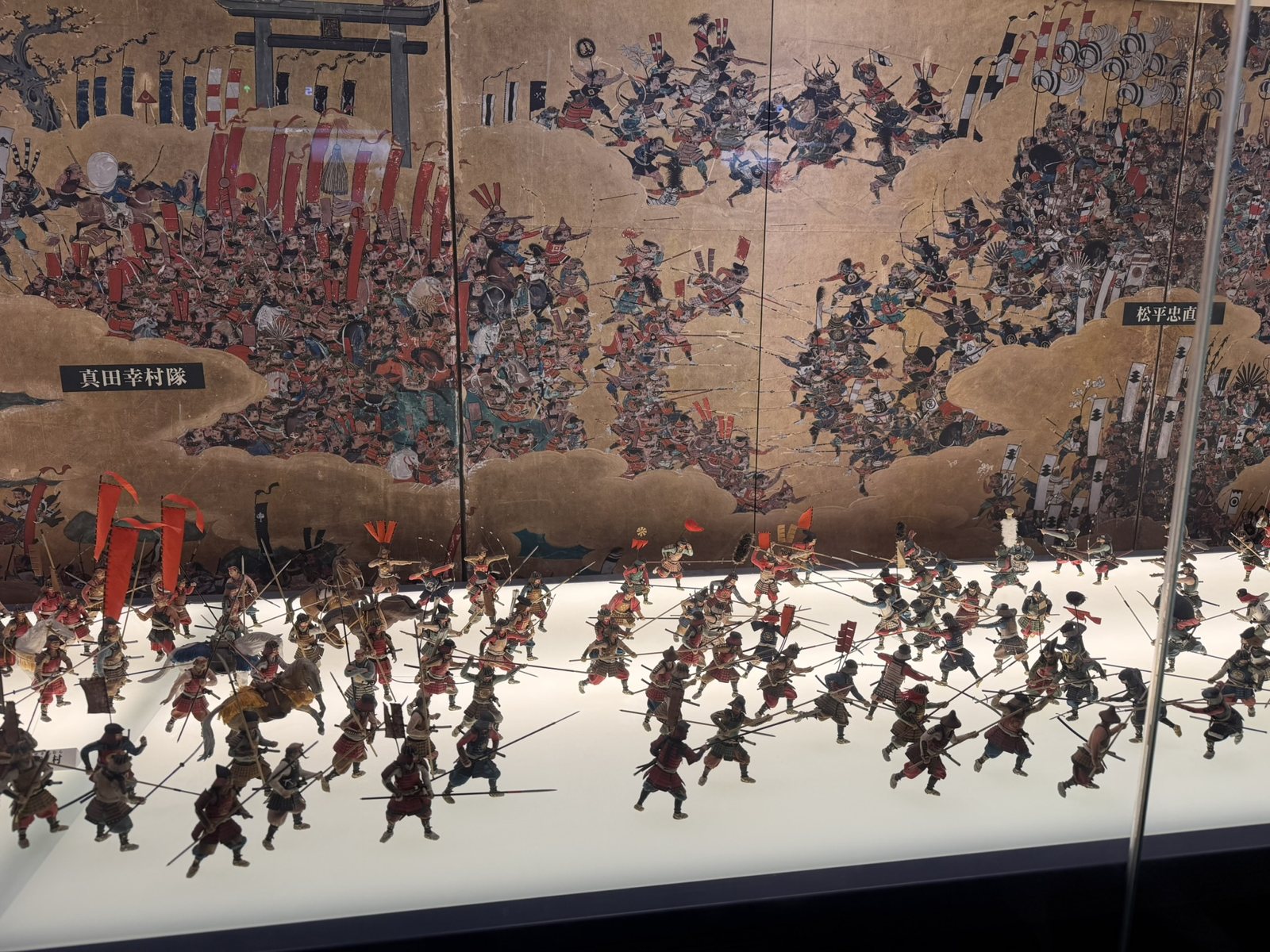
<p>Osaka Castle is where the Sengoku period finally ended. Toyotomi Hideyoshi, the second of the three unifiers, began it in 1583. After he died, Tokugawa Ieyasu, already shogun, besieged his heir there in the winter of 1614 and the summer of 1615 and destroyed the Toyotomi line. The defenders’ most famous commander, Sanada Yukimura, led a last charge toward Ieyasu’s headquarters and was killed. The museum inside the castle tells the story with a diorama in front of a painted folding screen, the kind of gold-ground <em>byōbu</em> that warlords commissioned to record their battles; the labels name Sanada Yukimura’s troops on the left and those of Matsudaira Tadanao, who fought them, on the right. The best-known screen of the battle, the <em>Ōsaka Natsu no Jin Zu Byōbu</em>, was commissioned by Kuroda Nagamasa, a general on the Tokugawa side, and is an Important Cultural Property in the castle’s collection.</p>

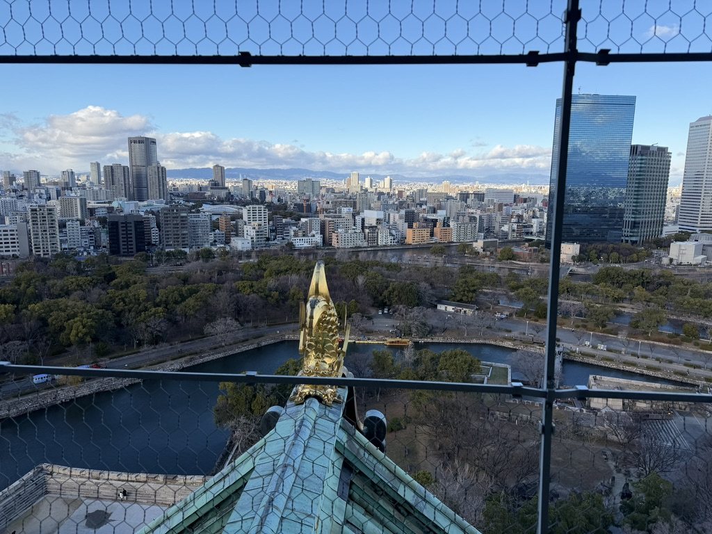
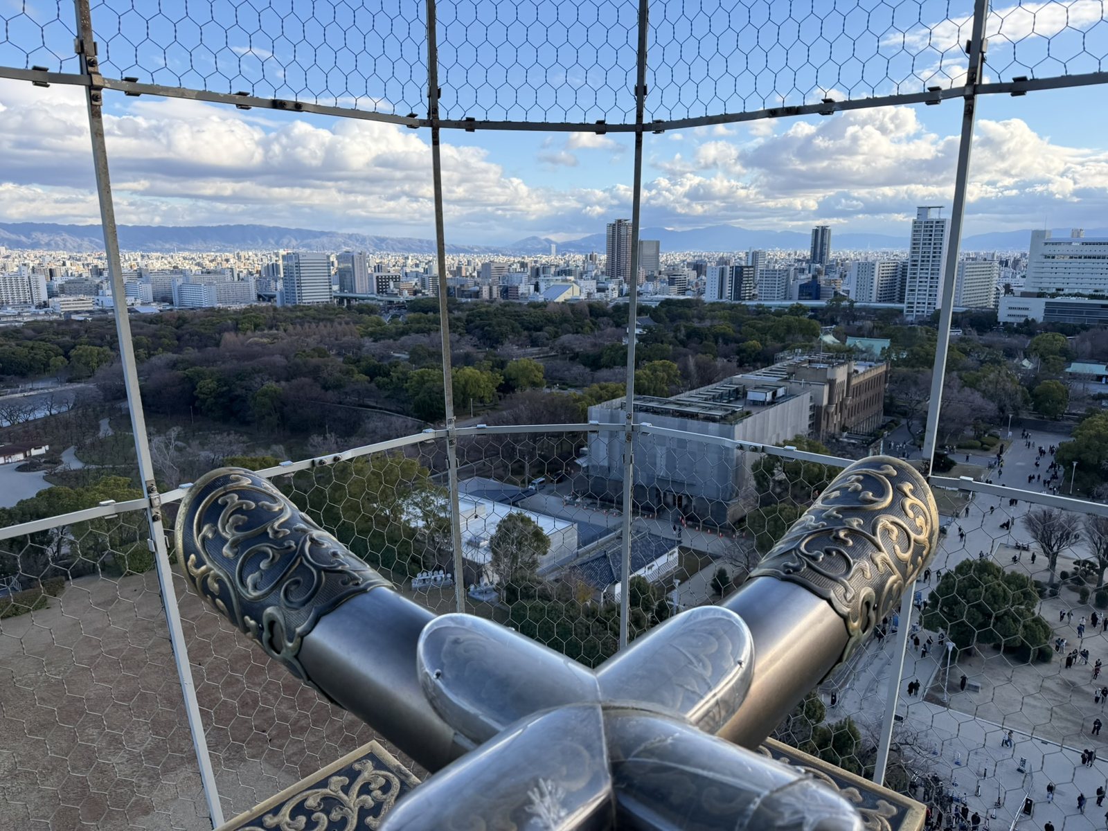
<p>The main tower today is a 1931 reinforced-concrete reconstruction, paid for by the people of Osaka. From the top, a gilded <em>shachihoko</em>, a fish with a tiger’s head meant to protect the roof from fire, looks out over the moats.</p>

<p class="caption"><img src="/assets/images/japan-2025/osaka-castle.jpg" alt="Osaka Castle's main tower above its stone base, with pine trees in the foreground" />
<em>Osaka Castle’s main tower, rebuilt in 1931.</em></p>

<p class="caption"><img src="/assets/images/japan-2025/siege-diorama.jpg" alt="A diorama of samurai fighting in front of a painted folding screen of the Siege of Osaka" />
<em>The Siege of Osaka, 1615. Sanada Yukimura’s troops are labeled on the left, Matsudaira Tadanao’s on the right.</em></p>

<p class="caption"><img src="/assets/images/japan-2025/castle-shachihoko.jpg" alt="A gilded shachihoko on the castle roof, with the moat and city below" />
<em>A gilded shachihoko on the roof, with the moats below.</em></p>

<p class="caption"><img src="/assets/images/japan-2025/castle-view.jpg" alt="The view over Osaka from the castle's top floor, framed by ornamental roof ends" />
<em>The view east from the top of the castle.</em></p>

<h3 id="the-nations-kitchen">The Nation’s Kitchen</h3>

<p>With peace, Osaka became the commercial capital of Edo Japan. Domains from across the country shipped their tax rice here to be sold, and the city became known as <em>tenka no daidokoro</em>, “the nation’s kitchen.” At the Dōjima Rice Exchange, officially recognized by the shogunate in 1730, merchants traded contracts on future rice deliveries, which is why Dōjima is often called the world’s first organized futures market. As someone who works in markets, I liked the thought that futures trading began with Inari’s crop.</p>

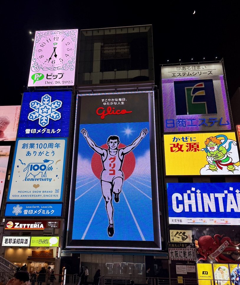
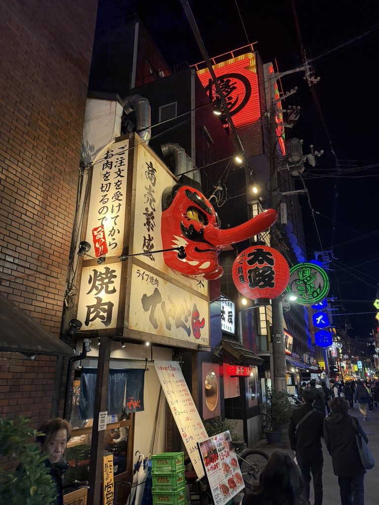
<p>The city’s motto is <em>kuidaore</em>, to eat until you drop. In Dōtonbori, the Glico running man, on his billboard in one form or another since 1935, crosses the finish line all night. In Shinsekai, the “New World” district laid out in 1912, a giant tengu mask advertises grilled meat and a shooting gallery promises good luck.</p>

<p class="caption"><img src="/assets/images/japan-2025/glico.jpg" alt="The Glico running-man billboard in Dōtonbori at night, with a clock reading Dec. 26, 2025" />
<em>The Glico sign in Dōtonbori, on 26 December 2025.</em></p>

<div class="pair">
  <figure><img src="/assets/images/japan-2025/shinsekai-tengu.jpg" alt="A large red tengu mask over a yakiniku restaurant in Shinsekai" loading="lazy" /><figcaption>A tengu over a yakiniku shop.</figcaption></figure>
  <figure><img src="/assets/images/japan-2025/shinsekai-shateki.jpg" alt="A brightly lit shooting-gallery storefront in Shinsekai" loading="lazy" /><figcaption>A shooting gallery in Shinsekai.</figcaption></figure>
</div>

<p>Osaka did not ask me to reflect. It asked me to enjoy. Walking through Dōtonbori on my last night, I realized it was the right ending: I did not leave Japan in silence, I left it with energy. I noticed the warmth in casual exchanges, the way food brings people together, the lack of pretense, and the contrast with Kyoto, and why both matter. Osaka reminded me that life is meant to be tasted, not just understood.</p>

<h2 id="rebalanced">Rebalanced</h2>

<p>Looking back, the trip moved in a deliberate arc. Tokyo taught me independence, Kyoto taught me restraint, and Osaka taught me ease. Underneath all three ran the two ideas I started with: kami in the mountains and the trees, and the Buddhist sense that everything passes, which is why the blossom is loved more than the rock. None of the questions I arrived with were answered, and that turned out to be fine; I had come to learn to stand inside them, and the samurai virtue I came home with was the quiet one, restraint as a form of strength. I did not leave Japan transformed. I left it rebalanced, and that was enough.</p>

<h2 id="getting-around">Getting Around</h2>

<p>Japan is easy to move around once three things are sorted.</p>

<ul>
  <li><strong>An IC card.</strong> Suica (JR East) and PASMO in Tokyo, and ICOCA in the Kansai region around Kyoto and Osaka, are rechargeable cards you tap at the ticket gates of trains, subways, and most buses, and at convenience stores and vending machines. The cards largely work across each other’s networks, though not for every journey that crosses between regions. Physical cards are on sale again after a chip shortage in 2023 and 2024; visitors can also buy a Welcome Suica at airports and major stations, or add a Suica to an iPhone’s Wallet and top it up with a credit card, which is what I did.</li>
  <li><strong>Some cash.</strong> Cards are now accepted widely, but small restaurants, temple and shrine offerings, market stalls, and the ticket machines at many ramen shops still want yen in coins and notes. Convenience-store ATMs, 7-Eleven’s in particular, generally take foreign cards.</li>
  <li><strong>The Shinkansen.</strong> The Nozomi, the fastest service on the Tōkaidō line, runs between Tokyo, Kyoto, and Osaka several times an hour. Reserve a seat on the right side heading west, seat E, for a chance at Mt Fuji between Mishima and Shin-Fuji. Bags larger than 160 cm in total dimensions need a seat reserved with an oversized-baggage area, or there is a ¥1,000 charge. For a single run from Tokyo to Osaka, individual tickets are usually cheaper than the national Japan Rail Pass, whose price rose sharply in 2023; do the arithmetic for your own route.</li>
</ul>

<h2 id="the-route">The Route</h2>

<p>This is the order I would follow if I did the trip again. It keeps each day in one part of the city and puts Fushimi Inari on the way to Nara; my own days ran in a slightly different order.</p>

<table>
  <thead>
    <tr>
      <th>Day</th>
      <th>Date</th>
      <th>Where</th>
      <th>What to do</th>
    </tr>
  </thead>
  <tbody>
    <tr>
      <td>1</td>
      <td>Fri 19 Dec</td>
      <td>Tokyo</td>
      <td>Arrive; ramen at Ichiran</td>
    </tr>
    <tr>
      <td>2</td>
      <td>Sat 20 Dec</td>
      <td>Tokyo</td>
      <td>Old Edo: the Imperial Palace, Tokyo Station, Nihonbashi and Kyōbashi; lunch in Kanda; Akihabara; Sensō-ji in Asakusa</td>
    </tr>
    <tr>
      <td>3</td>
      <td>Sun 21 Dec</td>
      <td>Tokyo</td>
      <td>West Tokyo: Meiji Jingu; Harajuku and Omotesando; Shibuya Sky at sunset; Shinjuku, Golden Gai, and Kabukichō</td>
    </tr>
    <tr>
      <td>4</td>
      <td>Mon 22 Dec</td>
      <td>Mt Fuji, Hakone</td>
      <td>Fuji’s fifth station and Komitake Shrine; Hakone</td>
    </tr>
    <tr>
      <td>5</td>
      <td>Tue 23 Dec</td>
      <td>Tokyo</td>
      <td>The bay: Tsukiji; teamLab Planets in Toyosu; Odaiba; Zōjō-ji and Tokyo Tower at dusk</td>
    </tr>
    <tr>
      <td>6</td>
      <td>Wed 24 Dec</td>
      <td>Kyoto</td>
      <td>Shinkansen to Kyoto; Gion, Yasaka Shrine, Hanamikoji, and Shirakawa at dusk</td>
    </tr>
    <tr>
      <td>7</td>
      <td>Thu 25 Dec</td>
      <td>Nara</td>
      <td>Fushimi Inari on the way; Kasuga Taisha, Nara Park, and Tōdai-ji</td>
    </tr>
    <tr>
      <td>8</td>
      <td>Fri 26 Dec</td>
      <td>Osaka</td>
      <td>Arashiyama and the Hozu gorge; train to Osaka; Osaka Castle, Shinsekai, and Dōtonbori</td>
    </tr>
    <tr>
      <td>9</td>
      <td>Sat 27 Dec</td>
      <td>—</td>
      <td>Sumiyoshi Taisha; fly home from Kansai</td>
    </tr>
  </tbody>
</table>

<h2 id="appendix-a-short-glossary">Appendix: A Short Glossary</h2>

<table>
  <thead>
    <tr>
      <th>Word</th>
      <th>Meaning</th>
    </tr>
  </thead>
  <tbody>
    <tr>
      <td>Kami</td>
      <td>A god or spirit in Shinto, often a mountain, river, tree, or force of nature</td>
    </tr>
    <tr>
      <td>Jinja, taisha</td>
      <td>A Shinto shrine; a <em>taisha</em> is a grand shrine</td>
    </tr>
    <tr>
      <td>-ji, tera</td>
      <td>A Buddhist temple</td>
    </tr>
    <tr>
      <td>Torii</td>
      <td>The gate that marks the entrance to a shrine’s sacred space</td>
    </tr>
    <tr>
      <td>Shogun</td>
      <td>The military ruler of Japan, at the head of the samurai, who governed in the emperor’s name</td>
    </tr>
    <tr>
      <td>Edo</td>
      <td>Tokyo’s name until 1868, and the period of Tokugawa rule, 1603–1868</td>
    </tr>
    <tr>
      <td>Sengoku</td>
      <td>The “Warring States” period of civil war, from 1467 until unification around 1600</td>
    </tr>
    <tr>
      <td>Ukiyo-e</td>
      <td>Edo-period woodblock prints, “pictures of the floating world”</td>
    </tr>
    <tr>
      <td>Ohayō gozaimasu</td>
      <td>Good morning (おはようございます)</td>
    </tr>
  </tbody>
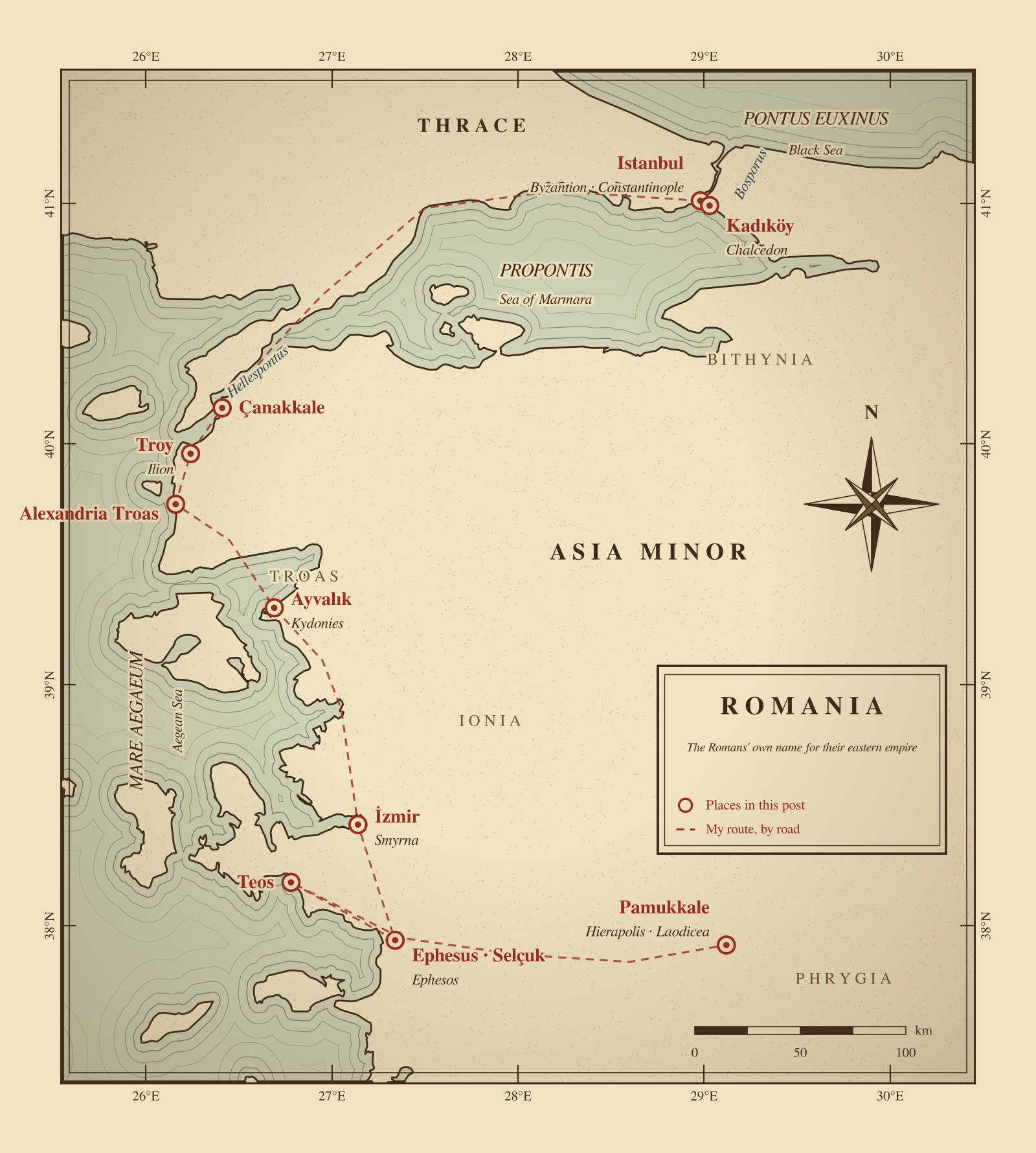
</table>]]></content><author><name>Johnew Zhang</name></author><category term="travel" /><category term="Japan" /><category term="history" /><summary type="html"><![CDATA[Central Japan, drawn for this post in the style of an old map. The dashed line follows the Tōkaidō Shinkansen; old names and provinces are in italics.]]></summary><media:thumbnail xmlns:media="http://search.yahoo.com/mrss/" url="https://wizardkingz.github.io/assets/images/japan-2025/yasaka-pagoda.jpg" /><media:content medium="image" url="https://wizardkingz.github.io/assets/images/japan-2025/yasaka-pagoda.jpg" xmlns:media="http://search.yahoo.com/mrss/" /></entry><entry><title type="html">The City and the Church: From Troy to Constantinople in Nine Days</title><link href="https://wizardkingz.github.io/the-city-and-the-church/" rel="alternate" type="text/html" title="The City and the Church: From Troy to Constantinople in Nine Days" /><published>2024-12-30T12:00:00-05:00</published><updated>2024-12-30T12:00:00-05:00</updated><id>https://wizardkingz.github.io/the-city-and-the-church</id><content type="html" xml:base="https://wizardkingz.github.io/the-city-and-the-church/"><![CDATA[<p class="caption"><img src="/assets/images/turkey-2024/turkey-map.jpg" alt="An old-style map of western Turkey marking the places in this post and the route between them" />
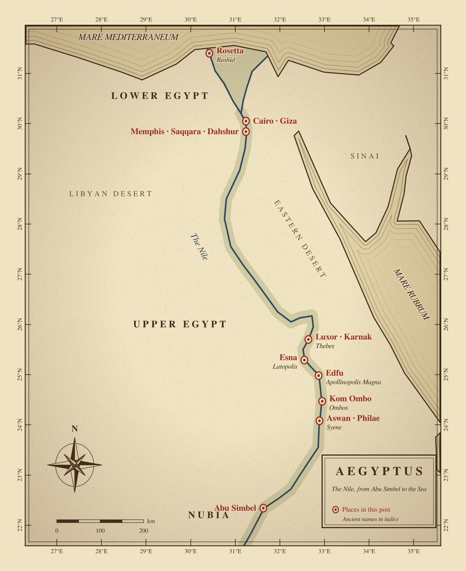
<em>Western Turkey, drawn for this post in the style of an old map. The dashed line is my route by road; ancient names are in italics. “Romania” was the eastern Romans’ own name for their empire.</em></p>

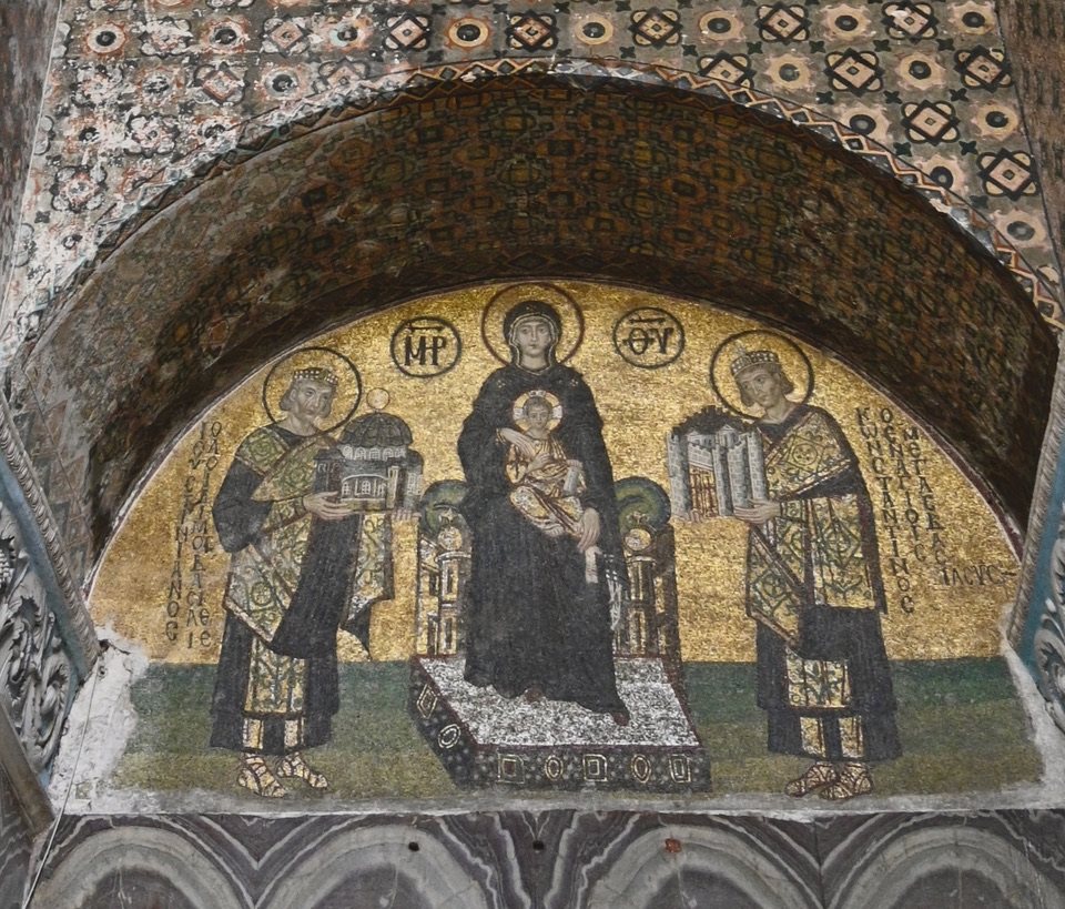
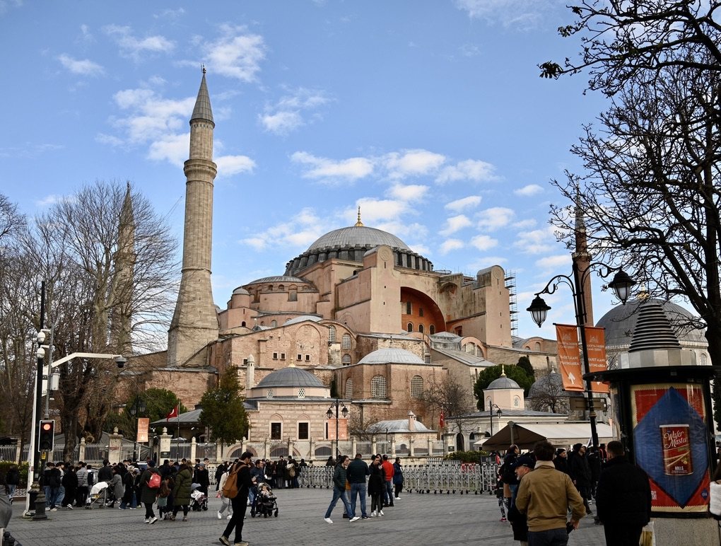
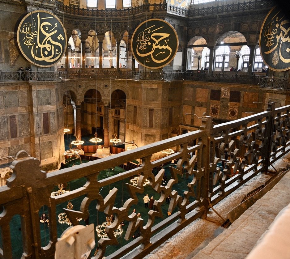
<p>Above a doorway in Hagia Sophia, two emperors stand on either side of the Virgin and Child, each holding out a gift. On the right, Constantine offers a model of the city he founded. On the left, Justinian offers a model of the church itself. The mosaic was set in the 10th century, when both men had been dead for centuries, and it reads like a deed of title: this city and this church, given to God by the Romans who built them. In December 2024 I spent nine days between Istanbul and the Aegean coast, and only later realized that the trip had followed how the city came to exist, from the Greek world that produced it to the empire that built it and the one that took it. So I have written it up in the order of that history rather than the order of my route.</p>

<p class="caption"><img src="/assets/images/turkey-2024/vestibule-mosaic.jpg" alt="The 10th-century mosaic of the Virgin and Child between Justinian and Constantine in Hagia Sophia" />
<em>The southwest vestibule mosaic in Hagia Sophia. Justinian, left, offers the church; Constantine, right, offers the city.</em></p>

<h2 id="the-periods-and-where-i-saw-them">The Periods, and Where I Saw Them</h2>

<p>Historians usually divide the history of this coast by who ruled it: Bronze Age kingdoms, Greek cities, Alexander’s successors, Rome, the eastern Roman Empire, and the Ottomans. The dates below are approximate.</p>

<table>
  <thead>
    <tr>
      <th>Period</th>
      <th>Dates</th>
      <th>Where I saw it</th>
    </tr>
  </thead>
  <tbody>
    <tr>
      <td>Bronze Age</td>
      <td>c. 3000–1180 BC</td>
      <td>Troy and the Troy Museum</td>
    </tr>
    <tr>
      <td>Archaic and Classical Greek</td>
      <td>c. 1050–334 BC</td>
      <td>Kadıköy (Chalcedon), Teos, the Temple of Artemis at Ephesus</td>
    </tr>
    <tr>
      <td>Hellenistic</td>
      <td>334–133 BC</td>
      <td>Alexandria Troas, Kadifekale in İzmir, Hierapolis</td>
    </tr>
    <tr>
      <td>Roman</td>
      <td>133 BC–AD 330</td>
      <td>Ephesus, the Agora of Smyrna, Hierapolis, Laodicea</td>
    </tr>
    <tr>
      <td>Eastern Roman (Byzantine)</td>
      <td>330–1453</td>
      <td>Hagia Sophia, Hagia Irene, the Basilica Cistern, the land walls, Chora, the Basilica of St John, Galata Tower</td>
    </tr>
    <tr>
      <td>Ottoman</td>
      <td>1453–1922</td>
      <td>Topkapı, Süleymaniye, the Blue Mosque, the bazaars, Dolmabahçe, Pera, Çanakkale, Ayvalık, İzmir</td>
    </tr>
    <tr>
      <td>Republic</td>
      <td>1923–</td>
      <td>İstiklal Avenue and Hagia Sophia</td>
    </tr>
  </tbody>
</table>

<h2 id="two-seas-and-two-continents">Two Seas and Two Continents</h2>

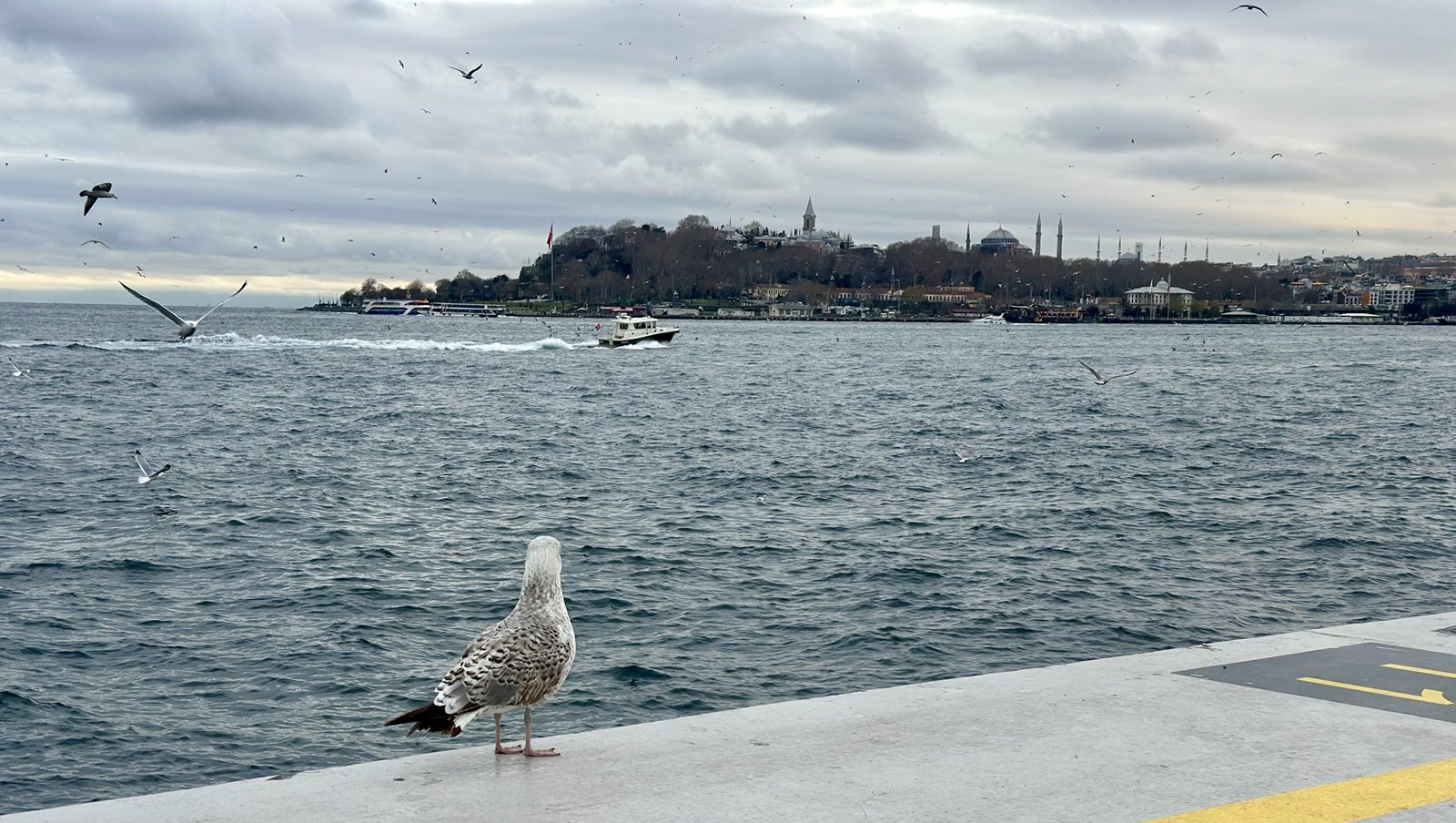
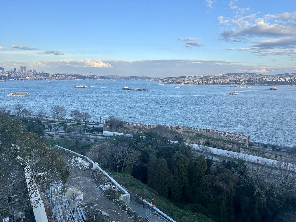
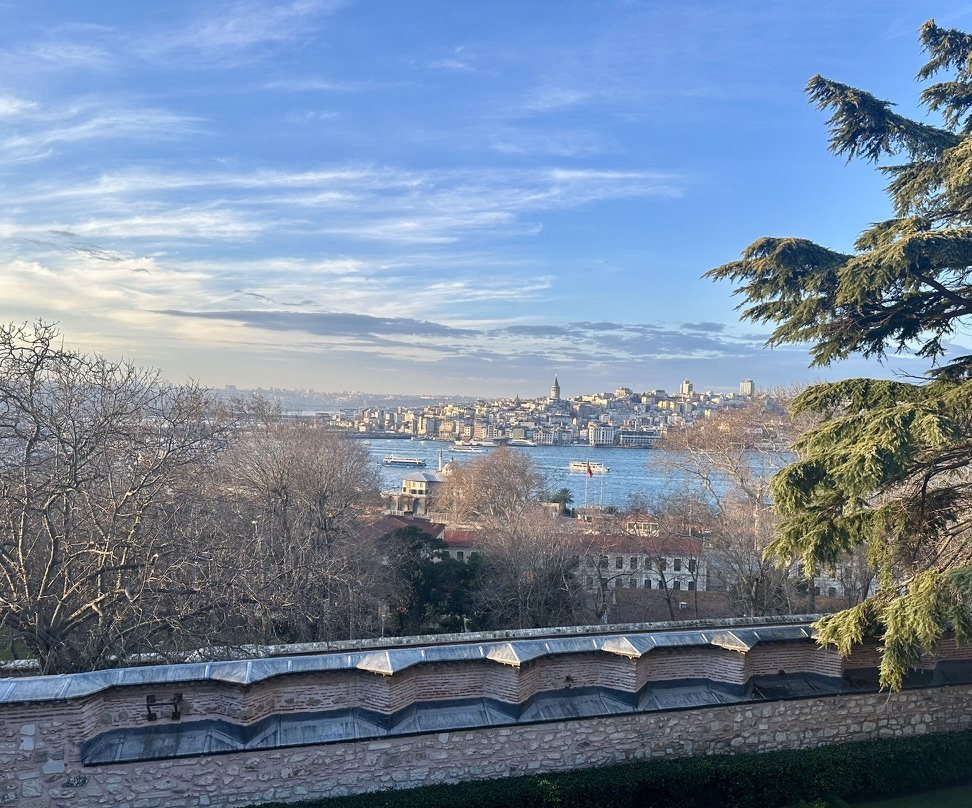
<p>Istanbul sits where Europe and Asia almost touch. The Bosphorus, a strait about 30 kilometers long, joins the Black Sea to the Sea of Marmara, which the Greeks called the Propontis, the “sea before the Pontus.” On the European side, an inlet called the Golden Horn makes a deep, sheltered harbor, and the triangle of land between the Horn and the Marmara is the old city. At the other end of the Marmara, the Dardanelles, the Hellespont of the Greeks, lead out into the Aegean. Whoever held both straits controlled the trade between the Black Sea and the Mediterranean, which is most of the reason this city mattered for 2,700 years.</p>

<p class="caption"><img src="/assets/images/turkey-2024/historic-peninsula.jpg" alt="Seagull on a pier, with the historic peninsula of Istanbul across the water" />
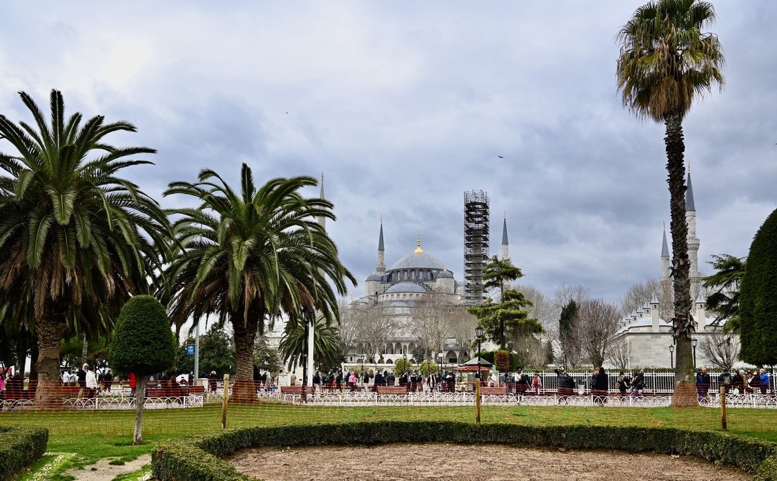
<em>The old city from across the Bosphorus: Topkapı and its Tower of Justice on the point, with Hagia Sophia and the Blue Mosque behind.</em></p>

<p>The city has had three names, and they are a short history in themselves. Greek settlers called it Byzantion. Constantine refounded it as Constantinople, “the city of Constantine.” Istanbul most likely comes from the Greek <em>eis tin polin</em>, “to the city,” which is what people said when they were heading there.</p>

<p>The people we call Byzantines never used the word. A German scholar, Hieronymus Wolf, introduced “Byzantine” in 1557, and it caught on later. The people themselves were Romans, <em>Rhomaioi</em>, and their state Romania. The Ottomans took them at their word: they called the empire’s Greek-speaking Christians Rum, “Romans,” and after 1453 Mehmed II took the title Kayser-i Rum, “Caesar of Rome.”</p>

<h2 id="bronze-age-troy">Bronze Age: Troy</h2>

<p class="dayline">c. 3000–1180 BC · Troy, Çanakkale · Day 5</p>

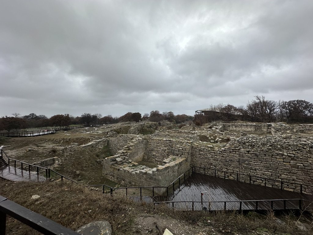
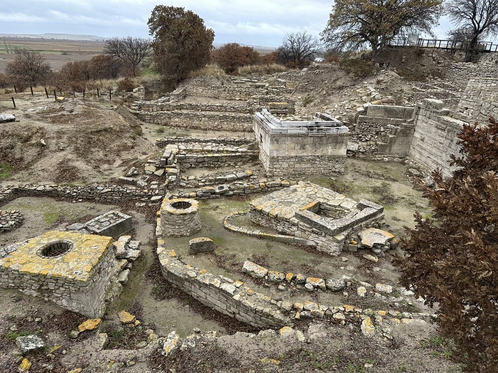
<p>I drove south from Istanbul on Christmas Day to the Dardanelles. Troy sits on a low mound called Hisarlık, a few kilometers from the strait it once watched. It is less a single city than about nine of them stacked on top of each other, from around 3000 BC into the Roman period. Heinrich Schliemann began excavating in 1871, convinced he would find Homer’s city, and in his hurry he dug a trench straight through several of the layers he was looking for. The layers usually linked to the Trojan War, Troy VI and VIIa, date to around 1300–1180 BC. The gold he called “Priam’s Treasure” is in fact about a thousand years older, and most of it is now in the Pushkin Museum in Moscow.</p>

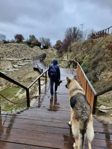
<p>The site is modest to look at: low walls, wells, and ramps, seen from wooden boardwalks, with the Troy Museum, opened nearby in 2018, doing much of the work of explaining them. In the rain I had it nearly to myself, apart from a local dog that walked the boardwalks with me.</p>

<p class="caption"><img src="/assets/images/turkey-2024/troy-walls.jpg" alt="Walls of Troy below a grey sky, with wooden boardwalks around them" />
<em>The walls of Troy, with the visitor boardwalks around them.</em></p>

<p class="caption"><img src="/assets/images/turkey-2024/troy-sanctuary.jpg" alt="Stone wells and altars among older walls at Troy" />
<em>Wells and altars from later Troy, built among the walls of earlier cities.</em></p>

<p class="caption"><img src="/assets/images/turkey-2024/troy-boardwalk.jpg" alt="Johnew walking along a wet boardwalk at Troy, with a dog following" />
<em>My guide at Troy, who asked for nothing.</em></p>

<p>Çanakkale, the town on the strait, has its own wooden horse on the waterfront, a film prop that Warner Bros. gave to the city, so the most photographed Trojan horse in Turkey came from Hollywood. <em>Update, 2026:</em> the horse is back on screen in Christopher Nolan’s <em>The Odyssey</em>, released in July, with Matt Damon’s Odysseus waiting inside.</p>

<p>The Hellespont itself carries the next layer of myth. The Greeks named it for Helle, who in legend fell from the golden-fleeced ram into these waters, and Leander was said to swim it nightly to reach Hero on the other side. Lord Byron swam it in 1810 to prove it could be done.</p>

<h2 id="archaic-and-classical-greece-cities-on-two-coasts">Archaic and Classical Greece: Cities on Two Coasts</h2>

<p class="dayline">c. 1050–334 BC · Kadıköy, Teos, Ephesus · Days 2–4 and 7</p>

<p>From around 1050 BC, Greek settlers spread along the Aegean coast of Anatolia. The central stretch, around Smyrna and Ephesus, became Ionia, and in the 6th century BC it was among the most advanced parts of the Greek world: Thales and the first Greek philosophers came from Miletus, a little south of Ephesus. The Ionian cities then sent colonists of their own. Teos, a small city on the coast southwest of İzmir, was the birthplace of the poet Anacreon and founded colonies as far away as Thrace and the Black Sea. Its Temple of Dionysus was designed by Hermogenes, one of the leading architects of the 2nd century BC, and part of it has been re-erected.</p>

<p>At Ephesus, the Temple of Artemis was counted among the Seven Wonders of the World. A man named Herostratus burned it in 356 BC to make himself famous, by tradition on the night Alexander the Great was born. Today a single column, reassembled from fragments, stands in a marshy field outside Selçuk.</p>

<p>Byzantion was another Greek colony. Settlers from Megara, near Athens, founded it around 667 or 657 BC on the European side of the Bosphorus. Settlers from the same city had founded Chalcedon, on the Asian shore opposite, about 17 years earlier. Herodotus says a Persian general later called the Chalcedonians blind for choosing the worse site when the better one was in plain view across the water. Chalcedon is now Kadıköy, a ferry ride from the old city, and the view from its waterfront makes the general’s point.</p>

<h2 id="hellenistic-alexanders-successors">Hellenistic: Alexander’s Successors</h2>

<p class="dayline">334–133 BC · Alexandria Troas, İzmir, Pamukkale · Days 5, 6, and 8</p>

<p>Alexander crossed the Hellespont into Asia in 334 BC, and he stopped first at Troy, where he honored the tomb of Achilles. Within a decade he had conquered the Persian Empire, and after his death his generals divided it. On this coast, one of them, Antigonus, founded a port city south of Troy around 306 BC and named it Antigonia; a rival, Lysimachus, took it and renamed it Alexandria Troas. Its ruins lie near the sea, a short drive from Troy.</p>

<p>Smyrna, modern İzmir, was refounded in the same years on the slopes of Mount Pagos, now Kadifekale. Pausanias tells the story that Alexander fell asleep there while hunting and dreamed that the goddesses called the Nemeses told him to build a city on the spot. The hill still looks out over the whole bay.</p>

<p>Inland, the hot springs above the Lycus valley became Hierapolis, the “holy city.” It was founded in the Hellenistic period, by either the Seleucid or the Pergamene kings; the sources differ.</p>

<h2 id="roman-asia-a-province-of-cities">Roman Asia: A Province of Cities</h2>

<p class="dayline">133 BC–AD 330 · Ephesus, İzmir, Hierapolis, Laodicea · Days 7 and 8</p>

<p>In 133 BC, the last king of Pergamon left his kingdom to Rome in his will, and it became the province of Asia, with Ephesus as its leading city. For the next four centuries it was among the wealthiest parts of the empire.</p>

<p>Ephesus is the reason most visitors come to this coast, and it is one of the best places anywhere to see what a Roman city looked like. Its main street runs downhill, paved in marble, to the Library of Celsus. Gaius Julius Aquila built it in the early 2nd century AD in honor of his father, Tiberius Julius Celsus Polemaeanus, a governor of the province, who is buried in a crypt beneath it. It held about 12,000 scrolls. The two-story façade fell in an earthquake and was re-erected in the 1970s from the original pieces. Its niches hold statues of four qualities credited to Celsus: Sophia, Arete, Ennoia, and Episteme, or Wisdom, Virtue, Intelligence, and Knowledge. The ones there now are copies; the originals went to Vienna after they were excavated.</p>

<p>The city’s theater seated about 25,000 people, and it is where, according to the Acts of the Apostles, a crowd of silversmiths drowned out the apostle Paul by shouting “Great is Artemis of the Ephesians” for two hours. Ephesus was a port; silt from the river has since pushed the sea several kilometers away, which is part of why the city declined.</p>

<p class="caption"><img src="/assets/images/turkey-2024/celsus-facade.jpg" alt="The two-story façade of the Library of Celsus at Ephesus, with statues in its niches" />
<em>The Library of Celsus, with copies of its statues in the niches.</em></p>

<p class="caption"><img src="/assets/images/turkey-2024/celsus-ceiling.jpg" alt="Looking straight up between the columns of the Library of Celsus at its carved, coffered ceilings" />
<em>Looking up between the columns of the façade.</em></p>

<p class="caption"><img src="/assets/images/turkey-2024/ephesus-cats.jpg" alt="A ginger cat and a black-and-white cat sitting on a marble column drum at Ephesus" />
<em>The present tenants of Ephesus.</em></p>

<p>In İzmir, the Roman agora of Smyrna survives in the middle of the modern city. It was rebuilt after an earthquake in AD 178 with help from Marcus Aurelius, and a portrait of his wife, Faustina, is carved on one of its arches.</p>

<p class="caption"><img src="/assets/images/turkey-2024/smyrna-agora-vaults.jpg" alt="Stone arches receding in a row in the vaulted basement of the Agora of Smyrna, with a water channel along the floor" />
<em>The vaulted basement of the Agora of Smyrna, with water still running along its floor.</em></p>

<p>Hierapolis grew into a spa town under Rome. Its springs deposit calcium carbonate down the hillside, and over thousands of years they have built the white terraces of Pamukkale, the “cotton castle.” Hotels once stood on the terraces; they were torn down after the site became a UNESCO World Heritage Site in 1988, and one hotel’s pool, full of fallen Roman columns, survives as the Antique Pool, which local legend says Mark Antony gave to Cleopatra. The city also had a Plutonium, a gate to the underworld, where carbon dioxide seeping from the ground killed the animals that priests led into it.</p>

<p class="caption"><img src="/assets/images/turkey-2024/pamukkale-pools.jpg" alt="Turquoise pools on the white travertine terraces of Pamukkale, with the village and a lake below" />
<em>The travertines of Pamukkale, with the modern village below.</em></p>

<p class="caption"><img src="/assets/images/turkey-2024/pamukkale-terraces.jpg" alt="The white crust of the travertines under a hazy late-afternoon sky" />
<em>Calcium carbonate, laid down by the springs one thin layer at a time.</em></p>

<p class="caption"><img src="/assets/images/turkey-2024/hierapolis-street.jpg" alt="A paved Roman street at Hierapolis under an orange evening sky" />
<em>The main street of Hierapolis at dusk.</em></p>

<p class="caption"><img src="/assets/images/turkey-2024/hierapolis-theater.jpg" alt="The Roman theater at Hierapolis, with its stage building and curved rows of seats" />
<em>The Roman theater at Hierapolis, on the hillside above the city.</em></p>

<p>Hierapolis also produced one of the best-known Stoics of the Roman era. Epictetus was born here around AD 50, was taken to Rome as a slave, and after he was freed taught philosophy in Greece. His student Arrian, the historian whose account of Alexander includes the visit to Achilles’ tomb, wrote down his lectures. The Stoics held that virtue is a kind of knowledge, the same idea carved into the façade of the Library of Celsus, and they named four virtues:</p>

<ul>
  <li><strong>Wisdom:</strong> knowing what is good and what is bad.</li>
  <li><strong>Courage:</strong> knowing what is to be feared and what is not.</li>
  <li><strong>Moderation:</strong> knowing what to pursue and what to avoid.</li>
  <li><strong>Justice:</strong> knowing what to give others and what not to.</li>
</ul>

<p>They also named four passions, each resting on a mistaken judgment: fear of an apparent bad to come, desire for an apparent good to come, pleasure in a good we believe we have, and distress at a bad we believe we have. A sage, who holds no false beliefs, feels none of them. He does feel three “good feelings,” the <em>eupatheiai</em>: wish, the rational pursuit of something; caution, its rational avoidance; and joy, rational elation. Each has gentler forms: goodwill and kindness under wish, modesty and reverence under caution, and delight and cheerfulness under joy. The Plutonium, a short walk away, is a good place to practice caution.</p>

<p class="caption"><img src="/assets/images/turkey-2024/pamukkale-sunset.jpg" alt="Johnew in silhouette on the edge of the travertines, facing the setting sun over the valley" />
<em>Sunset over the Lycus valley from the edge of the travertines.</em></p>

<p>Across the valley, Laodicea was a rich banking and textile city. It is one of the seven churches of Asia addressed in the Book of Revelation, alongside Ephesus and Smyrna, and it is the one rebuked for being “lukewarm, and neither cold nor hot.” A common reading links the line to its water, which arrived by aqueduct neither as hot as the springs at Hierapolis nor as cold as the water at nearby Colossae.</p>

<h2 id="the-eastern-roman-empire-new-rome">The Eastern Roman Empire: New Rome</h2>

<p class="dayline">330–1453 · Istanbul, Selçuk · Days 2–4 and 7</p>

<p>Constantine dedicated Constantinople as his new capital on 11 May 330. He chose Byzantion for the reason the Persian general had seen: it commanded the straits, it had the best harbor on the Bosphorus, and it was close to the frontiers that mattered. When the western half of the empire fell in the 5th century, the eastern half carried on from here for another thousand years.</p>

<h3 id="hagia-sophia">Hagia Sophia</h3>

<p>The church Constantine’s successors built on this site burned twice. The second time was in 532, during the Nika riots, when chariot-racing factions nearly overthrew Justinian. He rebuilt it in under six years. His architects, Anthemius of Tralles and Isidore of Miletus, were both from the Ionian coast, and the church they finished in 537 has a dome more than 30 meters across that seems to float on a ring of windows. The historian Procopius wrote that it looked suspended from heaven by a golden chain. A later legend has Justinian saying, at the dedication, “Solomon, I have surpassed thee.” The first dome collapsed in 558, and the one that stands today was finished in 562.</p>

<p class="caption"><img src="/assets/images/turkey-2024/hagia-sophia.jpg" alt="Hagia Sophia from the square, with its dome, buttresses, and a minaret" />
<em>Hagia Sophia from the square. The buttresses and minarets were added over the centuries that followed.</em></p>

<p>Foreign visitors now see the interior from the upper gallery, which is where I stood. The great green roundels hanging from the piers are Ottoman, painted in the 1840s by the calligrapher Kazasker Mustafa İzzet Efendi, with the names of God, the Prophet Muhammad, the first four caliphs, and Muhammad’s grandsons Hasan and Husayn.</p>

<p class="caption"><img src="/assets/images/turkey-2024/hagia-sophia-gallery.jpg" alt="The interior of Hagia Sophia from the upper gallery, with two calligraphic roundels" />
<em>From the gallery: the roundels for the caliph Uthman, left, and Hasan, center.</em></p>

<p>Next door, Hagia Irene is the city’s other great early church, and the simplest to read. Justinian rebuilt it after the same riots, and the Second Ecumenical Council met here in 381 in the church that came before. Its apse holds a plain black cross on a gold ground instead of a figure. It dates from Iconoclasm, the 8th and 9th centuries, when emperors banned religious images, and it survived because the Ottomans never turned this church into a mosque; they used it as an armory.</p>

<p class="caption"><img src="/assets/images/turkey-2024/hagia-irene.jpg" alt="The apse of Hagia Irene, with a large cross in the semi-dome" />
<em>The Iconoclast cross in the apse of Hagia Irene.</em></p>

<p>Justinian also built the Basilica Cistern, under the square, in 532. It is a forest of 336 columns, each about 9 meters tall, and it could hold up to 80,000 cubic meters of water piped in from outside the city. The builders reused whatever stone came to hand: two of its columns stand on Roman heads of Medusa, one on its side and one upside down. James Bond rowed through it in <em>From Russia with Love</em> in 1963, and Robert Langdon came back for Dan Brown’s <em>Inferno</em> in 2016.</p>

<p class="caption"><img src="/assets/images/turkey-2024/basilica-cistern.jpg" alt="Rows of lit marble columns rising from shallow water in the Basilica Cistern" />
<em>The Basilica Cistern, built under Justinian in 532.</em></p>

<h3 id="ephesus-again">Ephesus Again</h3>

<p>On the coast, the Christian layer sits directly on top of the Roman one. In 431, the Council of Ephesus declared that Mary should be called Theotokos, “Mother of God,” which is why she carries that title, abbreviated ΜΡ ΘΥ, in the mosaic over the door in Hagia Sophia. On the hill above Selçuk, Justinian built the Basilica of St John over the apostle’s traditional tomb, and its ruins look down on the single column left of the Temple of Artemis.</p>

<h3 id="the-walls-galata-and-1453">The Walls, Galata, and 1453</h3>

<p>The land walls of Theodosius II, finished around 413 and doubled after an earthquake in 447, kept Constantinople safe for a thousand years. The city outlasted sieges by Avars, Arabs, and Bulgars, and fell to a foreign army only once before 1453, to the Fourth Crusade in 1204. In the 14th century, the Byzantine nobleman Theodore Metochites rebuilt the Chora monastery near the walls and filled it with mosaics and frescoes often counted among the finest late Byzantine art; it reopened as a mosque in May 2024.</p>

<p>Across the Golden Horn, Galata was a Genoese trading colony, and the Genoese built Galata Tower in 1348. A legend recorded by the travel writer Evliya Çelebi says that in the 1630s a man named Hezarfen Ahmed Çelebi strapped on wings, jumped from the top, and glided across the Bosphorus to Üsküdar.</p>

<p class="caption"><img src="/assets/images/turkey-2024/galata-street.jpg" alt="A crowded street leading up to Galata Tower" />
<em>The street up to Galata Tower.</em></p>

<p class="caption"><img src="/assets/images/turkey-2024/karakoy-galata.jpg" alt="Karaköy waterfront with Galata Tower rising behind the buildings" />
<em>Galata Tower over Karaköy, the old Genoese harbor.</em></p>

<p>The end came in the spring of 1453. Mehmed II, 21 years old, besieged the city with an army many times the size of its garrison. A chain across the Golden Horn kept his fleet out, so he had ships dragged overland behind Galata and launched them into the Horn. On 29 May his troops broke through the land walls, and the last emperor, Constantine XI, died in the fighting.</p>

<h2 id="ottoman-istanbul-caesar-of-rome">Ottoman Istanbul: Caesar of Rome</h2>

<p class="dayline">1453–1922 · Istanbul, Çanakkale, Ayvalık, İzmir · Days 2–6</p>

<p>Mehmed made the city his capital and set out to fill it again. He turned Hagia Sophia into a mosque, began the Grand Bazaar, and built a new palace on the point of the old city, where the Byzantine acropolis had stood. He also built the castle at Çanakkale, in 1462, to close the Dardanelles.</p>

<h3 id="topkapı">Topkapı</h3>

<p>Topkapı was the seat of Ottoman government for about four centuries, and it is a series of courtyards, each more private than the last. The Gate of Salutation leads from the public first court into the second, where the business of the empire was done.</p>

<p class="caption"><img src="/assets/images/turkey-2024/topkapi-gate.jpg" alt="The Gate of Salutation at Topkapı Palace, with its two octagonal towers" />
<em>The Gate of Salutation, the entrance to Topkapı’s second court.</em></p>

<p>In the second court, the Imperial Council met in a domed hall under the Tower of Justice. The grand vizier ran the meetings; the sultan could listen unseen from behind a grilled window above them, and no one in the room could be sure whether he was there.</p>

<p class="caption"><img src="/assets/images/turkey-2024/topkapi-council.jpg" alt="The Imperial Council hall at Topkapı, with the Tower of Justice behind" />
<em>The Imperial Council hall and the Tower of Justice.</em></p>

<p class="caption"><img src="/assets/images/turkey-2024/topkapi-cypresses.jpg" alt="A path lined with cypresses in the grounds of Topkapı" />
<em>Cypresses in the palace grounds.</em></p>

<p>From the terraces at the far end, the view explains why every ruler of the city wanted this spot. On one side, the Bosphorus opens toward the Black Sea, with the Byzantine sea walls still running along the shore below. On the other lie the Golden Horn and Galata Tower.</p>

<p class="caption"><img src="/assets/images/turkey-2024/topkapi-bosphorus.jpg" alt="The Bosphorus from Topkapı, with a stretch of the Byzantine sea walls below" />
<em>The Bosphorus from Topkapı. The crenellated wall along the shore is part of the old sea walls.</em></p>

<p class="caption"><img src="/assets/images/turkey-2024/topkapi-golden-horn.jpg" alt="The Golden Horn and Galata from Topkapı, with Galata Tower on the skyline" />
<em>Across the Golden Horn to Galata, from the palace.</em></p>

<p class="caption"><img src="/assets/images/turkey-2024/topkapi-throne.jpg" alt="A gilded throne in a glass case inside a tiled pavilion at Topkapı" />
<em>A gilded throne on display in one of the tiled pavilions of the palace’s innermost court.</em></p>

<h3 id="mosques-and-bazaars">Mosques and Bazaars</h3>

<p>The Ottomans answered Hagia Sophia rather than replacing it. Mimar Sinan, the empire’s great architect, built the Süleymaniye for Süleyman the Magnificent between 1550 and 1557 on the city’s third hill, and Sultan Ahmed I built the Blue Mosque, with its six minarets, directly facing Hagia Sophia between 1609 and 1616.</p>

<p class="caption"><img src="/assets/images/turkey-2024/blue-mosque.jpg" alt="The Blue Mosque behind palm trees in Sultanahmet Square, with scaffolding on one minaret" />
<em>The Blue Mosque from Sultanahmet Square, with one minaret under repair.</em></p>

<p>Down by the water, the Spice Bazaar was finished in the 1660s as part of the New Mosque complex and is still called the Mısır Çarşısı, the “Egyptian Bazaar,” because revenues from the Ottoman province of Egypt paid for it.</p>

<p>The fishermen on the Galata Bridge are a newer tradition: the first bridge here opened in 1845, and the current one in 1994. They line both rails in all weather, and the grilled-fish sandwiches sold at the foot of the bridge are the other half of the scene.</p>

<p class="caption"><img src="/assets/images/turkey-2024/galata-bridge-fishermen.jpg" alt="Fishermen with rods on the Galata Bridge, with the Bosphorus behind" />
<em>Fishermen on the Galata Bridge, looking toward the Bosphorus.</em></p>

<p class="caption"><img src="/assets/images/turkey-2024/galata-bridge-dusk.jpg" alt="The Galata Bridge at dusk, with the domes and minarets of the New Mosque across the water" />
<em>The Galata Bridge at dusk, with the New Mosque and the Spice Bazaar on the far shore.</em></p>

<h3 id="pera">Pera</h3>

<p>In the 19th century, the European quarter across the Golden Horn, Pera, became the modern face of the empire. Its main street, the Grande Rue de Péra, was lined with embassies, churches, and apartment buildings for the city’s Greek, Armenian, Levantine, and Jewish families. The Tünel, a short underground funicular from the waterfront up to Pera, opened in 1875, which makes it the second-oldest underground railway in the world after London’s. The street is now İstiklal Avenue, and a restored red tram, brought back in 1990, still runs its length.</p>

<p class="caption"><img src="/assets/images/turkey-2024/istiklal-tram.jpg" alt="The red nostalgic tram on its Taksim–Tünel line" />
<em>The nostalgic tram, which runs from Taksim to Tünel.</em></p>

<p class="caption"><img src="/assets/images/turkey-2024/istiklal-facades.jpg" alt="Ornate 19th-century façades on İstiklal Avenue, with Greek and Turkish flags" />
<em>İstiklal Avenue, once the Grande Rue de Péra.</em></p>

<p>I walked İstiklal three days before Christmas, and St. Anthony of Padua, the largest Catholic church in the city, was decorated for it. It was built between 1906 and 1912 in Venetian neo-Gothic, and in the 1930s and 1940s the Vatican’s envoy to Turkey, Angelo Roncalli, preached here; he later became Pope John XXIII.</p>

<p class="caption"><img src="/assets/images/turkey-2024/st-anthony.jpg" alt="The vaulted, lit interior of St. Anthony of Padua, decorated for Christmas" />
<em>St. Anthony of Padua on İstiklal, decorated for Christmas.</em></p>

<p>On the Bosphorus shore below, Sultan Abdülmecid I moved the court out of Topkapı and into Dolmabahçe Palace, finished in 1856, a European-style palace for an empire trying to modernize. One clock there is still stopped at 9:05, in the bedroom where Mustafa Kemal Atatürk, the Republic’s founder, died on the morning of 10 November 1938.</p>

<h3 id="the-end-of-the-empire">The End of the Empire</h3>

<p>The empire’s last decade ran through the places on my route. At the Dardanelles in 1915, the minelayer <em>Nusret</em> laid the mines that sank three Allied battleships on 18 March, and the campaign on the Gallipoli peninsula that followed made the name of a young officer, Mustafa Kemal, the future Atatürk. A replica of <em>Nusret</em> sits by the naval museum in Çanakkale. In İzmir, the clock tower on Konak Square was built in 1901 for Sultan Abdülhamid II’s jubilee, with a clock given by Kaiser Wilhelm II. Twenty-one years later, in September 1922, at the end of the Greco-Turkish War, Turkish forces entered the city, and a fire destroyed most of its Greek and Armenian quarters. The population exchange between Greece and Turkey followed in 1923, and the Greek world on this coast, nearly 3,000 years old, came to an end.</p>

<p>On the drive south from Troy, I stopped at Ayvalık, a town that was mostly Greek Orthodox until 1922. Most of its Christians left for Lesbos, just across the water, and Muslims from Lesbos and Crete arrived in their place; some of their descendants still speak Greek at home.</p>

<p class="caption"><img src="/assets/images/turkey-2024/ayvalik-scooter.jpg" alt="A pale blue scooter parked by the sea at Ayvalık, with a sailboat and the far shore behind" />
<em>Ayvalık, on the Aegean, looking across the bay.</em></p>

<p>Istanbul’s street cats, estimated at well over 100,000, belong to no period and to every one of them.</p>

<p class="caption"><img src="/assets/images/turkey-2024/street-cat.jpg" alt="A black-and-white cat asleep on a café chair" />
<em>A local, off duty.</em></p>

<h2 id="the-republic-the-gift-above-the-door">The Republic: The Gift Above the Door</h2>

<p class="dayline">1923– · Istanbul · Days 2–4</p>

<p>The Republic of Turkey was declared in 1923, with its capital in Ankara, and for the first time in 1,600 years Istanbul was not the seat of an empire. Hagia Sophia has changed status with the country. It was a church for more than 900 years and a mosque for nearly 500. A cabinet decree in 1934 made it a museum, and in July 2020 it became a mosque again. Its Christian mosaics remain, and the vestibule mosaic is still above its door.</p>

<p>The city and the church have changed hands, names, and faiths since the 10th century, but in that mosaic Constantine and Justinian are still holding them out.</p>

<h2 id="the-route">The Route</h2>

<table>
  <thead>
    <tr>
      <th>Day</th>
      <th>Date</th>
      <th>Where</th>
      <th>What I did</th>
    </tr>
  </thead>
  <tbody>
    <tr>
      <td>1</td>
      <td>Sat 21 Dec</td>
      <td>Istanbul</td>
      <td>Arrival</td>
    </tr>
    <tr>
      <td>2–4</td>
      <td>Sun 22–Tue 24 Dec</td>
      <td>Istanbul</td>
      <td>Galata, Karaköy, and İstiklal; Hagia Sophia, Hagia Irene, Topkapı, the Basilica Cistern, the Blue Mosque, Süleymaniye, Chora, and the land walls; the bazaars; Kadıköy by ferry; Dolmabahçe</td>
    </tr>
    <tr>
      <td>5</td>
      <td>Wed 25 Dec</td>
      <td>Çanakkale</td>
      <td>Drive to the Dardanelles; the Trojan horse, the naval museum, and Çimenlik Castle; Troy and the Troy Museum; Alexandria Troas</td>
    </tr>
    <tr>
      <td>6</td>
      <td>Thu 26 Dec</td>
      <td>İzmir</td>
      <td>Drive south by way of Ayvalık; the Clock Tower, Kadifekale, the Asansör, and Hisar Mosque</td>
    </tr>
    <tr>
      <td>7</td>
      <td>Fri 27 Dec</td>
      <td>Pamukkale</td>
      <td>The Agora of Smyrna; Ephesus, the Temple of Artemis, Teos, and the Basilica of St John; drive inland</td>
    </tr>
    <tr>
      <td>8</td>
      <td>Sat 28 Dec</td>
      <td>Pamukkale</td>
      <td>Laodicea; the travertines, Hierapolis, the Antique Pool, and the theater</td>
    </tr>
    <tr>
      <td>9</td>
      <td>Sun 29 Dec</td>
      <td>—</td>
      <td>Flight from Denizli</td>
    </tr>
  </tbody>
</table>

<h2 id="appendix-reading-a-byzantine-mosaic">Appendix: Reading a Byzantine Mosaic</h2>

<p>Byzantine mosaics label their figures in Greek, and the labels use a few standard abbreviations. The letters look unfamiliar mainly because the C-shaped “lunate” sigma, Ϲ, stands in for Σ, and a bar over a pair of letters marks a sacred name written in short form.</p>

<table>
  <thead>
    <tr>
      <th>On the mosaic</th>
      <th>Greek in full</th>
      <th>Meaning</th>
    </tr>
  </thead>
  <tbody>
    <tr>
      <td>ΜΡ ΘΥ</td>
      <td>Μήτηρ Θεοῦ</td>
      <td>Mother of God (the title from the Council of Ephesus)</td>
    </tr>
    <tr>
      <td>ΙϹ ΧϹ</td>
      <td>Ἰησοῦς Χριστός</td>
      <td>Jesus Christ</td>
    </tr>
    <tr>
      <td>ΚΩΝϹΤΑΝΤΙΝΟϹ Ο ΕΝ ΑΓΙΟΙϹ ΜΕΓΑϹ ΒΑϹΙΛΕΥϹ</td>
      <td>Κωνσταντῖνος ὁ ἐν ἁγίοις μέγας βασιλεύς</td>
      <td>Constantine, the great emperor among the saints</td>
    </tr>
    <tr>
      <td>ΙΟΥϹΤΙΝΙΑΝΟϹ Ο ΑΟΙΔΙΜΟϹ ΒΑϹΙΛΕΥϹ</td>
      <td>Ἰουστινιανὸς ὁ ἀοίδιμος βασιλεύς</td>
      <td>Justinian, the emperor of glorious memory</td>
    </tr>
  </tbody>
</table>]]></content><author><name>Johnew Zhang</name></author><category term="travel" /><category term="Turkey" /><category term="history" /><summary type="html"><![CDATA[Western Turkey, drawn for this post in the style of an old map. The dashed line is my route by road; ancient names are in italics. “Romania” was the eastern Romans’ own name for their empire.]]></summary><media:thumbnail xmlns:media="http://search.yahoo.com/mrss/" url="https://wizardkingz.github.io/assets/images/turkey-2024/vestibule-mosaic.jpg" /><media:content medium="image" url="https://wizardkingz.github.io/assets/images/turkey-2024/vestibule-mosaic.jpg" xmlns:media="http://search.yahoo.com/mrss/" /></entry><entry><title type="html">In Search of Middle-earth: Nine Days in New Zealand</title><link href="https://wizardkingz.github.io/in-search-of-middle-earth/" rel="alternate" type="text/html" title="In Search of Middle-earth: Nine Days in New Zealand" /><published>2024-08-22T12:00:00-04:00</published><updated>2024-08-22T12:00:00-04:00</updated><id>https://wizardkingz.github.io/in-search-of-middle-earth</id><content type="html" xml:base="https://wizardkingz.github.io/in-search-of-middle-earth/"><![CDATA[<p class="caption"><img src="/assets/images/new-zealand-2024/nz-map.jpg" alt="An old-style map of New Zealand marking Auckland, Waitomo, Rotorua, Wai-O-Tapu, Christchurch, Tekapo, Aoraki/Mt Cook, Lake Pukaki, Oamaru, Moeraki, Dunedin, Arrowtown, Queenstown, and Glenorchy, with my route by road and air" />
<em>New Zealand, drawn for this post in the style of an old map. Māori names are in italics; the green dot marks a Middle-earth filming site on my route. Coastlines and lakes are approximate.</em></p>

<p>This was a trip to look for myself. I wanted to be somewhere far, far away, and New Zealand, the land I had always wanted to see, was about as far as I could go. So I treated it the way the books treat a road: as a journey, from one place to the next, in search of Middle-earth. I did not expect to find hobbits. I wanted to walk through the landscape that had stood in for a world I had only imagined.</p>

<p>The route ran the way the story does: out across the ice and stone of the South Island, and home through the fire of the North. Each leg turned out to have something to teach. The Mackenzie Country taught me perspective, the Otago coast patience, and the lakes around Queenstown that the story was real but quieter than the films. The volcanoes of the North Island taught me that the ground under all of it is still being made. So I have written it up by place, with the geology, the history, and the food folded in where I met them.</p>

<h2 id="a-young-land-and-every-landscape-but-one">A Young Land, and Every Landscape but One</h2>

<p>Two ideas help with almost everything a visitor sees in New Zealand.</p>

<p>The first is that the country is young and restless. It sits on the boundary between the Pacific and Australian plates, and most of it is the exposed top of a largely submerged continent that geologists call Zealandia. In the South Island the boundary runs along the Alpine Fault, about 600 kilometers long, and the Southern Alps have been pushed up along it over the last 12 million years. In the North Island the same collision feeds volcanoes and hot springs. People came late, too: Polynesian voyagers arrived around 1250 to 1300, which makes New Zealand one of the last major land areas on Earth to be settled. Their descendants, Māori, gave the country the name now often used beside the English one, Aotearoa, and the islands their own names: Te Waipounamu for the South and Te Ika-a-Māui, “the fish of Māui,” for the North.</p>

<p>The second idea is what that restlessness produces. In nine days I saw glaciers, alpine lakes, braided rivers, tussock plains, beech forest, a coast of stone spheres, volcanic craters, and pools of boiling mud. New Zealand seemed to hold every kind of landscape I could think of except one. It has no true desert. Its neighbor makes up for that: Australia’s ten named deserts cover about 18 percent of its mainland, and about 35 percent of the continent gets so little rain that it is effectively desert. Even New Zealand’s nearest thing to a desert, the Rangipo on the Central Plateau, gets 1,500 to 2,500 millimeters of rain a year; it only looks barren because of volcanic soil and drying winds. That made it convincing as the plains outside the Black Gate of Mordor, which were filmed there in 2000. Only in New Zealand would Mordor be too wet to qualify as a desert.</p>

<p>The comparison with Australia runs further. Australia is famous for things that can kill you. New Zealand has no land snakes, no scorpions, and no venomous insects; its one native venomous spider, the katipō, is rare, shy, and lives in coastal dunes. For a traveler who wants to walk off the path and sit in the grass, that is a real difference.</p>

<p>The films used all of this. Peter Jackson shot the three <em>Lord of the Rings</em> films together in his native New Zealand, in 274 days of principal photography between October 1999 and December 2000, at more than 150 locations across both islands. Most of the sites I passed are listed below. The dashes are honest: I did not reach Hobbiton or Mordor on this trip.</p>

<h3 id="middle-earth-and-where-i-stood">Middle-earth, and Where I Stood</h3>

<table>
  <thead>
    <tr>
      <th>In the films</th>
      <th>Filmed at</th>
      <th>Where I was</th>
    </tr>
  </thead>
  <tbody>
    <tr>
      <td>The Shire (Hobbiton)</td>
      <td>Matamata, Waikato</td>
      <td>—</td>
    </tr>
    <tr>
      <td>Pelennor Fields</td>
      <td>Farmland near Twizel</td>
      <td>Lake Pukaki, a few minutes’ drive north</td>
    </tr>
    <tr>
      <td>Ford of Bruinen</td>
      <td>The Arrow River at Arrowtown</td>
      <td>Arrowtown</td>
    </tr>
    <tr>
      <td>The Misty Mountains, opening of <em>The Two Towers</em></td>
      <td>The slopes of Mt Earnslaw</td>
      <td>Bennetts Bluff and Glenorchy, in view of the mountain</td>
    </tr>
    <tr>
      <td>Ithilien</td>
      <td>Twelve Mile Delta, Lake Wakatipu</td>
      <td>The Glenorchy road, which runs past it</td>
    </tr>
    <tr>
      <td>Isengard and Lothlórien</td>
      <td>The Dart valley and Paradise, beyond Glenorchy</td>
      <td>Glenorchy, at the edge of both</td>
    </tr>
    <tr>
      <td>Mordor and the Black Gate</td>
      <td>The Rangipo Desert</td>
      <td>—</td>
    </tr>
    <tr>
      <td>The props, armor, and creatures</td>
      <td>Weta Workshop</td>
      <td>Weta Workshop Unleashed, Auckland</td>
    </tr>
  </tbody>
</table>

<h2 id="the-mackenzie-country-sky-ice-and-perspective">The Mackenzie Country: Sky, Ice, and Perspective</h2>

<p class="dayline">Wed 14–Fri 16 Aug · Christchurch, Tekapo, Aoraki/Mt Cook, Lake Pukaki · Days 1–3</p>

<p>I flew overnight to Auckland and on to Christchurch. The first kiwi I saw in New Zealand was on a billboard at the baggage claim, selling a retirement savings plan. It was also the last.</p>

<p class="caption"><img src="/assets/images/new-zealand-2024/christchurch-airport.jpg" alt="The baggage hall at Christchurch Airport, with a billboard of a kiwi bird advertising KiwiSaver and a painted mountain mural behind" />
<em>Christchurch Airport. The only kiwi of the trip, working in financial services.</em></p>

<p>From Christchurch the road runs west across the flat Canterbury Plains, then climbs into the Mackenzie Basin, a high, wide bowl of tussock with the Southern Alps along one side. It was mid-August, late winter in the Southern Hemisphere, and everything above the basin was white.</p>

<h3 id="tekapo-a-sky-kept-dark-on-purpose">Tekapo: A Sky Kept Dark on Purpose</h3>

<p>Tekapo sits at the edge of the Aoraki Mackenzie International Dark Sky Reserve, created in 2012 and covering about 4,367 square kilometers, where outdoor lighting is controlled so that the night stays dark. That first night the Milky Way was clear enough to photograph with a phone, and the clouds that drifted across it looked bright by comparison.</p>

<p class="caption"><img src="/assets/images/new-zealand-2024/tekapo-stars.jpg" alt="The Milky Way across a deep blue night sky above Lake Tekapo, with a bank of cloud in the lower corner" />
<em>The night sky over Tekapo, inside the Dark Sky Reserve.</em></p>

<p>In the morning the lake was still. Lake Tekapo, like the other lakes of the basin, is fed by glaciers, and its milky turquoise color comes from rock flour, rock ground to dust by the ice and suspended in the meltwater. On its shore stands the Church of the Good Shepherd, built in 1935 as the first church in the Mackenzie Basin, for the district’s pioneer families. It is said to be one of the most photographed buildings in the country, and I did my part.</p>

<p class="caption"><img src="/assets/images/new-zealand-2024/tekapo-morning.jpg" alt="Lake Tekapo at sunrise, a gravel spit and bare trees reflected in still water, with snow-covered mountains behind" />
<em>Lake Tekapo at sunrise.</em></p>

<p class="caption"><img src="/assets/images/new-zealand-2024/good-shepherd.jpg" alt="The small stone Church of the Good Shepherd on a rise above the lake, among tussock grass" />
<em>The Church of the Good Shepherd, 1935.</em></p>

<h3 id="aoraki-and-the-tasman-glacier">Aoraki and the Tasman Glacier</h3>

<p>Aoraki/Mt Cook, at 3,724 meters, is the highest mountain in New Zealand, and the highest point of Zealandia that rises above the sea. In Ngāi Tahu tradition, Aoraki and his brothers were sky children whose canoe ran aground and turned to stone; the canoe is said to have become the South Island, and the brothers the peaks of the Southern Alps.</p>

<p>I saw it the way it is best seen, from a helicopter. Running down the mountain’s eastern side is the Tasman Glacier, at about 23.5 kilometers New Zealand’s longest. From above, it looks less like ice than like a river of gray rubble, because its lower reaches are buried under rock. At its foot is a lake that is only a few decades old. Meltwater ponds began to form on the glacier in the early 1970s, joined into Tasman Lake by 1990, and the lake has grown ever since as the ice retreats.</p>

<p class="caption"><img src="/assets/images/new-zealand-2024/tasman-glacier-air.jpg" alt="The Tasman Glacier seen from the air, a long gray river of ice and rock between snowy ridges, with a turquoise lake at its foot" />
<em>The Tasman Glacier from the helicopter, with Tasman Lake at its foot.</em></p>

<p>The helicopter landed on the snow high above the valley. The cold was sharp and the silence was complete. Standing there, looking down a glacier toward a lake that is only a few decades old, I felt small in the right way. My own questions did not disappear, but they took their proper size.</p>

<p class="caption"><img src="/assets/images/new-zealand-2024/tasman-snow-landing.jpg" alt="Deep snow on a high slope above a glacier valley, with snow-covered peaks under a blue sky" />
<em>The helicopter’s snow landing, high above the Tasman valley.</em></p>

<p>Back on the ground, I walked part of the Hooker Valley Track, which follows the Hooker River toward the mountain through tussock and alpine scrub. Cloud sat on the peaks, and the glacial lakes below them were the same impossible turquoise as Tekapo.</p>

<p class="caption"><img src="/assets/images/new-zealand-2024/hooker-valley-lake.jpg" alt="A turquoise glacial lake in a valley below cloud-covered snowy mountains, with alpine scrub in the foreground" />
<em>A glacial lake below the Southern Alps, from the Hooker Valley Track.</em></p>

<h3 id="lake-pukaki-and-the-pelennor-fields">Lake Pukaki, and the Pelennor Fields</h3>

<p>On the way out of the mountains, the road follows Lake Pukaki. On a boulder above the lakeshore stands a bronze Himalayan tahr, a wild mountain goat. In 1904 the Duke of Bedford gave the New Zealand government six tahr from his private herd in England, and they were released near Aoraki for hunting. With no predators, they thrived; today they are prized by hunters and culled by conservationists, and the statue, unveiled in 2014, commemorates both their arrival and the family that sent them.</p>

<div class="pair">
  <figure><img src="/assets/images/new-zealand-2024/pukaki-tahr.jpg" alt="A bronze statue of a shaggy Himalayan tahr on a rock above the blue water of Lake Pukaki" loading="lazy" /><figcaption>The tahr of Lake Pukaki, first released near Aoraki in 1904.</figcaption></figure>
  <figure><img src="/assets/images/new-zealand-2024/pukaki-salmon.jpg" alt="A small tray of salmon sashimi on a wooden picnic table by the lake" loading="lazy" /><figcaption>Salmon sashimi by the lake.</figcaption></figure>
</div>

<p>The same water feeds a salmon farm. Mt Cook Alpine Salmon raises freshwater king salmon in the cold, fast meltwater that flows down from the Alps, and its shop on the lakeshore sells sashimi to eat at a picnic table with the mountain in view. At home, I cook it as <a href="/kitchen/#r-adam-liaws-teriyaki-salmon">teriyaki salmon</a>, without the glacier.</p>

<p>A few minutes south, near the town of Twizel, the open farmland under the mountains became the Pelennor Fields, where the last great battle of <em>The Return of the King</em> was filmed. From the road it is only grass, fences, and sheep. That was the first lesson of the search: Middle-earth was filmed in ordinary places, and it takes attention to see the story in them.</p>

<p>What stayed with me from the Mackenzie Country was the scale: a sky with no light in it, a glacier that has lost kilometers within a lifetime, and a mountain that was here long before anyone named it. The Mackenzie Country taught me perspective.</p>

<h2 id="the-otago-coast-stone-and-time">The Otago Coast: Stone and Time</h2>

<p class="dayline">Fri 16–Sat 17 Aug · Oamaru, Moeraki, Dunedin · Days 3 and 4</p>

<p>The road from the mountains runs down the Waitaki valley to the Pacific coast at Oamaru.</p>

<h3 id="oamaru-the-smallest-penguins">Oamaru: The Smallest Penguins</h3>

<p>That evening I watched the little blue penguins come home. The kororā is the world’s smallest penguin, about 30 centimeters tall, with slate-blue feathers. It spends the day fishing at sea and comes ashore after dusk, in small groups, to waddle up the rocks to its burrow. The Ōamaru Blue Penguin Colony, set up in 1993 with 30 breeding pairs, protects a colony on the edge of the town, and visitors watch the return from a grandstand in the dark. Photography is not allowed during the evening viewing, since light disturbs the birds, so I have no picture of them. I did not mind. For once there was nothing to do but watch.</p>

<h3 id="the-moeraki-boulders">The Moeraki Boulders</h3>

<p>On Koekohe Beach near Moeraki, dozens of near-perfect stone spheres lie in the surf, some up to about two meters across and weighing several tonnes. They look carved, and they are not. They are concretions: minerals that slowly cemented around a center in the mud of the seafloor about 60 million years ago, growing like pearls over millions of years. The soft mudstone around them has since been lifted and is now eroding from the cliffs behind the beach, releasing the boulders one by one. In Māori tradition they are something else: the eel baskets, gourds, and kūmara washed ashore from the wreck of the voyaging canoe Ārai-te-uru, whose hull is said to lie as a reef at Shag Point to the south.</p>

<p class="caption"><img src="/assets/images/new-zealand-2024/moeraki-boulders.jpg" alt="Large round boulders in a line along a wet sandy beach at dawn, with waves washing around them" />
<em>The Moeraki Boulders, about 60 million years in the making.</em></p>

<p>I arrived early, with the tide around the boulders and the sky just lightening. Sixty million years is long enough for a stone to form, be buried, and be returned to the light. It made my own timelines feel more forgiving.</p>

<h3 id="dunedin-edinburgh-of-the-south">Dunedin: Edinburgh of the South</h3>

<p>Dunedin was founded in 1848 by settlers from the Free Church of Scotland, and its name comes from Dùn Èideann, the Gaelic name for Edinburgh. The city’s grandest building is its railway station, opened in 1906 and designed by George Troup in the Flemish Renaissance style, in dark basalt trimmed with white Oamaru limestone. The decoration earned Troup the nickname “Gingerbread George.”</p>

<p class="caption"><img src="/assets/images/new-zealand-2024/dunedin-station.jpg" alt="The ornate Dunedin Railway Station in black basalt and white limestone, with its clock tower under a cloudy sky" />
<em>Dunedin Railway Station, 1906, by “Gingerbread George” Troup.</em></p>

<p>Dunedin also holds a less dignified record. Baldwin Street is recognized by Guinness World Records as the steepest street in the world, with a gradient of 34.8 percent at its steepest. It lost the title in 2019 to a street in Harlech, Wales, and won it back in 2020 after a Dunedin surveyor showed that the street should be measured along its center line, which Guinness accepted.</p>

<p class="caption"><img src="/assets/images/new-zealand-2024/baldwin-street.jpg" alt="Baldwin Street seen from the bottom at road level, with the center line rising steeply toward houses on the hill" />
<em>Baldwin Street, Dunedin: 34.8 percent at its steepest.</em></p>

<p>The Otago coast taught me patience. The boulders took millions of years, the station took three to build, and the street took a year of arguing to get its title back.</p>

<h2 id="the-southern-lakes-into-middle-earth">The Southern Lakes: Into Middle-earth</h2>

<p class="dayline">Sat 17–Sun 18 Aug · Arrowtown, Queenstown, Glenorchy · Days 4 and 5</p>

<h3 id="arrowtown-and-the-ford-of-bruinen">Arrowtown and the Ford of Bruinen</h3>

<p>In 1862 gold was found in the Arrow River, and within months more than a thousand miners were camped along its banks. The settlement was first called Fox’s, after William Fox, one of the prospectors who claimed the strike, before it became Arrowtown. Chinese miners came later in the 1860s, invited by the provincial government after many of the first miners left for new goldfields on the West Coast; their restored huts still stand at the edge of town. The main street keeps its old wooden buildings and picket fences, and in late afternoon light it looked like a set, though it is entirely real.</p>

<p class="caption"><img src="/assets/images/new-zealand-2024/arrowtown.jpg" alt="A wooden cottage with a white picket fence on a quiet street in Arrowtown, with bare trees and hills behind" />
<em>Arrowtown, a gold-rush town of 1862.</em></p>

<p>The Arrow River just outside town is where the Ford of Bruinen was filmed, the scene in <em>The Fellowship of the Ring</em> where Arwen outruns the Black Riders across the water with Frodo. Arrowtown was the first place on the trip where a scene I knew well was only a short walk away.</p>

<h3 id="queenstown-and-the-sleeping-giant">Queenstown and the Sleeping Giant</h3>

<p>Queenstown sits on Lake Wakatipu, the longest lake in New Zealand at about 80 kilometers, and one of the deepest: its floor, at up to 380 meters down, lies below sea level. The lake is shaped like a lightning bolt, or, in the Ngāi Tahu story, like a giant lying on his side. The giant Matau stole a chief’s daughter, Manata; the young man Matakauri freed her, then returned while the giant slept and set him on fire. The burning body melted a deep hollow that filled with water, with Glenorchy at the giant’s head, Kingston at his feet, and Queenstown on his knee. Only his heart survived, and it is said to still beat beneath the water. The lake does rise and fall, by several centimeters, in a regular rhythm. Scientists call it a seiche, a standing wave set off by wind and changes in air pressure. I prefer the heartbeat.</p>

<p>Dinner that night was at Fergburger, which nearly every guide to Queenstown sends you to. The wrapper said “Nice to meet you,” and it was.</p>

<p class="caption"><img src="/assets/images/new-zealand-2024/fergburger.jpg" alt="A burger in a printed paper wrapper reading &quot;Nice to meet you&quot; on a Fergburger bag" />
<em>Fergburger, Queenstown.</em></p>

<h3 id="glenorchy-the-edge-of-the-map">Glenorchy: The Edge of the Map</h3>

<p>The next day was the one I had come for. Glenorchy is a small town at the head of Lake Wakatipu, about 45 minutes from Queenstown along a road that follows the shore. The road itself is part of the story. It passes Twelve Mile Delta, where the scenes in Ithilien were filmed, and climbs to Bennetts Bluff, a lookout over the lake toward the mountains at its head.</p>

<p class="caption"><img src="/assets/images/new-zealand-2024/wakatipu-morning.jpg" alt="Lake Wakatipu under low cloud, with dark wooded shore and mountains rising into the mist" />
<em>Lake Wakatipu on the road to Glenorchy.</em></p>

<p class="caption"><img src="/assets/images/new-zealand-2024/bennetts-bluff.jpg" alt="A gravel lookout above scrub at Bennetts Bluff, with Lake Wakatipu and brown mountains beyond" />
<em>Bennetts Bluff, looking up the lake toward Glenorchy.</em></p>

<p>The mountain at the head of the lake is Mt Earnslaw, Pikirakatahi to Ngāi Tahu, 2,819 meters high. Its slopes appear in the opening sequence of <em>The Two Towers</em>, as the camera sweeps over the peaks. Beyond Glenorchy, the Dart River valley stood in for Isengard, and the beech forest on the road to a place actually named Paradise became Lothlórien, the forest of the Elves. On a gray winter morning, with cloud lying across the peaks, it was easy to see why a filmmaker would choose it. It looked like the edge of the map.</p>

<p>In Glenorchy itself I walked the lagoon boardwalk, which crosses wetland and golden tussock below the mountains. In winter it was almost empty. Willows stood bare along a stream, and the grass moved in the wind.</p>

<div class="pair">
  <figure><img src="/assets/images/new-zealand-2024/glenorchy-willows.jpg" alt="Bare willow trees along a still stream through dry golden grass, with mountains in the distance" loading="lazy" /><figcaption>Willows along the Glenorchy lagoon.</figcaption></figure>
  <figure><img src="/assets/images/new-zealand-2024/glenorchy-rail.jpg" alt="A weathered wooden railing in the foreground, with tussock and brown hills behind" loading="lazy" /><figcaption>The boardwalk rail.</figcaption></figure>
</div>

<p class="caption"><img src="/assets/images/new-zealand-2024/glenorchy-boardwalk.jpg" alt="A wooden boardwalk running through golden tussock toward a small pond, with mountains along the horizon" />
<em>The Glenorchy lagoon boardwalk.</em></p>

<p class="caption"><img src="/assets/images/new-zealand-2024/glenorchy-tussock.jpg" alt="Tall golden tussock grass in the foreground below a range of dark mountains with snow and cloud on their tops" />
<em>Tussock below the mountains at Glenorchy.</em></p>

<p>This was the moment the trip had been building toward, and it was quieter than I expected. There was no music and no Fellowship on the ridge, only grass, water, and mountains, and the story was in them because I had brought it with me. I think that is what I had come all this way to learn. The places in the films are real, but the journey is the part you supply yourself. Middle-earth was not something I found at Glenorchy; it was a way of looking that I had carried there.</p>

<p class="caption"><img src="/assets/images/new-zealand-2024/glenorchy-wharf.jpg" alt="The rocky lakeshore at Glenorchy with an old wharf, the lake, and mountains under heavy cloud" />
<em>The lakeshore at Glenorchy, at the head of Lake Wakatipu.</em></p>

<h3 id="queenstown-from-above">Queenstown from Above</h3>

<p>Back in Queenstown, the Skyline gondola, open since 1967 and often described as the steepest cable-car lift in the Southern Hemisphere, climbs about 450 meters to Bob’s Peak. From the top the whole shape of the lake opens out, with the town on its bay, the peninsula reaching into the water, and the jagged line of the Remarkables across it.</p>

<p class="caption"><img src="/assets/images/new-zealand-2024/skyline-view.jpg" alt="Queenstown and Lake Wakatipu from Bob's Peak, with the town, a wooded peninsula, and the Remarkables under a blue sky" />
<em>Queenstown and Lake Wakatipu from Bob’s Peak.</em></p>

<p>Down in town, St Peter’s Anglican Church stands in stone among bare winter trees, a reminder of how much of this region was built by settlers who came for gold and stayed for the land.</p>

<p class="caption"><img src="/assets/images/new-zealand-2024/st-peters.jpg" alt="St Peter's Anglican Church in Queenstown, a stone church with a spire, behind bare trees" />
<em>St Peter’s Anglican Church, Queenstown.</em></p>

<p>Dinner was crayfish, the New Zealand spiny rock lobster that Māori call kōura, served as sashimi with its shell. I ate it in Queenstown, but it came from Milford Sound in Fiordland, whose waters are the most productive part of Southland’s rock lobster fishery, the largest in the country. The fiords I did not have time to see were only a few hours away. At home, my nearest equivalent is <a href="/kitchen/#r-cantonese-ginger-scallion-lobster">ginger scallion lobster</a>, cooked the Cantonese way.</p>

<p class="caption"><img src="/assets/images/new-zealand-2024/crayfish.jpg" alt="A ceramic bowl of crayfish sashimi on ice, presented with the lobster shells and flowers" />
<em>Crayfish from Milford Sound, served in Queenstown.</em></p>

<p class="caption"><img src="/assets/images/new-zealand-2024/queenstown-night.jpg" alt="The Queenstown lakefront at night, a lit willow tree and a string of lights along the water under dramatic moonlit cloud" />
<em>The Queenstown lakefront at night.</em></p>

<p>The Southern Lakes taught me that the story was real, but quieter than the films, and that the quiet was the point.</p>

<h2 id="auckland-behind-the-curtain">Auckland: Behind the Curtain</h2>

<p class="dayline">Mon 19 Aug · Auckland · Day 6</p>

<p>I left Queenstown on a clear morning, with fresh snow on the Remarkables above the airport.</p>

<p class="caption"><img src="/assets/images/new-zealand-2024/remarkables-airport.jpg" alt="Snow-dusted mountains above the car park at Queenstown Airport, with taxis in the foreground under a blue sky" />
<em>The Remarkables from Queenstown Airport.</em></p>

<p>If the South Island showed me where Middle-earth was filmed, Auckland showed me how it was made. Weta Workshop, the Wellington company that designed and built the armor, weapons, creatures, and miniatures for the films, opened Weta Workshop Unleashed at Auckland’s SkyCity in December 2020, its first venture of its own outside Wellington. It is a guided walk through make-believe film sets of horror, science fiction, and fantasy, built around Weta’s own imagined worlds rather than any one film. Visitors are met by Jeff, the company’s head of health and safety, an animatronic creature with a coffee mug and a sling. The miniatures, with their tiny trees and painted castles, show how much of a fantasy world is built by hand at tabletop scale.</p>

<div class="pair">
  <figure><img src="/assets/images/new-zealand-2024/weta-jeff.jpg" alt="An animatronic creature in a high-visibility vest holding a coffee mug at a security desk, with monitors behind" loading="lazy" /><figcaption>Jeff, head of health and safety.</figcaption></figure>
  <figure><img src="/assets/images/new-zealand-2024/weta-gollum.jpg" alt="A detailed figure of Gollum crouched on a rock holding a fish" loading="lazy" /><figcaption>A familiar figure, with his fish.</figcaption></figure>
</div>

<p class="caption"><img src="/assets/images/new-zealand-2024/weta-miniature.jpg" alt="A miniature film set with a twisted dead tree on a rock in front of a painted castle and a red sky" />
<em>A miniature at Weta Workshop Unleashed.</em></p>

<p>Seeing behind the curtain did not spoil anything. It completed the picture. Middle-earth on screen was the landscape I had walked through the day before, plus thousands of hours of craft.</p>

<p>That evening I went up the Sky Tower, which opened in 1997 and at 328 meters is the tallest structure in New Zealand. It looks out over the Waitematā Harbour, the city’s towers, and the islands of the Hauraki Gulf. Afterward I walked down to the waterfront, where the Ferry Building, completed in 1912 in Edwardian Baroque, glowed after the rain, and back up Queen Street with the tower lit above it.</p>

<p class="caption"><img src="/assets/images/new-zealand-2024/sky-tower-view.jpg" alt="Auckland's city center and harbor from the Sky Tower in evening light, with islands on the horizon" />
<em>Auckland and the Waitematā Harbour from the Sky Tower.</em></p>

<div class="pair">
  <figure><img src="/assets/images/new-zealand-2024/ferry-building.jpg" alt="The lit Edwardian Ferry Building in Auckland at night, with its clock tower and wet paving" loading="lazy" /><figcaption>The Ferry Building, 1912.</figcaption></figure>
  <figure><img src="/assets/images/new-zealand-2024/queen-street.jpg" alt="A Queen Street sign and traffic light at night, with the Sky Tower lit behind" loading="lazy" /><figcaption>Queen Street and the Sky Tower.</figcaption></figure>
</div>

<h2 id="rotorua-where-the-ground-breathes">Rotorua: Where the Ground Breathes</h2>

<p class="dayline">Tue 20–Wed 21 Aug · Waitomo, Rotorua, Wai-O-Tapu · Days 7 and 8</p>

<p>The road south from Auckland crosses green dairy country toward Rotorua, on the volcanic plateau of the North Island. On the way I stopped at Waitomo.</p>

<h3 id="waitomo-stars-underground">Waitomo: Stars Underground</h3>

<p>Below the farmland around Waitomo, underground streams have carved caves through the limestone, and their ceilings are lit by glowworms. The name is misleading: the glowworm, <em>Arachnocampa luminosa</em>, is the larva of a small fungus gnat found only in New Zealand. Each one hangs sticky threads of silk from the rock and glows to lure insects into them. Local Māori knew the caves long before Chief Tane Tinorau and the English surveyor Fred Mace explored this one in December 1887, floating in on a raft of flax stems by candlelight. Tane Tinorau and his wife, Huti, were leading visitors through it by 1889, and in 1989 the land and the cave were returned to their descendants.</p>

<p>The tour ends with a boat ride, in silence and in the dark, through the Glowworm Grotto. Cameras are not allowed, so again I have no photo. Five days after the stars over Tekapo, I found a second night sky, this one underground and alive.</p>

<h3 id="farm-country">Farm Country</h3>

<p>New Zealand’s farms are part of its landscape and its economy, and the Agrodome, a working farm outside Rotorua founded in 1971, explains them with a show. Nineteen breeds of sheep walk onstage one at a time and take their places on a tiered stand, each labeled with its name, before a shearing demonstration and a turn from the sheepdogs. The farm tour afterward included alpacas.</p>

<p class="caption"><img src="/assets/images/new-zealand-2024/agrodome-sheep.jpg" alt="Sheep of many breeds standing on a tiered wooden stage, each above a name label, inside the Agrodome" />
<em>The sheep show at the Agrodome: one ram of each breed.</em></p>

<div class="pair">
  <figure><img src="/assets/images/new-zealand-2024/alpaca-brown.jpg" alt="Two brown alpacas in a paddock at the Agrodome farm" loading="lazy" /><figcaption>Alpacas on the farm tour.</figcaption></figure>
  <figure><img src="/assets/images/new-zealand-2024/alpaca-white.jpg" alt="A white alpaca in profile, with sheep behind it" loading="lazy" /><figcaption>A white alpaca among the sheep.</figcaption></figure>
</div>

<h3 id="a-town-on-hot-ground">A Town on Hot Ground</h3>

<p>Rotorua smells of sulfur, and steam rises from drains, parks, and gardens. In the afternoon I walked by the lake and into the Government Gardens, where a pool steamed in the low winter sun as if someone had left a kettle on.</p>

<p class="caption"><img src="/assets/images/new-zealand-2024/rotorua-hot-pool.jpg" alt="A steaming geothermal pool edged with white mineral deposits, with sunlit shrubs and a building behind" />
<em>A geothermal pool by the Government Gardens, Rotorua.</em></p>

<p>On the edge of town is the Redwoods, a grove of California coast redwoods planted in 1901 as a forestry experiment, mostly by prison labor. In New Zealand’s soil and rain they have grown faster than in California, and the tallest now pass 70 meters. In late light the grove felt like a cathedral that someone planted a century ago without knowing what it would become.</p>

<p class="caption"><img src="/assets/images/new-zealand-2024/rotorua-redwoods.jpg" alt="Tall redwood trunks rising from a forest floor of red needles, with a fallen log in the foreground" />
<em>The Redwoods, Rotorua, planted in 1901.</em></p>

<h3 id="wai-o-tapu-the-fire-at-the-end">Wai-O-Tapu: The Fire at the End</h3>

<p>The next morning I went to Wai-O-Tapu, “sacred waters,” a geothermal area south of Rotorua in the Taupō Volcanic Zone. Its centerpiece is the Champagne Pool, a hot spring formed about 900 years ago when a hydrothermal eruption blew out a crater about 65 meters across and 62 meters deep. Its surface sits at around 74°C and fizzes with carbon dioxide, which gave it its name. The bright orange rim is colored by minerals, including orpiment, an arsenic sulfide. On a cold morning the steam rolled off it so thickly that the far side disappeared.</p>

<p class="caption"><img src="/assets/images/new-zealand-2024/champagne-pool.jpg" alt="Steam drifting over the Champagne Pool, with its bright orange mineral rim and gray sinter shore" />
<em>The Champagne Pool, Wai-O-Tapu, formed about 900 years ago.</em></p>

<p>Near the end of the path is the Devil’s Bath, a crater filled with water of an unreal, fluorescent yellow-green, colored by sulfur. It looks like something that belongs in Mordor.</p>

<p class="caption"><img src="/assets/images/new-zealand-2024/devils-bath.jpg" alt="A crater pool of bright fluorescent yellow-green water surrounded by rocks and bush in the mist" />
<em>The Devil’s Bath, Wai-O-Tapu.</em></p>

<p>The books end with fire: the long journey finishes at the volcano where the Ring was made. Mine ended there too, in a gentler way. Standing over the Champagne Pool, I understood that the land I had crossed all week, the mountains, the lakes, the boulders, was not finished. The ground here is still moving, still hot, still being made. I found that hopeful.</p>

<h2 id="auckland-standing-in-a-crater">Auckland: Standing in a Crater</h2>

<p class="dayline">Wed 21 Aug · Auckland · Day 8</p>

<p>On the last afternoon, back in Auckland, I climbed Maungawhau/Mount Eden. At 196 meters it is the highest natural point on the Auckland isthmus, and it is one of about 53 volcanoes in the Auckland volcanic field, on which most of the city is built. The volcano last erupted about 28,000 years ago and left a bowl-shaped crater 50 meters deep. The crater is tapu, sacred, known as Te Ipu Kai a Mataaho, the food bowl of Mataaho, the god of things hidden in the ground, and visitors are asked not to enter it. I stood on the rim with my shadow stretched across the grass.</p>

<p class="caption"><img src="/assets/images/new-zealand-2024/mt-eden-crater.jpg" alt="The grassy bowl of the Mount Eden crater under a blue sky, with my shadow on the rim" />
<em>The crater of Maungawhau/Mount Eden, with my shadow on the rim.</em></p>

<p>From there I went east along the waterfront, past the marina at Ōrākei, and up to the Michael Joseph Savage Memorial on Takaparawhau/Bastion Point. Savage, New Zealand’s first Labour prime minister, died in office in 1940, and the memorial over his grave was dedicated in 1943. Its wide lawn looks out over the harbor, and it was a calm last view.</p>

<div class="pair">
  <figure><img src="/assets/images/new-zealand-2024/okahu-bay.jpg" alt="Yachts moored in the marina at Ōrākei, Auckland, under a blue sky" loading="lazy" /><figcaption>The marina at Ōrākei.</figcaption></figure>
  <figure><img src="/assets/images/new-zealand-2024/savage-memorial.jpg" alt="A wide striped green lawn under a blue sky with white clouds" loading="lazy" /><figcaption>The lawn at the Savage Memorial.</figcaption></figure>
</div>

<h3 id="new-zealand-today">New Zealand Today</h3>

<p>The country I visited was at a turning point that I follow for work. On August 14, 2024, the day I flew out to New Zealand, the Reserve Bank of New Zealand cut its official cash rate from 5.5 to 5.25 percent, its first cut since March 2020, as inflation eased and the economy slowed. Tourism, meanwhile, was still recovering from the pandemic. A few weeks after I left, on October 1, 2024, the government nearly tripled its levy on most international visitors, from NZ$35 to NZ$100. Arrivals kept growing anyway: 3.51 million visitors came in 2025, the most in any year since 2020 but still about 90 percent of the 2019 level. Queenstown’s tourism body says more than half of international holiday visitors include the Queenstown Lakes in their trip, and I understand why.</p>

<h2 id="there-and-back-again">There and Back Again</h2>

<p>Looking back, the trip moved the way the story does: out across the ice and stone of the South Island, through the quiet country where the films were made, and home through the fire of the North. The Mackenzie Country taught me perspective, the Otago coast patience, the Southern Lakes that the story was real but quieter than the films, and the volcanoes that the ground under all of it is still being made. I went as far away as I could to look for myself, and I came looking for Middle-earth. I found that both were less a place than a way of seeing, and that I had to carry them with me to find them. I came home with the same questions, but I knew which road I was on.</p>

<h2 id="getting-around">Getting Around</h2>

<p>New Zealand is easy to travel, but it is bigger and emptier than it looks on a map.</p>

<ul>
  <li><strong>Entry.</strong> Most visitors need either a visa or a New Zealand Electronic Travel Authority (NZeTA) before they fly, and most also pay the International Visitor Conservation and Tourism Levy, NZ$100 per person since October 1, 2024, which is added when you apply. Check the rules for your own passport on the Immigration New Zealand website.</li>
  <li><strong>Biosecurity.</strong> New Zealand protects its farms and native species strictly. Declare all food, plant, and animal products on arrival, along with outdoor gear such as hiking boots.</li>
  <li><strong>Flying to save days.</strong> Distances are long and roads wind through mountains. Domestic flights between Auckland, Christchurch, and Queenstown turned what would have been days of driving into hours, and let me see both islands in one trip.</li>
  <li><strong>Driving.</strong> Traffic keeps left. Many rural roads are two lanes with one-lane bridges, and in winter mountain roads can ice over or close, so allow more time than the map suggests.</li>
  <li><strong>Cameras.</strong> Two of the best experiences ban photography: the evening penguin viewing at Oamaru and the Waitomo Glowworm Cave. Plan to remember them instead.</li>
  <li><strong>Season.</strong> I went in August, which is winter. The days were short and cold, but the mountains were white, the skies were clear at night, and the famous spots were quiet. In winter, pack layers and expect weather to change plans.</li>
</ul>

<h2 id="the-route">The Route</h2>

<p>This is the order I would follow if I did the trip again: south through the Mackenzie Country to the coast and the lakes, then north to the volcanic plateau, with each stop on the road it sits on, so Waitomo falls on the drive from Auckland to Rotorua. My own days ran in a slightly different order.</p>

<table>
  <thead>
    <tr>
      <th>Day</th>
      <th>Date</th>
      <th>Where</th>
      <th>What to do</th>
    </tr>
  </thead>
  <tbody>
    <tr>
      <td>1</td>
      <td>Wed 14 Aug</td>
      <td>In flight</td>
      <td>Flight to Auckland</td>
    </tr>
    <tr>
      <td>2</td>
      <td>Thu 15 Aug</td>
      <td>Christchurch, Tekapo</td>
      <td>Flew to Christchurch; drove across the Canterbury Plains; stargazing at Tekapo</td>
    </tr>
    <tr>
      <td>3</td>
      <td>Fri 16 Aug</td>
      <td>Tekapo, Aoraki/Mt Cook, Lake Pukaki, Oamaru</td>
      <td>Church of the Good Shepherd; helicopter over the Tasman Glacier with a snow landing; Hooker Valley Track; salmon at Lake Pukaki; little blue penguins at Oamaru</td>
    </tr>
    <tr>
      <td>4</td>
      <td>Sat 17 Aug</td>
      <td>Moeraki, Dunedin, Arrowtown, Queenstown</td>
      <td>Moeraki Boulders; Dunedin Railway Station and Baldwin Street; Arrowtown; Fergburger</td>
    </tr>
    <tr>
      <td>5</td>
      <td>Sun 18 Aug</td>
      <td>Glenorchy, Queenstown</td>
      <td>The Glenorchy road, Bennetts Bluff, and the lagoon boardwalk; Skyline gondola; St Peter’s; crayfish</td>
    </tr>
    <tr>
      <td>6</td>
      <td>Mon 19 Aug</td>
      <td>Auckland</td>
      <td>Flew to Auckland; Weta Workshop Unleashed; Sky Tower; Ferry Building and Queen Street</td>
    </tr>
    <tr>
      <td>7</td>
      <td>Tue 20 Aug</td>
      <td>Waitomo, Rotorua</td>
      <td>Waitomo Glowworm Caves; Agrodome farm show and tour; Government Gardens; the Redwoods</td>
    </tr>
    <tr>
      <td>8</td>
      <td>Wed 21 Aug</td>
      <td>Wai-O-Tapu, Auckland</td>
      <td>Champagne Pool and Devil’s Bath; Mount Eden; Ōrākei and the Savage Memorial; overnight flight home</td>
    </tr>
    <tr>
      <td>9</td>
      <td>Thu 22 Aug</td>
      <td>—</td>
      <td>Home</td>
    </tr>
  </tbody>
</table>

<h2 id="appendix-a-short-glossary">Appendix: A Short Glossary</h2>

<p>Translations of Māori names are the ones commonly given; many have more than one reading.</p>

<table>
  <thead>
    <tr>
      <th>Word</th>
      <th>Meaning</th>
    </tr>
  </thead>
  <tbody>
    <tr>
      <td>Aotearoa</td>
      <td>The Māori name now widely used for New Zealand, often translated “land of the long white cloud”</td>
    </tr>
    <tr>
      <td>Te Waipounamu</td>
      <td>The South Island, often translated “the waters of greenstone”</td>
    </tr>
    <tr>
      <td>Te Ika-a-Māui</td>
      <td>The North Island, “the fish of Māui”</td>
    </tr>
    <tr>
      <td>Aoraki</td>
      <td>Mt Cook, the highest mountain in New Zealand, an ancestor in Ngāi Tahu tradition</td>
    </tr>
    <tr>
      <td>Ngāi Tahu</td>
      <td>The principal iwi, or tribe, of the South Island</td>
    </tr>
    <tr>
      <td>Tapu</td>
      <td>Sacred or restricted</td>
    </tr>
    <tr>
      <td>Kōura</td>
      <td>Crayfish, the spiny rock lobster</td>
    </tr>
    <tr>
      <td>Wai-O-Tapu</td>
      <td>“Sacred waters”</td>
    </tr>
    <tr>
      <td>Maungawhau</td>
      <td>Mount Eden, “the mountain of the whau tree”</td>
    </tr>
    <tr>
      <td>Kia ora</td>
      <td>Hello, and a general greeting of goodwill</td>
    </tr>
  </tbody>
</table>]]></content><author><name>Johnew Zhang</name></author><category term="travel" /><category term="New Zealand" /><category term="nature" /><summary type="html"><![CDATA[New Zealand, drawn for this post in the style of an old map. Māori names are in italics; the green dot marks a Middle-earth filming site on my route. Coastlines and lakes are approximate.]]></summary><media:thumbnail xmlns:media="http://search.yahoo.com/mrss/" url="https://wizardkingz.github.io/assets/images/new-zealand-2024/glenorchy-tussock.jpg" /><media:content medium="image" url="https://wizardkingz.github.io/assets/images/new-zealand-2024/glenorchy-tussock.jpg" xmlns:media="http://search.yahoo.com/mrss/" /></entry><entry><title type="html">Where the Writing Ended: Three Thousand Years of Egypt in Seven Days</title><link href="https://wizardkingz.github.io/egypt-where-the-writing-ended/" rel="alternate" type="text/html" title="Where the Writing Ended: Three Thousand Years of Egypt in Seven Days" /><published>2023-11-30T12:00:00-05:00</published><updated>2023-11-30T12:00:00-05:00</updated><id>https://wizardkingz.github.io/egypt-where-the-writing-ended</id><content type="html" xml:base="https://wizardkingz.github.io/egypt-where-the-writing-ended/"><![CDATA[<p class="caption"><img src="/assets/images/egypt-2023/egypt-map.jpg" alt="An old-style map of Egypt marking the places in this post along the Nile" />
<em>Egypt, drawn for this post in the style of an old map. The places I visited run along the Nile from Abu Simbel to Rosetta; ancient names are in italics.</em></p>

<p>On a wall at Philae, near Aswan, there is a short inscription carved in AD 394. It is the last dated text anyone wrote in Egyptian hieroglyphs. No later one has been found, and the script that had recorded some 3,500 years of kings went silent. I stood in front of it in November 2023, and only later realized that the week had covered nearly the whole arc of that civilization, from its first stone building to its last word. So I have written it up in the order of Egypt’s history rather than the order of my route.</p>

<h2 id="the-periods-and-where-i-saw-them">The Periods, and Where I Saw Them</h2>

<p>Egyptologists divide ancient Egypt into kingdoms, when one king ruled the whole Nile valley, and intermediate periods, when that unity broke down. The dates below are approximate.</p>

<table>
  <thead>
    <tr>
      <th>Period</th>
      <th>Dates</th>
      <th>Where I saw it</th>
    </tr>
  </thead>
  <tbody>
    <tr>
      <td>Early Dynastic</td>
      <td>c. 3100–2686 BC</td>
      <td>The Narmer Palette at the Egyptian Museum</td>
    </tr>
    <tr>
      <td>Old Kingdom</td>
      <td>c. 2686–2181 BC</td>
      <td>Memphis, Saqqara, Dahshur, Giza, Djoser’s statue at the Egyptian Museum</td>
    </tr>
    <tr>
      <td>First Intermediate and Middle Kingdom</td>
      <td>c. 2181–1650 BC</td>
      <td>—</td>
    </tr>
    <tr>
      <td>Second Intermediate</td>
      <td>c. 1650–1550 BC</td>
      <td>—</td>
    </tr>
    <tr>
      <td>New Kingdom</td>
      <td>c. 1550–1069 BC</td>
      <td>Karnak, Luxor Temple, the Valleys of the Kings and Queens, Abu Simbel, the Luxor Museum, the Egyptian Museum</td>
    </tr>
    <tr>
      <td>Third Intermediate and Late Period</td>
      <td>c. 1069–332 BC</td>
      <td>The Nubian Museum and a Nubian village, Aswan</td>
    </tr>
    <tr>
      <td>Ptolemaic</td>
      <td>332–30 BC</td>
      <td>Kom Ombo, Edfu, most of Philae, the Rosetta Stone (British Museum)</td>
    </tr>
    <tr>
      <td>Roman</td>
      <td>30 BC–AD 395</td>
      <td>Esna, Philae</td>
    </tr>
  </tbody>
</table>

<h2 id="the-nile-and-the-two-lands">The Nile and the Two Lands</h2>

<p>Everything in Egypt depends on the Nile. The river flows north, from Aswan to the Mediterranean, so Upper Egypt is the south, upstream, and Lower Egypt is the north, the Delta. Egyptians called their country Kemet, “the black land” <span class="hg" role="img" aria-label="Kemet in hieroglyphs">𓆎𓅓𓏏𓊖</span>, after the dark silt the flood left on the fields. The desert on either side was Deshret, “the red land.”</p>

<p>Each half had its own emblems, and they appear on almost everything I saw:</p>

<ul class="glyphs">
<li><span class="hg" role="img" aria-label="White crown in hieroglyphs">𓋑</span>White crown: Upper Egypt</li>
<li><span class="hg" role="img" aria-label="Red crown in hieroglyphs">𓋔</span>Red crown: Lower Egypt</li>
<li><span class="hg" role="img" aria-label="Double crown in hieroglyphs">𓋖</span>Double crown: the king of both</li>
<li><span class="hg" role="img" aria-label="Lotus in hieroglyphs">𓆸</span>Lotus: the plant of Upper Egypt</li>
<li><span class="hg" role="img" aria-label="Papyrus in hieroglyphs">𓇉</span>Papyrus: the plant of Lower Egypt</li>
<li><span class="hg" role="img" aria-label="King of Upper and Lower Egypt in hieroglyphs">𓇓𓆤</span>"King of Upper and Lower Egypt": the sedge of the south and the bee of the north</li>
</ul>

<p>The two plants carry the same idea into architecture. Temple columns are carved as bundles of papyrus or lotus, and the sides of royal thrones, including those of the colossi at Abu Simbel, show the sema-tawy, “uniting the Two Lands”: a lotus and a papyrus tied around the sign for “unite” <span class="hg" role="img" aria-label="Sema in hieroglyphs">𓄥</span>.</p>

<p>Papyrus was also Egypt’s paper. Scribes cut the plant’s pith into strips, laid them crosswise, and pressed them into sheets, and the Greek word for the plant, <em>papyros</em>, gave English the word <em>paper</em>. Carved hieroglyphs were the formal script for monuments; on papyrus, scribes wrote faster, cursive forms.</p>

<p>Royal names were written inside a cartouche, an oval loop of rope that protected the name it enclosed. I have drawn a few in this post, with the signs in a single line for simplicity.</p>

<h2 id="early-dynastic-and-old-kingdom-the-pyramid-age">Early Dynastic and Old Kingdom: The Pyramid Age</h2>

<p class="dayline">c. 3100–2181 BC · Cairo, Memphis, Saqqara, Dahshur, Giza · Day 1</p>

<p>Egypt became one country around 3100 BC, when the kings of Upper Egypt took Lower Egypt. The best-known record of that moment is the Narmer Palette in the Egyptian Museum, a siltstone slab about 63 centimeters tall. On one side, King Narmer wears the white crown of Upper Egypt and raises a mace over a kneeling enemy from the Delta; on the other, he wears the red crown of Lower Egypt.</p>

<p class="caption"><img src="/assets/images/egypt-2023/narmer-palette.jpg" alt="The Narmer Palette in its case at the Egyptian Museum in Cairo" />
<em>The Narmer Palette, Egyptian Museum, Cairo. Narmer, in the white crown, strikes an enemy from the Delta.</em></p>

<p>The palette matters less as a record of events than as a template. It is one of the earliest images of an Egyptian king, the earliest to show a king in both crowns, and it carries some of the earliest hieroglyphs. Scholars still debate whether it shows a real conquest or a ritual claim to rule both lands. Either way, its central image of the king with his mace raised over an enemy became the standard picture of kingship for the next 3,000 years, and I kept meeting it, down to the last Greek kings at Edfu and Philae.</p>

<p>Narmer’s successors ruled from Memphis, near modern Cairo. By the Old Kingdom, the king was treated as a god on earth, and the state’s main project was his tomb.</p>

<p>Little of Memphis survives above ground, largely because later builders carried off its stone. At its open-air museum, a limestone colossus of Ramesses II lies on its back, a reminder that the city stayed a royal seat long after the pyramid age.</p>

<p class="caption"><img src="/assets/images/egypt-2023/memphis-ramesses.jpg" alt="Fallen limestone colossus of Ramesses II at Memphis" />
<em>The fallen colossus of Ramesses II at Memphis.</em></p>

<p>Saqqara, the burial ground of Memphis, is where the tomb-building started. Before the pyramids, kings were buried under mastabas, flat-topped tombs of mud brick or stone, and officials kept using them long after. In one, I found a false door carved into the wall: a doorway that does not open, framed by the owner’s names and titles, with a panel above showing him seated at a table of offerings. Egyptians believed the ka, the part of the soul that needed food, passed through it to collect what the living left on the stone slab in front.</p>

<p class="caption"><img src="/assets/images/egypt-2023/saqqara-false-door.jpg" alt="A carved false door in a mastaba tomb at Saqqara, with an offering slab in front" />
<em>A false door in a mastaba at Saqqara. The doorway is solid stone; only the ka could pass through it.</em></p>

<p>The Step Pyramid of Djoser at Saqqara, designed by the architect Imhotep around 2670 BC, is the oldest large stone building in the world. It is six mastabas stacked into a staircase to the sky, and you can see the idea being invented.</p>

<p class="caption"><img src="/assets/images/egypt-2023/step-pyramid.jpg" alt="The Step Pyramid of Djoser at Saqqara" />
<em>The Step Pyramid of Djoser at Saqqara.</em></p>

<p>Djoser himself is in the Egyptian Museum. His limestone statue, found in 1925 in a serdab, a sealed chamber beside the pyramid, is often described as the oldest known life-size statue from ancient Egypt. The serdab had two small eye holes so the king could watch the offerings, and a copy now sits in his place. Behind the statue, the museum has set a wall of blue faience tiles from the chambers under his pyramid.</p>

<p class="caption"><img src="/assets/images/egypt-2023/djoser-statue.jpg" alt="The seated limestone statue of Djoser in front of a wall of blue tiles" />
<em>Djoser, Egyptian Museum, Cairo, in front of tiles from the chambers beneath his pyramid.</em></p>

<p>At Dahshur, the Bent Pyramid of Sneferu <span class="cartouche" role="img" aria-label="Sneferu in hieroglyphs">𓋴𓄤𓂋𓅱</span> shows the next step, from stepped sides to smooth ones, going wrong. Partway up, the builders reduced the angle, probably because the structure was becoming unstable. Sneferu then built the Red Pyramid nearby with the correction applied, and his son Khufu <span class="cartouche" role="img" aria-label="Khufu in hieroglyphs">𓐍𓅱𓆑𓅱</span> took the lesson to Giza.</p>

<p class="caption"><img src="/assets/images/egypt-2023/bent-pyramid.jpg" alt="The Bent Pyramid of Sneferu at Dahshur" />
<em>The Bent Pyramid at Dahshur. The change of angle is visible about halfway up.</em></p>

<p>Khufu’s Great Pyramid remained the tallest man-made structure on earth for nearly 4,000 years, and it did not always look as it does now. The stepped blocks visible today are its core. When it was finished, it was faced with fine white limestone, polished smooth, which would have shone in the sun. Over the centuries, most of that casing was carried off for other buildings, much of it for medieval Cairo. The capstone is gone too. Some pyramid capstones were gilded or covered in electrum, an alloy of gold and silver, but no one knows what Khufu’s was made of.</p>

<p class="caption"><img src="/assets/images/egypt-2023/great-pyramid-base.jpg" alt="The north face of the Great Pyramid with visitors at its base" />
<em>At the foot of the Great Pyramid. What remains is the core; the white casing is almost all gone.</em></p>

<p>Those bare steps also made the pyramid climbable, and for most of modern history visitors went up the outside. Nineteenth-century travelers treated the summit as part of the tour, hauled up the waist-high blocks by local guides who pulled from above, pushed from below, and expected a tip at the top. Mark Twain made the climb in 1867 and wrote about the help with little affection. Egypt banned climbing in 1951, partly because climbers had fallen to their deaths and partly to protect the stone, though the rule was loosely enforced for decades. In 2020, parliament made climbing an antiquity without a permit a crime, punishable by a month in prison, a fine, or both. My own ascent therefore ended a few courses up, at the tourist entrance, which was as high as the law, and my knees, would allow.</p>

<p>Inside, the climb up the Grand Gallery to the King’s Chamber is steep, hot, and cramped, and the chamber itself is bare granite. That emptiness is the point. Everything else I saw that week, from Abu Simbel’s colossi to the last hieroglyphs at Philae, descends from the confidence this building expressed.</p>

<p class="caption"><img src="/assets/images/egypt-2023/giza-sphinx.jpg" alt="The Sphinx with the pyramids of Khafre and Khufu behind it" />
<em>The Sphinx, probably carved for Khafre <span class="cartouche" role="img" aria-label="Khafre in hieroglyphs">𓇳𓈍𓆑</span>, with his pyramid and Khufu’s behind it.</em></p>
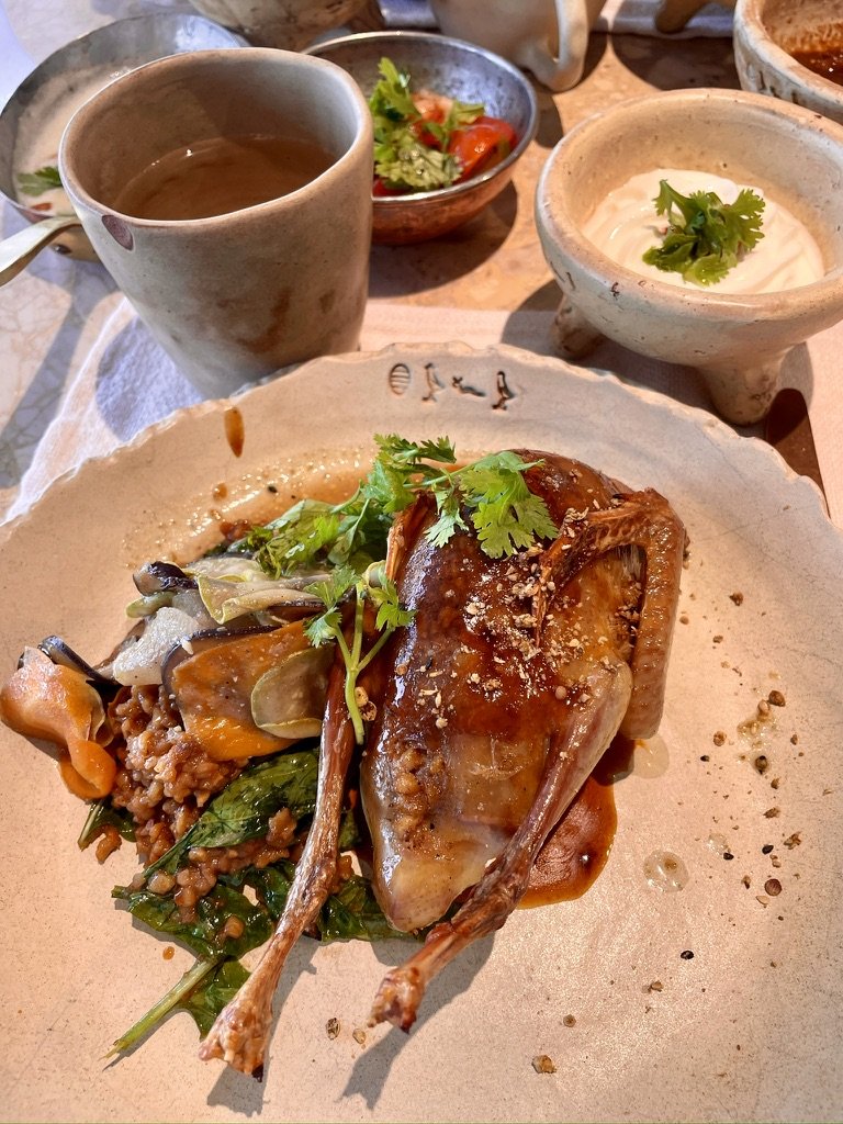
<p>The Sphinx has gone by several names. Egyptians called statues like it shesep-ankh, “living image” <span class="hg" role="img" aria-label="Shesep-ankh in hieroglyphs">𓊏𓊪𓋹</span>, and the Greek word “sphinx” may be borrowed from it, though it may instead come from a Greek verb meaning “to squeeze.” By the New Kingdom, Egyptians worshipped this one as Horemakhet, “Horus in the horizon,” and Thutmose IV cleared the sand from its body and set up the Dream Stela between its paws. In Arabic it is Abu al-Hol, “the father of dread.”</p>

<p>Lunch was at Khufu’s, a restaurant on the Giza plateau whose terrace looks straight at the Great Pyramid. Its chef, Mostafa Seif, reworks the rural dishes he grew up with. The restaurant has since been named the best in Egypt and ranked fourth on the Middle East and North Africa’s 50 Best list for 2025. I ordered hamam, roast pigeon. Pigeon is a staple of Egyptian cooking, and the mud-brick dovecotes that house the birds are still a common sight in villages along the Nile.</p>

<div class="pair">
  <figure><img src="/assets/images/egypt-2023/khufus-terrace.jpg" alt="Johnew at a table on Khufu's terrace with the Great Pyramid behind" loading="lazy" /><figcaption>The terrace at Khufu's.</figcaption></figure>
  <figure><img src="/assets/images/egypt-2023/khufus-hamam.jpg" alt="Roast pigeon on greens and grains" loading="lazy" /><figcaption>Hamam at Khufu's.</figcaption></figure>
</div>

<h2 id="new-kingdom-empire-and-the-houses-of-eternity">New Kingdom: Empire, and the Houses of Eternity</h2>

<p class="dayline">c. 1550–1069 BC · Luxor, Abu Simbel, Cairo · Days 1, 3, 5, and 6</p>

<p>The Old Kingdom ended in more than a century of division. Kings from Thebes, modern Luxor, reunited the country around 2055 BC in what is now called the Middle Kingdom. That unity broke again when the Hyksos, rulers of Near Eastern origin, took the north, and another Theban dynasty expelled them around 1550 BC. The New Kingdom that followed was Egypt at its height: an empire reaching into Nubia and the Levant, run from Thebes and devoted to its god, Amun.</p>

<h3 id="karnak-a-city-of-temples">Karnak: A City of Temples</h3>

<p>Karnak is less a temple than a city of temples, enlarged by king after king for some 2,000 years. The way in is an avenue of ram-headed sphinxes, the ram being one of Amun’s animals, each with a small figure of the king under its chin for protection. They lead to the first pylon, begun by Nectanebo I in the fourth century BC and never finished. Because the temple grew from the inside out, the first thing a visitor walks through is one of the last things built.</p>

<p class="caption"><img src="/assets/images/egypt-2023/karnak-entrance.jpg" alt="The avenue of ram-headed sphinxes leading to the first pylon at Karnak" />
<em>The entrance to Karnak: ram-headed sphinxes and the unfinished first pylon.</em></p>

<p>Beyond it, the 134 columns of the Great Hypostyle Hall, completed under Seti I and Ramesses II, are the reason to go, and the scale is difficult to convey. Standing among them, you feel the purpose of the design, which was to make a human feel small before Amun <span class="hg" role="img" aria-label="Amun in hieroglyphs">𓇋𓏠𓈖</span>, whose name means “the hidden one.” The columns of the central aisle are carved as open papyrus flowers.</p>

<h3 id="hatshepsut">Hatshepsut</h3>

<p>The kings of this period also changed how they were buried. Egyptians built for the living on the east bank and buried their dead on the west, where the sun sets. Pyramids had proven too easy to rob, so the New Kingdom’s kings cut their tombs instead into a hidden valley on the west bank, the Valley of the Kings.</p>

<p>Hatshepsut ruled as pharaoh for about 20 years, from around 1479 BC. Her terraced temple at Deir el-Bahari reads almost as modern architecture. Her successor, Thutmose III, later tried to erase her from the record, but her obelisk still stands at Karnak, a reminder that the erasure did not entirely succeed.</p>

<p class="caption"><img src="/assets/images/egypt-2023/hatshepsut.jpg" alt="Hatshepsut's terraced temple below the cliffs of Deir el-Bahari" />
<em>Hatshepsut’s temple at Deir el-Bahari.</em></p>

<h3 id="amenhotep-iii-akhenaten-and-tutankhamun">Amenhotep III, Akhenaten, and Tutankhamun</h3>

<p>Luxor Temple was begun under Amenhotep III around 1390 BC, just before a religious crisis. His son Akhenaten abandoned Amun for the single sun disc of the Aten and moved the capital to a new city. The Luxor Museum, small, well lit, and the best-curated collection of the trip, shows that break directly: one wall is rebuilt from blocks of temples Akhenaten raised to the Aten at Karnak, which later kings pulled down and used as fill inside their own pylons.</p>

<p>The crisis ended with Tutankhamun <span class="cartouche" role="img" aria-label="Tutankhamun in hieroglyphs">𓇋𓏠𓈖𓏏𓅱𓏏𓋹</span>, who was born Tutankhaten, changed his name, and restored Amun. The name means “living image of Amun.” Amun’s name is written first in the cartouche out of respect, and the ankh <span class="hg" role="img" aria-label="Ankh in hieroglyphs">𓋹</span>, the sign for life, sits at the end.</p>

<p>Tutankhamun was a minor king who died at about 19, yet his burial alone filled rooms of the Egyptian Museum on Tahrir Square, where I saw it with an Egyptologist on my first day. That made it easier to imagine what the great pharaohs, whose tombs were robbed in antiquity, once took with them. <em>Update, 2026:</em> since my visit, most of the collection, including the gold mask, has moved to the Grand Egyptian Museum near Giza, which opened fully in November 2025 and shows the whole burial in one place for the first time.</p>

<p>I also went down into his tomb in the Valley of the Kings. It is small for a king’s, and only the burial chamber is painted, but the treasure I had seen in Cairo came out of these few rooms, and the king’s mummy still lies here.</p>

<p class="caption"><img src="/assets/images/egypt-2023/tutankhamun-tomb.jpg" alt="Painted burial chamber of Tutankhamun's tomb with his stone sarcophagus" />
<em>Tutankhamun’s burial chamber. On the right, his successor Ay performs the Opening of the Mouth ritual on the king, shown as Osiris; the stone sarcophagus is in the foreground.</em></p>

<p>That afternoon I was back at the Winter Palace, which opened in 1907. Lord Carnarvon, who financed Howard Carter’s excavation, was a regular guest. After the tomb was found in 1922, the hotel became the base for the world’s press, and Carter posted news of the find on its noticeboard.</p>

<p class="caption"><img src="/assets/images/egypt-2023/winter-palace-sunset.jpg" alt="Sunset over the Nile from the Winter Palace in Luxor" />
<em>Sunset over the Nile from the Winter Palace.</em></p>

<h3 id="seti-i-and-ramesses-ii">Seti I and Ramesses II</h3>

<p>The tomb of Seti I has the finest painted reliefs I saw in Egypt. His son Ramesses II <span class="cartouche" role="img" aria-label="Ramesses in hieroglyphs">𓇳𓄟𓋴𓋴</span>, whose name means “Ra bore him,” reigned for 66 years, and he is everywhere: in the courtyard he added to Luxor Temple, in the tomb of his chief queen, Nefertari, and above all at Abu Simbel.</p>

<p class="caption"><img src="/assets/images/egypt-2023/luxor-temple.jpg" alt="Colossus of Ramesses II in the courtyard of Luxor Temple" />
<em>Ramesses II in the courtyard he added to Luxor Temple.</em></p>

<p>Nefertari’s tomb in the Valley of the Queens has colors that look as if they were painted last year.</p>

<p class="caption"><img src="/assets/images/egypt-2023/nefertari.jpg" alt="Painted wall of Nefertari's tomb" />
<em>The tomb of Nefertari. The queen, right, is led by the hand by a falcon-headed god.</em></p>

<p>Abu Simbel sits about 40 kilometers from the Sudanese border, and I flew there from Aswan. Ramesses II cut the temple into the cliff to celebrate what he presented as a victory over the Hittites at Kadesh in about 1274 BC. Its four seated colossi, each about 20 meters high, wear the double crown of Upper and Lower Egypt. Set at the southern frontier, they told Nubia who was in charge.</p>

<p class="caption"><img src="/assets/images/egypt-2023/abu-simbel.jpg" alt="The seated colossi of Ramesses II at Abu Simbel" />
<em>The colossi of Ramesses II. One lost its upper body in an ancient earthquake; the head still lies at its feet.</em></p>

<p>Inside, the walls of the great hall tell the official story. Ramesses rides into battle in his chariot, bow drawn, far larger than anyone around him, and the Kadesh scene on the north wall comes with a text in which he claims he won alone after his army abandoned him.</p>

<p class="caption"><img src="/assets/images/egypt-2023/abu-simbel-chariot.jpg" alt="Relief of Ramesses II firing a bow from his chariot" />
<em>Ramesses II in his chariot, from the battle reliefs in the great hall at Abu Simbel.</em></p>

<p>The historian’s footnote is that Kadesh was not a victory. It was close to a draw, and some 15 years later Egypt and the Hittites signed what is often cited as the earliest surviving peace treaty. Abu Simbel is therefore one of history’s great works of political messaging. It is also a survivor. In the 1960s, UNESCO cut the whole temple into blocks and moved it 65 meters higher to save it from the lake behind the new Aswan High Dam. The temple faces east, and twice a year the rising sun still reaches the statues in its inner sanctuary.</p>

<h2 id="third-intermediate-and-late-period-nubias-turn">Third Intermediate and Late Period: Nubia’s Turn</h2>

<p class="dayline">c. 1069–332 BC · Aswan · Days 2 and 3</p>

<p>After the New Kingdom, Egypt split again, and this time the south took over. Aswan was ancient Egypt’s southern border, the point where Egypt ended and Nubia began. Around 750 BC, Nubian kings from beyond that border conquered Egypt and ruled it as the 25th Dynasty, pharaohs whom Egypt’s own records tended to underplay. Assyrian invasions pushed them back south within a century, and Egypt then passed through Persian rule before Alexander the Great arrived in 332 BC.</p>

<p>The Nubian Museum in Aswan tells that story, and it also tells the modern one. The High Dam, built under Nasser in the 1960s, holds the river back in Lake Nasser, one of the largest man-made lakes in the world. It ended the annual flood that had organized Egyptian life since prehistory; the ancient calendar itself had three seasons, named for the inundation, the growing, and the harvest. The lake drowned much of Nubia, displacing its villages and forcing an international rescue of the temples in its path, Abu Simbel and Philae among them.</p>

<p class="caption"><img src="/assets/images/egypt-2023/nubian-village.jpg" alt="Brightly painted Nubian houses" />
<em>A Nubian village on the west bank near Aswan.</em></p>

<p>An afternoon in a Nubian village gave the other side of the dam’s story. Nubian houses are painted in bright colors and patterns, and Nubian languages are still spoken at home. Over tea, I kept thinking about the inversion of history the 25th Dynasty represents: for once, Nubia ruled Egypt.</p>

<p>I stayed at the Old Cataract, a Victorian hotel that Thomas Cook built in 1899 for its Nile travelers. Agatha Christie is said to have written part of <em>Death on the Nile</em> on its terrace. The terrace at sunset is still the hotel’s real attraction, and I would not swap it for anything newer. The best view of it, though, is from a felucca, the traditional Nile sailboat, which has no engine and moves only with the wind. At sunset, with sand dunes on the west bank and the hotel lit up on the bluff, it was the best hour of the trip.</p>

<p class="caption"><img src="/assets/images/egypt-2023/old-cataract-felucca.jpg" alt="The Old Cataract hotel seen from a felucca on the Nile" />
<em>The Old Cataract from the river.</em></p>

<h2 id="ptolemaic-egypt-greek-kings-in-pharaohs-dress">Ptolemaic Egypt: Greek Kings in Pharaohs’ Dress</h2>

<p class="dayline">332–30 BC · Kom Ombo, Edfu · Day 4</p>

<p>After Alexander died, his general Ptolemy took Egypt, and his descendants ruled it for nearly three centuries, until Cleopatra VII died in 30 BC. They were Macedonian Greeks, but they adopted the full costume of pharaonic kingship and built some of the largest temples in Egypt. Three temples line the 3.5-hour drive from Aswan to Luxor, and the first two are theirs.</p>

<p>Kom Ombo is unusual because it is a double temple, split between the crocodile god Sobek and the falcon god Haroeris. Next door, a small museum holds mummified crocodiles, which the priests once kept and buried.</p>

<p>Edfu, dedicated to Horus, is often called the best-preserved temple in Egypt. Granite falcons of the god stand at its doors, and its pylon shows Ptolemy XII smiting his enemies before Horus, the same image Narmer used on his palette some 3,000 years earlier.</p>

<p class="caption"><img src="/assets/images/egypt-2023/edfu-horus.jpg" alt="Granite statue of Horus as a falcon at Edfu" />
<em>Horus as a falcon, at the temple of Edfu.</em></p>

<p class="caption"><img src="/assets/images/egypt-2023/edfu-hypostyle.jpg" alt="Johnew with two local men among the carved columns of Edfu's hypostyle hall" />
<em>My best impression of an archaeologist, among the columns at Edfu.</em></p>

<p>High on one wall, a band of text runs under a winged sun disk, the emblem of Horus of Behdet, Edfu’s own form of the god. In the middle of it is an elephant. The elephant is a hieroglyph, read <em>abu</em>. It was the Egyptian word for elephant and also the name of Elephantine, the island at Aswan that marked Egypt’s southern border and traded in ivory from farther south. The Greek name, Elephantine, simply translates it. So the sign here most likely names a place rather than an animal. The Ptolemies who built Edfu knew real elephants as well. They sent hunting expeditions down the Red Sea coast to capture African elephants for their army, an answer to the Indian war elephants of their Seleucid rivals in Syria.</p>

<p class="caption"><img src="/assets/images/egypt-2023/edfu-elephant.jpg" alt="An elephant hieroglyph in a band of text below a winged sun disk at Edfu" />
<em>An elephant among the hieroglyphs at Edfu, below the winged sun disk of Horus of Behdet.</em></p>

<h2 id="roman-egypt-where-the-writing-ended">Roman Egypt: Where the Writing Ended</h2>

<p class="dayline">30 BC–AD 395 · Esna, Philae · Days 2 and 4</p>

<p>Rome took Egypt from Cleopatra, and Roman emperors in turn had themselves carved as pharaohs. Esna, the third temple on the drive north, is dedicated to the creator god Khnum and sits below the level of the modern town. Its hall, decorated largely under the Romans, has been cleaned in recent years to reveal color that was invisible for centuries.</p>

<p>Philae is where the story ends. In the UNESCO campaign, the temple of Isis was dismantled and rebuilt block by block on higher ground on Agilkia Island, which is why the site I found most romantic in Egypt is also, in a sense, a reconstruction. Its importance lies not in its age, since most of what stands is Ptolemaic and Roman, but in its longevity. Isis was still worshipped here long after Christianity became Rome’s official religion, and the temple stayed open until Justinian closed it around AD 537.</p>

<p class="caption"><img src="/assets/images/egypt-2023/philae-pylon.jpg" alt="The first pylon of the temple of Isis at Philae" />
<em>The first pylon at Philae, where Ptolemy XII smites his enemies before Isis, as he does at Edfu.</em></p>

<p class="caption"><img src="/assets/images/egypt-2023/philae.jpg" alt="Johnew leaning on a column among the carved capitals at Philae" />
<em>Philae, the temple of Isis, rebuilt on Agilkia Island.</em></p>

<p>The inscription of AD 394 is a few lines on a wall here. After it, Egyptians wrote their language in Coptic, an alphabet based on Greek, and no one could read hieroglyphs for some 1,400 years.</p>

<p class="caption"><img src="/assets/images/egypt-2023/rosetta-stone.jpg" alt="The Rosetta Stone in the British Museum" />
<em>The Rosetta Stone, British Museum.</em></p>

<p>The key turned out to be a Ptolemaic decree. The Rosetta Stone, which French soldiers found in 1799, records a decree of 196 BC in three scripts: hieroglyphs, Demotic, and Greek. Because the Greek could be read, Jean-François Champollion could match the royal names in its cartouches, Ptolemy <span class="cartouche" role="img" aria-label="Ptolemy in hieroglyphs">𓊪𓏏𓅱𓃭𓅓𓇋𓇋𓋴</span> first, and then Cleopatra on an obelisk taken from Philae itself. He announced the decipherment in 1822.</p>

<p>The stone’s significance reaches well beyond Egyptology. Reading hieroglyphs again gave back three millennia of Egypt’s own records, which until then had been known largely through Greek and Roman writers and the Bible. Its name has also become shorthand for any key to a hard problem. The text itself is modest: a decree by priests at Memphis honoring the young Ptolemy V, closer to political messaging than to scripture, much like Abu Simbel a thousand years earlier.</p>

<p>It is also contested. British forces took the stone from the French under the surrender terms of 1801, and it has been in the British Museum since 1802. Petitions in Egypt, including one led by former antiquities minister Zahi Hawass, call for its return, some proposing the Grand Egyptian Museum as its new home. The British Museum’s position is that the 1801 agreement was signed on Egypt’s behalf by an Ottoman admiral, since the Ottoman sultan nominally ruled Egypt at the time.</p>

<p>Some 3,000 years after Djoser’s pyramid, Philae is where the writing ended, and a name carved under the Ptolemies is where it was read again.</p>

<h2 id="the-route">The Route</h2>

<table>
  <thead>
    <tr>
      <th>Day</th>
      <th>Date</th>
      <th>Where</th>
      <th>What I did</th>
    </tr>
  </thead>
  <tbody>
    <tr>
      <td>1</td>
      <td>Sun 19–Mon 20 Nov</td>
      <td>Cairo</td>
      <td>Memphis, Saqqara (Djoser), Dahshur (Bent Pyramid), Giza (inside the Great Pyramid) and the Sphinx; lunch at Khufu’s; Egyptian Museum with an Egyptologist</td>
    </tr>
    <tr>
      <td>2</td>
      <td>Tue 21 Nov</td>
      <td>Aswan</td>
      <td>Flight to Aswan; High Dam, Philae, Nubian village and tea</td>
    </tr>
    <tr>
      <td>3</td>
      <td>Wed 22 Nov</td>
      <td>Aswan</td>
      <td>Flight to Abu Simbel and back; Nubian Museum; felucca at sunset</td>
    </tr>
    <tr>
      <td>4</td>
      <td>Thu 23 Nov</td>
      <td>Luxor</td>
      <td>Drive north (~3.5 h) via Kom Ombo, Edfu, and Esna</td>
    </tr>
    <tr>
      <td>5</td>
      <td>Fri 24 Nov</td>
      <td>Luxor</td>
      <td>West Bank: Valley of the Kings (Seti I, Tutankhamun), Hatshepsut’s temple, Valley of the Queens (Nefertari); afternoon at the hotel</td>
    </tr>
    <tr>
      <td>6</td>
      <td>Sat 25 Nov</td>
      <td>Cairo</td>
      <td>Karnak, Luxor Temple, Luxor Museum; evening flight to Cairo</td>
    </tr>
    <tr>
      <td>7</td>
      <td>Sun 26 Nov</td>
      <td>—</td>
      <td>Flight home from Cairo</td>
    </tr>
  </tbody>
</table>

<h2 id="appendix-reading-a-cartouche">Appendix: Reading a Cartouche</h2>

<p>Hieroglyphs are not an alphabet. Most signs stand for a whole word or for two or three consonants, some are silent and only show what kind of word it is, and vowels were not written at all. About 25 signs, though, each stand for a single consonant, and scribes used them to spell foreign names. That gave Champollion his way in: Ptolemy and Cleopatra were Greek names, spelled out sound by sound.</p>

<p>Here are those signs, in the order Egyptologists list them. Each shows what the sign depicts and the letter scholars use for its sound; the sounds themselves are approximate.</p>

<ul class="glyphs">
<li><span class="hg" role="img" aria-label="Vulture in hieroglyphs">𓄿</span>Vulture: ꜣ, a catch in the throat, usually read as "a"</li>
<li><span class="hg" role="img" aria-label="Reed leaf in hieroglyphs">𓇋</span>Reed leaf: i, read as "i" or "y"</li>
<li><span class="hg" role="img" aria-label="Two reed leaves in hieroglyphs">𓇌</span>Two reed leaves: y</li>
<li><span class="hg" role="img" aria-label="Forearm in hieroglyphs">𓂝</span>Forearm: ꜥ, a sound from deep in the throat, usually read as "a"</li>
<li><span class="hg" role="img" aria-label="Quail chick in hieroglyphs">𓅱</span>Quail chick: w, read as "w" or "u"</li>
<li><span class="hg" role="img" aria-label="Foot in hieroglyphs">𓃀</span>Foot: b</li>
<li><span class="hg" role="img" aria-label="Stool in hieroglyphs">𓊪</span>Stool: p</li>
<li><span class="hg" role="img" aria-label="Horned viper in hieroglyphs">𓆑</span>Horned viper: f</li>
<li><span class="hg" role="img" aria-label="Owl in hieroglyphs">𓅓</span>Owl: m</li>
<li><span class="hg" role="img" aria-label="Water in hieroglyphs">𓈖</span>Water: n</li>
<li><span class="hg" role="img" aria-label="Mouth in hieroglyphs">𓂋</span>Mouth: r</li>
<li><span class="hg" role="img" aria-label="Reed shelter in hieroglyphs">𓉔</span>Reed shelter: h</li>
<li><span class="hg" role="img" aria-label="Twisted flax in hieroglyphs">𓎛</span>Twisted flax: ḥ, a stronger h</li>
<li><span class="hg" role="img" aria-label="Placenta in hieroglyphs">𓐍</span>Placenta: ḫ, "kh" as in Scottish loch</li>
<li><span class="hg" role="img" aria-label="Animal's belly in hieroglyphs">𓄡</span>Animal's belly: ẖ, a softer "kh"</li>
<li><span class="hg" role="img" aria-label="Door bolt in hieroglyphs">𓊃</span>Door bolt: z</li>
<li><span class="hg" role="img" aria-label="Folded cloth in hieroglyphs">𓋴</span>Folded cloth: s</li>
<li><span class="hg" role="img" aria-label="Pool in hieroglyphs">𓈙</span>Pool: š, "sh"</li>
<li><span class="hg" role="img" aria-label="Hillside in hieroglyphs">𓈎</span>Hillside: q, a k made further back</li>
<li><span class="hg" role="img" aria-label="Basket in hieroglyphs">𓎡</span>Basket: k</li>
<li><span class="hg" role="img" aria-label="Jar stand in hieroglyphs">𓎼</span>Jar stand: g</li>
<li><span class="hg" role="img" aria-label="Bread loaf in hieroglyphs">𓏏</span>Bread loaf: t</li>
<li><span class="hg" role="img" aria-label="Tethering rope in hieroglyphs">𓍿</span>Tethering rope: ṯ, "ch"</li>
<li><span class="hg" role="img" aria-label="Hand in hieroglyphs">𓂧</span>Hand: d</li>
<li><span class="hg" role="img" aria-label="Cobra in hieroglyphs">𓆓</span>Cobra: ḏ, "dj"</li>
</ul>

<p>Ptolemy’s cartouche <span class="cartouche" role="img" aria-label="Ptolemy in hieroglyphs">𓊪𓏏𓅱𓃭𓅓𓇋𓇋𓋴</span> uses six of them, plus one extra. Read left to right, it gives p, t, w, then a lion <span class="hg" role="img" aria-label="Lion in hieroglyphs">𓃭</span>, then m, y, and s. Egyptian had no sign for l, so scribes of the Greek period borrowed the lion for it. Without vowels, <em>p-t-w-l-m-y-s</em> is as close as the script gets to the Greek <em>Ptolemaios</em>.</p>

<p>The other cartouches in this post mix in larger signs:</p>

<ul>
  <li><strong>Khufu</strong> <span class="cartouche" role="img" aria-label="Khufu in hieroglyphs">𓐍𓅱𓆑𓅱</span>: placenta, quail chick, viper, quail chick, or <em>ḫ-w-f-w</em>. Every sign is in the list above.</li>
  <li><strong>Sneferu</strong> <span class="cartouche" role="img" aria-label="Sneferu in hieroglyphs">𓋴𓄤𓂋𓅱</span>: s, then a heart and windpipe <span class="hg" role="img" aria-label="Nefer in hieroglyphs">𓄤</span>, one sign for the three consonants <em>n-f-r</em>, meaning “good.” The r after it repeats the sign’s last sound as a reading aid, and w ends the name.</li>
  <li><strong>Ramesses</strong> <span class="cartouche" role="img" aria-label="Ramesses in hieroglyphs">𓇳𓄟𓋴𓋴</span>: the sun disk is Ra, written first out of respect; three fox skins <span class="hg" role="img" aria-label="Mes in hieroglyphs">𓄟</span> stand for <em>ms</em>, “born of”; two folded cloths add <em>s-s</em>. Together, “Ra bore him.”</li>
</ul>

<p>The sign list follows Alan Gardiner’s <em>Egyptian Grammar</em>, the standard reference since 1927.</p>]]></content><author><name>Johnew Zhang</name></author><category term="travel" /><category term="Egypt" /><category term="history" /><summary type="html"><![CDATA[Egypt, drawn for this post in the style of an old map. The places I visited run along the Nile from Abu Simbel to Rosetta; ancient names are in italics.]]></summary><media:thumbnail xmlns:media="http://search.yahoo.com/mrss/" url="https://wizardkingz.github.io/assets/images/egypt-2023/step-pyramid.jpg" /><media:content medium="image" url="https://wizardkingz.github.io/assets/images/egypt-2023/step-pyramid.jpg" xmlns:media="http://search.yahoo.com/mrss/" /></entry><entry><title type="html">Essay on Asset Returns with Intertemporal CAPM</title><link href="https://wizardkingz.github.io/icapm-evidence/" rel="alternate" type="text/html" title="Essay on Asset Returns with Intertemporal CAPM" /><published>2019-05-22T00:00:00-04:00</published><updated>2019-05-22T00:00:00-04:00</updated><id>https://wizardkingz.github.io/icapm-evidence</id><content type="html" xml:base="https://wizardkingz.github.io/icapm-evidence/"><![CDATA[<p>I replicate the return decompositions of Campbell and Vuolteenaho (2004) and Campbell, Giglio, Polk, and Turley (2018), which explained the size and value “anomalies” in stock returns. Because cash-flow and discount-rate news co-move in the modern period, I find little evidence that value stocks have significantly higher cash-flow betas than growth stocks; news about expected future market volatility, however, effectively disentangles the size-and-value puzzle. Small and value stocks require a smaller hedging premium than large and growth stocks. Their methodology also shows some ability to price the abnormal returns of popular equity strategies and currency carry trade premiums.</p>

<p><em>Update: I reran these tests on public data through September 2026. The <a href="/icapm/">refreshed version</a> has the updated tables and interactive charts.</em></p>

<hr />

<h2 id="introduction">Introduction</h2>

<p>It is well known that the CAPM, with the value-weighted S&amp;P 500 return as the market proxy, fails to explain average stock returns in the modern period (after 1963). In Sharpe (1964) and Lintner (1965), a stock’s beta with a single total-wealth portfolio summarizes its return characteristics. However, Fama and French (1995) documented the size and value anomalies and showed that portfolios tilted toward small and value stocks tend to earn excess returns. Campbell and Vuolteenaho (2004) solved Merton’s (1973) intertemporal capital asset pricing model (ICAPM) for a representative agent with Epstein and Zin (1989) utility and offered an elegant explanation: they split beta into a “bad” beta on cash-flow news and a “good” beta on discount-rate news. They found evidence that value and small stocks have considerably higher cash-flow betas than growth and large stocks. In other words, for a conservative long-term investor under the ICAPM, small and value stocks are intertemporal hedges that perform well when investment opportunities deteriorate; however, in equilibrium, these assets should have delivered lower average returns, so rational long-term investors should not tilt their portfolios toward small and value stocks. In a subsequent paper, Campbell et al. (2018) argued that either rising stock-return volatility or falling expected stock returns can worsen investment opportunities in the stock market. Adding low-frequency movements in equity volatility, they proposed a three-beta ICAPM with cash-flow, discount-rate, and risk news to explain the cross-section of asset returns, with results consistent with “Bad Beta, Good Beta.”</p>

<p>I examine whether the two-beta ICAPM of Campbell and Vuolteenaho (2004) and the three-beta ICAPM of Campbell et al. (2018) still explain the size and value puzzle in the latest modern data (1963:07-2018:12). For both vector-autoregressive (VAR) economies, I estimated the parameters on the full sample (1929:06-2018:12). I first describe both models and the data, then compare my estimates for the 25 ME- and BE/ME-sorted portfolios from Ken French’s website with both Campbell papers, and finally test both models out of sample on popular equity and currency strategies. I find that, because cash-flow and discount-rate news co-move in the modern data, cash-flow betas no longer separate value from growth stocks, but betas on news about market volatility do: small and value stocks require a smaller hedging premium than large and growth stocks.</p>

<h2 id="model">Model</h2>

<p>Following Campbell and Shiller (1988), Campbell and Vuolteenaho (2004) used the log-linear approximate return decomposition of Campbell (1993):</p>

\[r_{t+1} - E_tr_{t+1} = (E_{t+1} - E_t)\sum_{j=0}^{\infty}\rho^j \Delta d_{t+1+j} - (E_{t+1} - E_t)\sum_{j=0}^{\infty}\rho^j \Delta r_{t+1+j} = N_{CF, t+1} - N_{DR, t+1}\]

<p>where \(r_{t+1}\) is a log stock return, \(d_{t+1}\) is the log dividend paid by the stock, \(\Delta\) denotes a one-period change, \(E_t\) denotes a rational expectation at time \(t\), and \(\rho\) is a discount coefficient. I use \(\rho = 0.95^{1/12}\) throughout. \(N_{CF}\) denotes news about future cash flows and \(N_{DR}\) denotes news about future discount rates. They assume the data are generated by a first-order VAR model</p>

\[z_{t+1} = a + \Gamma z_t + u_{t+1}\]

<p>where \(r_{t+1}\) is the first element of \(z_{t+1}\). Given this process, cash-flow and discount-rate news are</p>

\[N_{CF, t+1} = (e_1'+e_1'\lambda)\mu_{t+1}\]

\[N_{DR, t+1} = e_1'\lambda \mu_{t+1}\]

<p>where \(\lambda = \rho \Gamma(I-\rho\Gamma)^{-1}\) and \(e_1\) is a vector whose first element is 1 and whose other elements are 0. The two-beta ICAPM is then</p>

\[E_t[R_{i, t+1} - R_{j, t+1}] = \gamma Cov_t[r_{i, t+1} - r_{j, t+1}, N_{CF, t +1}] + Cov_t[r_{i, t+1} - r_{j, t+1}, -N_{DR, t +1}]\]

<p>Campbell et al. (2018) argued that when the intertemporal CAPM allows for stochastic volatility, its log stochastic discount factor has three factors:</p>

\[m_{t+1} - E_tm_{t+1} = -\gamma N_{CF, t+1} - [-N_{DR, t+1}] + \frac{1}{2} N_{RISK, t+1}\]

<p>where \(N_{RISK, t+1}\) is news about volatility. They therefore assumed the economy follows a first-order VAR</p>

\[z_{t+1} = a + \Gamma z_t + \sigma_tu_{t+1}\]

<p>where the first two elements of \(z_{t+1}\) are \(r_{t +1}\) and \(\sigma_{t+1}^2\). They also assume that \(u_{t+1}\) has a constant variance-covariance matrix \(\Sigma\), with element \(\Sigma_{11}=1\), and \(\sigma_t^2\) is equal to the conditional variance of market returns. Given this structure, news about discount rates can be written as</p>

\[N_{DR, t+1} = e_1'\lambda\sigma_t\mu_{t+1}\]

<p>while implied cash-flow news is</p>

\[N_{CF, t+1} = (e_1'+e_1'\lambda)\sigma_t\mu_{t+1}\]

<p>In their specification, news about risk is proportional to news about market return variance, \(N_V\):</p>

\[N_{RISK, t+1} = \omega\rho e_2'(I-\rho\Gamma)^{-1}\sigma_tu_{t+1} = \omega N_{V, t+1}\]

<p>They then derived the three-beta ICAPM:</p>

\[E_t[R_{i, t+1} - R_{j, t+1}] = \gamma Cov_t[r_{i, t+1} - r_{j, t+1}, N_{CF, t +1}] + Cov_t[r_{i, t+1} - r_{j, t+1}, -N_{DR, t +1}]-\frac{1}{2}\omega Cov_t[r_{i, t+1} - r_{j, t+1}, N_{V, t +1}]\]

<h3 id="beta-measurement">Beta Measurement</h3>

<p>For consistency with Campbell (1993), I define the betas as</p>

\[\beta_{i, CF} \equiv \frac{Cov(r_{i, t}, N_{CF, t})}{Var(r_{M, t} - E_{t-1} r_{M, t})}\]

\[\beta_{i, DR} \equiv \frac{Cov(r_{i, t}, -N_{DR, t})}{Var(r_{M, t} - E_{t-1} r_{M, t})}\]

\[\beta_{i, V} \equiv \frac{Cov(r_{i, t}, N_{V, t})}{Var(r_{M, t} - E_{t-1} r_{M, t})}\]

<p>and estimate them with one lag:</p>

\[\widehat{\beta}_{i, CF} = \frac{Cov(r_{i, t}, N_{CF, t})}{Var(N_{CF, t} - N_{DR, t}+ I_{V}N_{V, t})}+\frac{Cov(r_{i, t}, N_{CF, t-1})}{Var(N_{CF, t} - N_{DR, t}+ I_{V}N_{V, t})}\]

\[\widehat{\beta}_{i, DR} = \frac{Cov(r_{i, t}, -N_{DR, t})}{Var(N_{CF, t} - N_{DR, t}+ I_{V}N_{V, t})} +\frac{Cov(r_{i, t}, -N_{DR, t-1})}{Var(N_{CF, t} - N_{DR, t}+ I_{V}N_{V, t})}\]

\[\widehat{\beta}_{i, V} = \frac{Cov(r_{i, t}, N_{V, t})}{Var(N_{CF, t} - N_{DR, t}+ I_{V}N_{V, t})} + \frac{Cov(r_{i, t}, N_{V, t-1})}{Var(N_{CF, t} - N_{DR, t}+ I_{V}N_{V, t})}\]

<p>where \(I_V = 1\) in the three-beta model and \(I_V = 0\) otherwise. Following Campbell, I include one lag of the market’s news terms in the numerator because, early in the sample, not all stocks in the test-asset portfolios traded frequently and synchronously.</p>

<h2 id="data-description">Data Description</h2>

<p>My VAR economy has six state variables: the excess market return (the log excess return on the Center for Research in Security Prices (CRSP) S&amp;P value-weighted index over 30-day Treasury bills); the expected market volatility, estimated with a lagged regression model; the log yield of the 30-day Treasury bill; the market’s smoothed price-earnings ratio (the log ratio of the S&amp;P 500 price index to a ten-year moving average of S&amp;P 500 earnings, from Shiller’s website); the default credit spread (the log yield spread between Moody’s BAA and AAA bonds, from the Federal Reserve Bank of St. Louis); and the small-stock value spread (the difference between the log book-to-market ratios of small value and small growth stocks).</p>

<p>Campbell et al. (2018) argued that stochastic market volatility contributes significantly to explaining the cross-sectional risk premia of asset prices. They introduced expected market volatility (EVOL) to capture the variance of market returns, \(\sigma_t^2\), conditional on information available at time \(t\). To construct \(EVOL_t\), I first computed \(RVOL_t\), the within-month realized variance of daily returns at each time \(t\). I then regressed \(RVOL_{t+1}\) on lagged realized variance and the other state variables at time \(t\). The predicted value from this regression is the expected market variance (\(EVOL_t\equiv \widehat{RVOL}_{t+1}\)). Campbell et al. (2018) also included the default spread (DEF) because it tracks time-series variation in expected real returns on the market portfolio, and shocks to DEF should reflect news about aggregate default probabilities. Brennan, Wang, and Xia (2004) showed that the value spread predicts future market returns. Table I reports descriptive statistics for the monthly VAR state variables between 1929:06 and 2018:12.</p>

<p><img src="/assets/images/icapm_evidence/image1.png" alt="Table I: descriptive statistics of the VAR state variables" /></p>

<h2 id="results">Results</h2>

<h3 id="var-estimates">VAR Estimates</h3>

<p>Tables II and IV report parameter estimates for the two-beta and three-beta VAR models, respectively, over my full sample period, June 1929 to June 2018. I excluded expected market volatility from the two-beta model, consistent with the Campbell and Vuolteenaho (2004) formulation, and used all state variables in the three-beta model. Ordinary least squares standard errors appear in parentheses below the coefficients, along with the \(R^2\) for each regression. Both tables show that the lagged market excess return, together with the other state variables, has some ability to predict future market returns; the coefficients on the term yield spread and the small value spread are consistent with Campbell and Vuolteenaho (2004). Campbell et al. (2018) found that expected volatility and the default credit spread positively predict excess returns. In my three-beta VAR economy, by contrast, the default credit spread has a negative but insignificant coefficient. One explanation is that market volatility tends to widen the credit spread, so EVOL absorbs most of the default spread’s information and DEF’s negative coefficient acts as an offset. The smoothed price-earnings ratio predicts returns negatively. Overall, an \(R^2\) of about 2 percent for both forecasting models is reasonable for monthly returns.</p>

<p><img src="/assets/images/icapm_evidence/image2.png" alt="Table II: two-beta VAR parameter estimates" /></p>

<p><img src="/assets/images/icapm_evidence/image4.png" alt="Table IV: three-beta VAR parameter estimates" /></p>

<p>Tables III and V summarize the implied news terms: cash-flow and discount-rate news from the two-beta model, and cash-flow, discount-rate, and volatility news from the three-beta model, respectively. My cash-flow news has a lower variance than my discount-rate news, which agrees with the finding of Campbell (1991) that discount-rate news is the dominant component of the market return.</p>

<p><img src="/assets/images/icapm_evidence/image5.png" alt="Table III: implied cash-flow and discount-rate news, two-beta model" /></p>

<p><img src="/assets/images/icapm_evidence/image6.png" alt="Table V: implied cash-flow, discount-rate and volatility news, three-beta model" /></p>

<p>Figures 1 and 2 show the VAR model’s view of stock market history around NBER recessions; the shaded area indicates the amber recession alert period. My results are similar to Campbell’s in the common period (1963-2001). During the 2008 financial crisis, both discount-rate and cash-flow news drop significantly, a pattern Campbell and Vuolteenaho (2004) call a “mixed recession” (as in the Great Depression). News about volatility also peaks sharply in 2008.</p>

<p><img src="/assets/images/icapm_evidence/image3.png" alt="Figure 1: VAR news components and NBER recessions" /></p>

<p><img src="/assets/images/icapm_evidence/image7.png" alt="Figure 2: VAR news components and NBER recessions" /></p>

<h3 id="betas">Betas</h3>

<p>Table VI reports beta estimates for the 25 size- and book-to-market portfolios over the 1963-2018 period under both the two-beta (Panel A) and three-beta (Panel B) ICAPMs. Each matrix places growth stocks at the left, value stocks at the right, small stocks at the top, and large stocks at the bottom. In each panel, the first matrix shows the cash-flow betas and the second shows the discount-rate betas; Panel B adds a third matrix of volatility-news betas. Unsurprisingly, cash-flow betas are significantly lower than discount-rate betas, because cash-flow news comes from VAR economies with limited forecastability. In Panel B, because the excess return should include a volatility (Jensen’s inequality) term reflecting a precautionary saving motive, the negative volatility betas are consistent with investors paying a hedging premium against volatility news. In both ICAPMs, small stocks still have higher discount-rate and cash-flow betas, and value stocks have lower discount-rate betas. However, value stocks also have lower cash-flow betas than growth stocks. This suggests that the two types of news co-move in the modern period, so the two-beta model may struggle to disentangle the size-and-value puzzle. In the three-beta ICAPM, by contrast, my volatility betas are consistent with the earlier-sample evidence in Campbell et al. (2018): small and value stocks require a lower hedging premium, which may explain the size-and-value anomalies in the modern period.</p>

<p><img src="/assets/images/icapm_evidence/image9.png" alt="Table VI: cash-flow, discount-rate and volatility betas for the 25 size and book-to-market portfolios" /></p>

<h3 id="empirical-estimates-of-risk-premia">Empirical Estimates of Risk Premia</h3>

<p>With the estimated betas, I run the cross-sectional regressions</p>

\[\bar{R}_i^e  = g_1\widehat{\beta}_{i, CF} + g_2\widehat{\beta}_{i, DR} + e_i\]

\[\bar{R}_i^e  = g_1\widehat{\beta}_{i, CF} + g_2\widehat{\beta}_{i, DR} + g_3\widehat{\beta}_{i, V} + e_i\]

<p>for the two-beta and three-beta models, respectively, where \(\bar{R}_{i}^e\equiv \bar{R}_i -\bar{R}_{rf}\) denotes the sample average simple excess return on asset \(i\). The implied risk-aversion coefficient is \(g_1/g_2\). Table VII shows that the traditional CAPM and the two-beta ICAPM explain the cross-sectional variation only fairly. This is expected: as the previous subsection shows, cash-flow and discount-rate news co-move for most of the updated period (2001-2018), especially during the financial crisis, which weakens the two-beta ICAPM. The three-beta ICAPM, by contrast, explains more than 30% of the cross-sectional variation in average excess returns. The two-beta ICAPM has an implied risk aversion of 12.31, while the three-beta ICAPM implies 5.25. Figure 3 summarizes these results visually; I multiply the estimates by 1,200 to express them as annualized percentage returns.</p>

<p><img src="/assets/images/icapm_evidence/image10.png" alt="Table VII: cross-sectional risk premia estimates" /></p>

<p><img src="/assets/images/icapm_evidence/image8.png" alt="Figure 3: predicted versus realized average excess returns" /></p>

<h3 id="pricing-popular-equity-and-currency-strategies">Pricing Popular Equity and Currency Strategies</h3>

<p>I next use my ICAPMs to assess common anomalies from the asset pricing literature. Table VIII analyzes several well-known equity anomalies using data from Ken French’s website. The sample period is 1963:07-2018:12. The anomaly portfolios are the market (RMRF), size (SMB), and value (HML) factors discussed in this paper, the profitability (RMW) and investment (CMA) factors added in Fama and French (2015), the momentum (UMD) factor of Carhart (1997), and the short-term (STR) and long-term (LTR) reversal factors. I also include the long-short currency carry trade portfolios of Lustig, Roussanov, and Verdelhan (2011), for all countries and for developed countries only. For each portfolio, Table VIII reports the mean excess return in the first column and the return standard deviation in the second. Columns 3-5 report the portfolios’ betas on my estimates of discount-rate, cash-flow, and volatility news. Columns 6-9 use these betas to construct the components of fitted excess returns based on discount-rate news (\(\lambda_{DR}\)), cash-flow news in the two-beta ICAPM (\(\lambda^{2−BETA}_{CF}\)), cash-flow news in the three-beta ICAPM (\(\lambda^{3−BETA}_{CF}\)), and variance news in the three-beta ICAPM (\(\lambda_V\)). These fitted excess returns use the two-beta and three-beta parameter estimates reported in Table VII. Because I did not re-estimate any parameters, this analysis is an out-of-sample test. Columns 10-12 report the alphas of the anomalies (their sample average excess returns less their predicted excess returns) under the CAPM, the two-beta ICAPM, and the three-beta ICAPM. All portfolios except RMRF were chosen to have positive CAPM alphas.</p>

<p>Table VIII shows that volatility risk exposure explains most of the abnormal returns. Most anomaly portfolios have negative betas on volatility news, which makes them riskier and helps explain their positive excess returns; the exceptions are SMB, RMW, and CMA. The two-beta model is not clearly better than the CAPM, but it does explain the developed-country carry trade return well. The three-beta ICAPM explains the value and size portfolio returns much better than the two-beta ICAPM. It also better explains the all-country carry trade return, which suggests that the carry premium arises from volatility news in US equity markets. Overall, the three-beta ICAPM predicts anomaly returns more accurately than both the CAPM and the two-beta ICAPM.</p>

<p><img src="/assets/images/icapm_evidence/image11.png" alt="Table VIII: pricing equity anomalies and currency carry trades" /></p>

<h2 id="conclusions">Conclusions</h2>

<p>I find that value and small stocks carry considerably lower premiums for hedging future volatility shocks, which can explain their higher average returns. However, I find no clear evidence of higher cash-flow betas for these stocks in either the two-beta or the three-beta ICAPM. Chen and Zhao (2009) argued that because cash-flow news is computed as a residual from discount-rate news, it captures all the noise in the VAR model: any variable omitted from the VAR but in rational investors’ information set ends up in cash-flow news. Cash-flow news is therefore highly sensitive to the VAR specification. Under alternative VAR specifications, they showed that value companies do not have larger cash-flow betas, which is consistent with my estimates. The disagreement over cash-flow betas may therefore stem from misspecified VAR economies.</p>

<h2 id="references">References</h2>

<ul>
  <li>Brennan, Michael J., Ashley W. Wang, and Yihong Xia, 2004, Estimation and test of a simple model of intertemporal capital asset pricing, <em>The Journal of Finance</em> 59, 1743–1776.</li>
  <li>Campbell, John Y., 1991, A variance decomposition for stock returns, <em>The Economic Journal</em> 101, 157–179.</li>
  <li>Campbell, John, 1993, Intertemporal asset pricing without consumption data, <em>American Economic Review</em> 83, 487–512.</li>
  <li>Campbell, John Y., Stefano Giglio, Christopher Polk, and Robert Turley, 2018, An intertemporal CAPM with stochastic volatility, <em>Journal of Financial Economics</em> 128, 207–233.</li>
  <li>Campbell, John Y., and Robert J. Shiller, 1988, The dividend-price ratio and expectations of future dividends and discount factors, <em>The Review of Financial Studies</em> 1, 195–228.</li>
  <li>Campbell, John Y., and Tuomo Vuolteenaho, 2004, Bad beta, good beta, <em>American Economic Review</em> 94, 1249–1275.</li>
  <li>Carhart, Mark M., 1997, On persistence in mutual fund performance, <em>The Journal of Finance</em> 52, 57–82.</li>
  <li>Chen, Long, and Xinlei Zhao, 2009, Return decomposition, <em>The Review of Financial Studies</em> 22, 5213–5249.</li>
  <li>Epstein, Larry G., and Stanley E. Zin, 1989, Substitution, risk aversion, and the temporal behavior of consumption and asset returns: A theoretical framework, <em>Econometrica</em> 57, 937–969.</li>
  <li>Fama, Eugene F., and Kenneth R. French, 1995, Size and book-to-market factors in earnings and returns, <em>The Journal of Finance</em> 50, 131–155.</li>
  <li>Fama, Eugene F., and Kenneth R. French, 2015, Dissecting anomalies with a five-factor model, <em>The Review of Financial Studies</em> 29, 69–103.</li>
  <li>Lintner, John, 1965, The valuation of risk assets and the selection of risky investments in stock portfolios and capital budgets, <em>The Review of Economics and Statistics</em> 47, 13–37.</li>
  <li>Lustig, Hanno, Nikolai Roussanov, and Adrien Verdelhan, 2011, Common risk factors in currency markets, <em>The Review of Financial Studies</em> 24, 3731–3777.</li>
  <li>Merton, Robert, 1973, An intertemporal capital asset pricing model, <em>Econometrica</em> 41, 867–87.</li>
  <li>Sharpe, William F., 1964, Capital asset prices: A theory of market equilibrium under the condition of risk, <em>The Journal of Finance</em> 19, 425–442.</li>
</ul>]]></content><author><name>Johnew Zhang</name></author><category term="finance" /><category term="ICAPM" /><category term="stochastic volatility" /><category term="cross-section returns" /><summary type="html"><![CDATA[I replicate the return decompositions of Campbell and Vuolteenaho (2004) and Campbell, Giglio, Polk, and Turley (2018), which explained the size and value “anomalies” in stock returns. Because cash-flow and discount-rate news co-move in the modern period, I find little evidence that value stocks have significantly higher cash-flow betas than growth stocks; news about expected future market volatility, however, effectively disentangles the size-and-value puzzle. Small and value stocks require a smaller hedging premium than large and growth stocks. Their methodology also shows some ability to price the abnormal returns of popular equity strategies and currency carry trade premiums.]]></summary><media:thumbnail xmlns:media="http://search.yahoo.com/mrss/" url="https://wizardkingz.github.io/assets/images/share-logo.png" /><media:content medium="image" url="https://wizardkingz.github.io/assets/images/share-logo.png" xmlns:media="http://search.yahoo.com/mrss/" /></entry><entry><title type="html">Protein Secondary Structure Prediction</title><link href="https://wizardkingz.github.io/protein-secondary-structure-prediction/" rel="alternate" type="text/html" title="Protein Secondary Structure Prediction" /><published>2018-10-10T19:00:00-04:00</published><updated>2018-10-10T19:00:00-04:00</updated><id>https://wizardkingz.github.io/protein-secondary-structure-prediction</id><content type="html" xml:base="https://wizardkingz.github.io/protein-secondary-structure-prediction/"><![CDATA[]]></content><author><name>Johnew Zhang</name></author><category term="deep learning" /><category term="sequence models" /><category term="Keras" /><category term="Python" /><summary type="html"><![CDATA[A hybrid convolutional–recurrent sequence model that combines local amino-acid patterns with long-range context to predict Q8 secondary-structure labels, with ten recorded validation runs averaging 64.05% masked accuracy. The full project report, including the data, architecture, results, an interactive 3D structure viewer, and the code, is at /protein-secondary-structure/.]]></summary><media:thumbnail xmlns:media="http://search.yahoo.com/mrss/" url="https://wizardkingz.github.io/assets/images/share-logo.png" /><media:content medium="image" url="https://wizardkingz.github.io/assets/images/share-logo.png" xmlns:media="http://search.yahoo.com/mrss/" /></entry><entry><title type="html">WRDS Data Access via the Python API</title><link href="https://wizardkingz.github.io/wrdsdataaccesspython-tutorial/" rel="alternate" type="text/html" title="WRDS Data Access via the Python API" /><published>2018-10-01T00:00:00-04:00</published><updated>2018-10-01T00:00:00-04:00</updated><id>https://wizardkingz.github.io/wrdsdataaccesspython-tutorial</id><content type="html" xml:base="https://wizardkingz.github.io/wrdsdataaccesspython-tutorial/"><![CDATA[<h2 id="prerequisites">Prerequisites</h2>

<ul>
  <li>An active Wharton Research Data Services (WRDS) account</li>
  <li>Python 2.7+ or 3.0+</li>
  <li>The <code class="language-plaintext highlighter-rouge">wrds</code> Python library (install it with <code class="language-plaintext highlighter-rouge">pip install wrds</code>)</li>
</ul>

<h2 id="setup">Setup</h2>

<h3 id="create-the-pgpass-file">Create the .pgpass File</h3>

<p>On a Mac, create the <code class="language-plaintext highlighter-rouge">.pgpass</code> file under <code class="language-plaintext highlighter-rouge">/Users/username</code> with the following line:</p>

<pre><code class="language-unix">wrds-pgdata.wharton.upenn.edu:9737:wrds:your_username:your_password
</code></pre>

<p>Replace your_username and your_password with your WRDS username and password.</p>

<h4 id="restrict-file-permissions">Restrict File Permissions</h4>

<p><code class="language-plaintext highlighter-rouge">chmod 600 ~/.pgpass</code></p>

<h2 id="getting-started">Getting Started</h2>

<p>With the profile set up, you can access your WRDS account through the Python API:</p>

<div class="language-python highlighter-rouge"><div class="highlight"><pre class="highlight"><code><span class="kn">import</span> <span class="nn">wrds</span>
<span class="c1">## provide your username 
</span><span class="n">db</span> <span class="o">=</span> <span class="n">wrds</span><span class="p">.</span><span class="n">Connection</span><span class="p">(</span><span class="n">wrds_username</span><span class="o">=</span><span class="s">'username'</span><span class="p">)</span>

<span class="c1">## Here is an example to get DOW daily index value.
</span><span class="n">db</span><span class="p">.</span><span class="n">raw_sql</span><span class="p">(</span><span class="s">'SELECT date,dji FROM djones.djdaily limit 10'</span><span class="p">)</span>

<span class="c1">## Get data from CRSP
</span><span class="n">crsp</span> <span class="o">=</span> <span class="n">db</span><span class="p">.</span><span class="n">raw_sql</span><span class="p">(</span><span class="s">'select cusip,permno,date,bidlo,askhi from crsp.dsf LIMIT 100'</span><span class="p">)</span>
</code></pre></div></div>]]></content><author><name>Johnew Zhang</name></author><category term="finance" /><category term="research" /><category term="Python" /><summary type="html"><![CDATA[Prerequisites]]></summary><media:thumbnail xmlns:media="http://search.yahoo.com/mrss/" url="https://wizardkingz.github.io/assets/images/share-logo.png" /><media:content medium="image" url="https://wizardkingz.github.io/assets/images/share-logo.png" xmlns:media="http://search.yahoo.com/mrss/" /></entry></feed>